Friday, April 21, 2017

Chaos around Baltimore's Public Markets

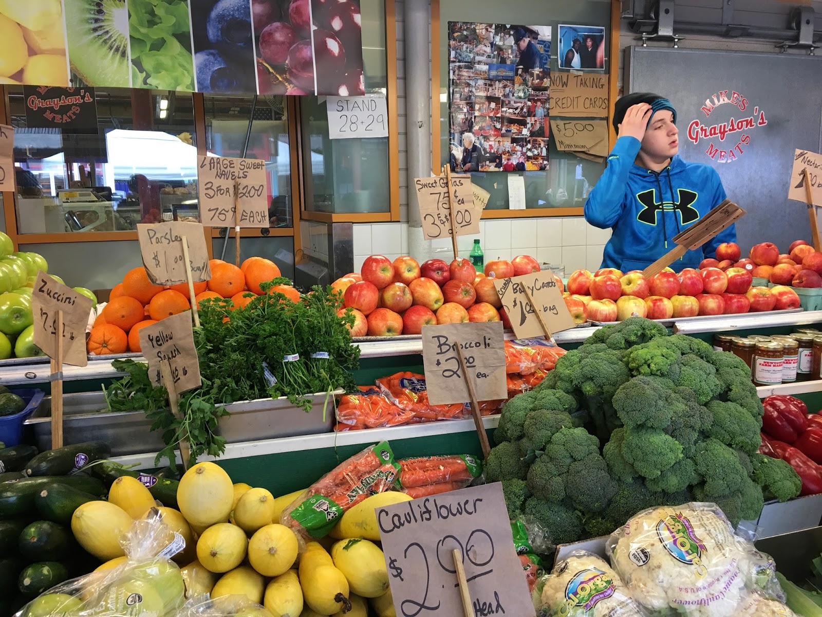
Rarely has the future of Baltimore's public markets been so uncertain as now and rarely have they been more important.

public markets are popular and important
Five of six Baltimore markets are in play for a major change without that there is a comprehensive clear strategy for them or an articulated program for what they should and could do.

The volatile situation around the markets is exacerbated by the delays and the chaos around Cross Street Market, which could be seen as a guinea pig for a new approach including the private sector. But whatever that approach was supposed to prove, it certainly hasn't been convincing.

Still, the Public Market non-profit and its board is charging full steam ahead and has put four (!) more markets on the line for additional experiments. At times the Executive Director of the market non-profit, Robert Thomas seems to be as surprised by the next move as the public, for example when the previous Mayor announced that the Lexington Market would be fully demolished.  One has to ask who is really calling the shots. Confusion may have started with conception of the non-profit market corporation in 1995 through a set of easily conflicting but very general goals. According to Executive Director Robert Thomas "the Market Corporation was formed for the purpose of leasing and managing the Markets, to fulfill community/customer/merchant needs, and to assist the City with its community development efforts”.
 
Although the various requests for proposals were staggered and vary in the anticipated project delivery, right now they are all up for consideration at the same time. Two new requests are on the street right now without any of the previous requests having come to a satisfactory conclusion. This should be of concern to everybody, especially the new Mayor who is sliding into this situation without having had a chance to define the path forward.
Refurbished Northeast Market

The only  seemingly stable market is now the North-East Market on East Monument Street which has been renovated in 2013, and seemed rather marginal before. It is still under the control of Baltimore Public Markets and is enjoying increased interest and support from the adjacent Johns Hopkins hospital and the reconstructed EBDI area.
Broadway Market

Broadway Market in Fells Point, located in the heart of one of Baltimore's finest historic areas and tourist attractions, appears to be doomed as a market. It was offered for private development of any kind with no stipulation that it needs to continue as a market, private or public. Agonizing over the future of the markets has gone on for years. Fells Point development has gone through the roof, but the markets inexplicably languished.

The City is currently undertaking a complete reconstruction of the public space in the center of Broadway near the water. Two Broadway public market buildings sit north of that plaza. Both define the southern end of the Broadway corridor and the character of Fells Point. There is no plausible scenario in which the center island of an urban boulevard should be used for anything other than a public purpose. No decision has been made about the future of these parcels, whatever proposals were submitted is not public knowledge. The City should not be permitted to hand those parcels to the private sector for any use that is not public and serves the public interest.

In 2012 Project for Public Spaces had been commissioned to look at Lexington Market. In its report PPS observed a renaissance of public markets around the country and described their importance in a way which is worth a verbatim quote because it applies to all of Baltimore's public markets:
The reasons for the renaissance of public markets, one of the oldest and most universal forms of retail trade, are diverse. Cities looking to bring consistent activity to their public spaces are using regularly scheduled markets to transform streets, plazas, and parking lots into bustling “people places,” alive with vitality and commerce.
Public markets are valued because they create common ground in the community, where people feel comfortable to mix, mingle, and enjoy the serendipitous pleasures of strolling, socializing, people-watching, and shopping in a special environment.
Others see public markets as an effective way to support local economic development and small businesses in their city. As a means for the distribution of needed goods and services, market merchants and vendors provide farm fresh fruits and vegetables, ethnic foods, crafts, and personal services that are often unavailable elsewhere at the same level of quality, variety, and price.
People are rediscovering that public markets, with their emphasis on locally grown, locally made, and locally owned businesses, accentuate the qualities that make their community special. (PPS Report)
Hollins Market
The Hollins Market RFP has been issued along with the one for Broadway, but here it is stipulated that it must remain a public market, even though it could be privately designed and operated.

The proposals for Hollins Market and Broadway Market were due in February, but no selection has been made to date. The process for the two markets is still at the beginning of discussions with respondents to determine if there can be a deal or how to get there for each Market. Scott Plank of Warhorse LLC has publicly stated that he submitted a proposal for the Hollins Market. He was initially also interested in the Cross Street Market but had dropped out of his partnership with Caves Valley.

The two public markets most recently offered up "on the market" are Lexington Market and the Avenue Market on Pennsylvania Avenue each with a very different model of "project delivery".
Lexington Market  (Photo: Philipsen)

Lexington Market is supposed to be privately developed in a "fee for service" model in which a development company would act like a construction manager for a turn-key project. The kicker: The project is already partly designed by Murphy and Dittenhafer Architects as part of earlier assignments. The current RFP asks the developer to work with the existing design team. Baltimore Public Markets would then manage and operate the new market after completion. The design foresees a modern two story glass structure to be erected on the current parking lot south of the existing Market which can be constructed while the current market remains in operation.

The Avenue Market is envisioned to be privately designed and operated just like the Hollins and the Cross Street markets. (This is the design-build delivery model). Even on the surface, one can see from the different demographics in which the three markets are located (two of them in food deserts), that developers would take on different responsibilities in each case. The Avenue Market RFP is largely boiler-plate language and seems to include no explicit lessons from the experience of the Cross Street Market, where the developer initially envisioned to clear out the entire market for rehabilitation without offering existing vendors a way to survive or a guarantee to come back. The RFP is specific about the location of antennas and satellite dishes but has no requirements for the merchandise mix, the inclusion of local businesses, the retention and protection of existing merchants or the avoidance of non-food merchants that sell cell phones and the like.
The Avenue Market (Photo: Philipsen)

Proposals for the Avenue Market and Lexington Market are due on May 16. Interest to date has been moderate based on representation at the pre-proposal meetings with only one team being represented for the Avenue Market and three for Lexington Market and some additional online interest.

Meanwhile, the Cross Street Market is still in turmoil. It was awarded to Caves Valley until the developer publicly withdrew from the deal but then came back to the table so now the contract with the City is still in effect. Opponents and supporters of Caves Valley can be found among residents and merchants. Nobody seems to know for certain what is going on with the redevelopment, although there seems to be an assumption now that the work will be phased and that some merchants can operate during construction. An originally envisioned Starbucks chain coffee shop is now going to be a local Ceremony coffee shop.
The private developer/operator model at the Cross Street Market has certainly not gone smoothly. From taking a very long time to hash out an agreement to shortly thereafter going up in flames with competing petitions circulating in the community, upset merchants, and surprise merchant lease terminations that then were reversed.  Given that rocky performance, one has to wonder why the City is so eager to offer another two markets under the same model.
A long shuttered public market: North Avenue
Market  (Photo: Philipsen)

In fact, one has to wonder if the City isn't biting off too much at once with five markets all in various stages of decision making without any viable proof of concept.

As I reported here in various articles, other cities have very successful markets, notably Philadelphia with the Reading Market, Seattle with Pike's Place Market and Cincinnati with Findlays Market. All three cities run their markets through non profit organizations that were created with the sole purpose of running, operating and maintaining one public market under strict stipulations and controls.
Seattle's Pike's Place Market

It is quite amazing that Baltimore would want to abandon the model of running markets with a publicly controlled non-profit instead of fine-tuning it. Times have never been better to run a market, which is why the private sector is creating their own (R-House, Belvedere and Mount Vernon markets). It isn't obvious at all, the the City should sell its public markets so that they become like those private markets.

Klaus Philipsen, FAIA

see also the previous article about the Baltimore Markets on this blog

Thursday, April 20, 2017

Rye whiskey on the waterfront

Hi
Baltimore around 1910 (Maryland Archive)
Rye whiskey has a working class history and has once been an identifiable and important part of Baltimore's history. The poor man's whiskey, Pikesville 3-year 80-proof ceased production in 2016 just when Sagamore Spirit geared up to its full scale production in a brand-new waterfront distillery for which the ribbon was cut Thursday. Certainly there will be those who cast the story of Baltimore's rye whiskey into the narrative of the two Baltimores with Kevin Plank's venture into whiskey production as just another sign of a corporate takeover of Baltimore. Others, including guests who talked at the ribbon cutting, (Mayor Pugh, Congressman Ruppersberger, Lieutenant Governor Rutherford) welcome the revival of a rich Baltimore history as an economic development initiative in the mold of local production and an enhancement of the Baltimore brand.

Sagamore Spirit, one of the Plank Industries, seems like a quirky move by Kevin Plank, with its farm architecture taken from his 530 acre Baltimore County farm planted on Baltimore's industrial waterfront by architects of Ayer Saint Gross. The Baltimore firm with its offices overlooking the Domino Sugar operations is Baltimore's waterfront expert, it

prepared among other things the Harbor 2.0 masterplan for the Inner Harbor.
“There is no article made in Baltimore that has done more to spread the fame of the city as a commercial center than has Hunter Baltimore Rye.” (1912 publication quoted by Jacques Kelly)
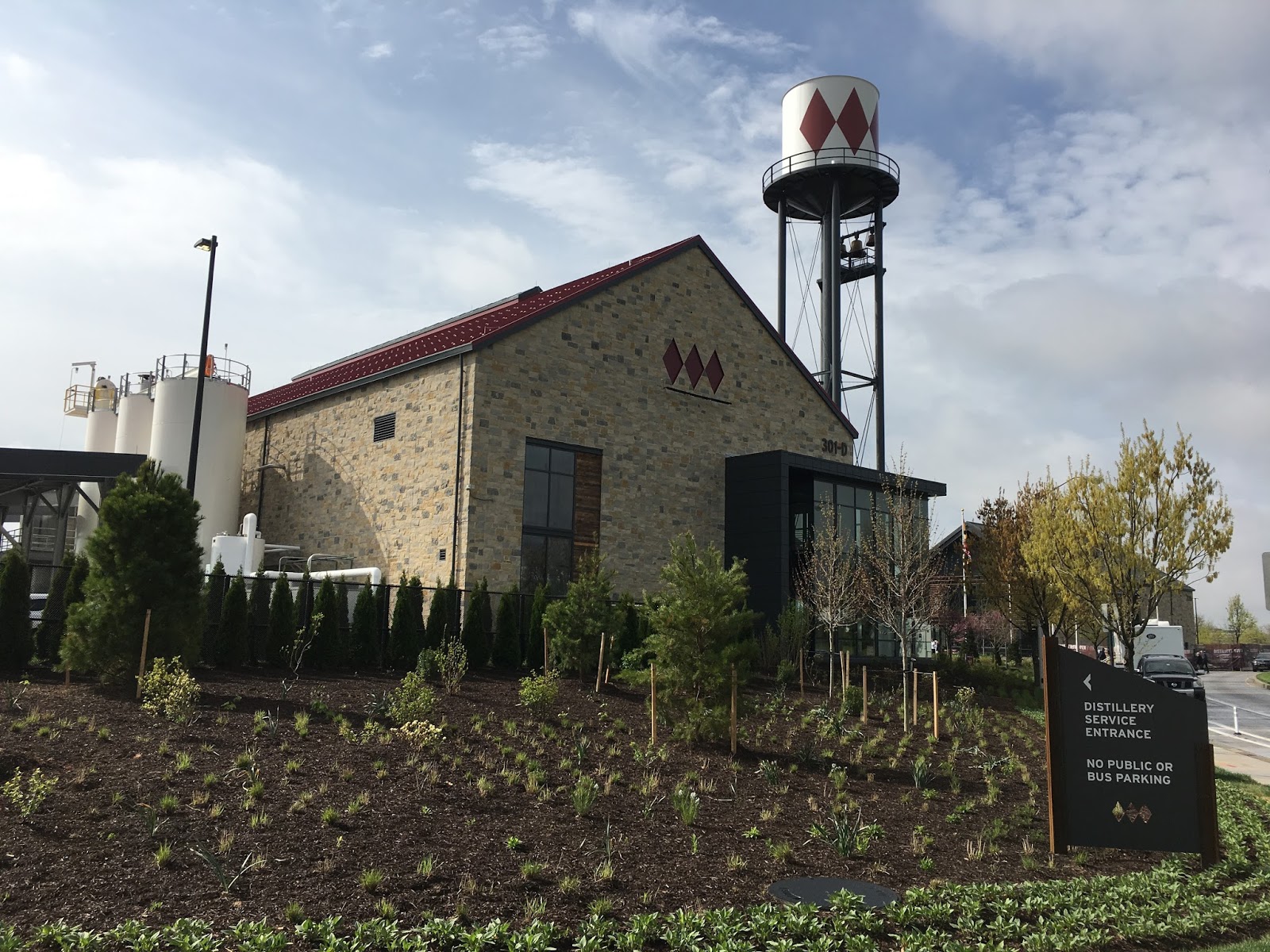
When ASG designed Plank's distillery the bigger Plan for Port Covington had not been publicly hatched yet and the distillery was designed as a solitaire. At the initial design presentation to UDARP in March of 2015 the Sagamore representative stated no knowledge about the overall plans for Port Covington. UDARP members considered the farm theme "manufactured" and Planning Director Stosur found that "too many stories [were] being told here". Now, after the full plan is known, one can be sure that the distillery with its 120' old style water tank will eventually stick out as whimsical amidst the glass towers of Under Armour's new headquarters and the dense surrounding city envisioned to emerge from the old industrial Port Covington railyard. But that may be a good thing, given that new towns usually suffer from a certain kind of blandness that comes from everything being new and of the same vintage and mindset. The architecture manages to blend clean, modern details with the rural vernacular of the buildings.

The Sagamore Farm well-house from 1907
The water-tank carries the story of Sagamore Farm's special limestone spring water that will be trucked here as a key ingredient for whiskey making. The spring water's 1907 well house is a cornerstone of Sagamore Spirit and is said to have brought the idea of whiskey production to Kevin Plank. Apparently he had been asked to consider wine making on his farm but didn't consider himself to be a wine guy.

Whiskey with its own Baltimore story fascinated Plank who was not at hand at the opening and had the stories told by Sagamore Spirit founding partner Bill McDermond. Plank is trying to tie his global Under Armour brand to memorable local roots and generate a narrative of local production.

The distillery is not a toy project. It already provides 50 jobs (without the restaurant which will open in June), its four grain silos hold 40,000 pounds of
Silos, barns and water-tower on the waterfront
 (Photo Philipsen)
grain each, the 5 acre, 61,000 sqft facility expects 100,000 visitors annually. The restaurant operator is the same guy from New York who runs the Pendry's restaurant in Fell Point. The interior of the restaurant which was not yet on display is designed by Patrick Sutton, who also designed the interior of the Pendry Hotel.

Two of the three initial projects that now dot the Port Covington waterfront are early indicators of Plank's ambitions for making stuff in Baltimore: City Garage, and the whiskey distillery. The converted Sams Club is currently used for HR offices and will be later demolished.

Plank's high flying company took a few hits recently, demonstrating what Baltimore has learned many times before: In a fast moving
Careful landscaping by Core Studio Design
(Photo Philipsen)
world it is impossible to predict 25 years into the future. This shouldn't be an excuse not to plan for it anyway. The Port Covington masterplan may be modified many times.

Meanwhile folks who like to chill over a drink and food while gazing over the water of the Middle Branch can do this now not only at Nick's Fish House, possibly also partially owned by Plank, but also at Sagamore Spirit and its new restaurant.

Klaus Philipsen, FAIA

The distillery will be open to the public for free tours during opening weekend on April 21 – 23. Tours will be available from 10:00 a.m. until 6:00 p.m. with the last tour beginning at 5:00 p.m.

Sagamore Spirits wants to revive Maryland's rye whiskey heritage
The golden era of Baltimore made rye whiskey


A new whiskey that won awards for the bottle and
the content (Photo Philipsen)

View from the deck of the visitor center
(Photo Philipsen)

Wednesday, April 19, 2017

What should a new Sustainability Plan do?

Baltimore wasn't the first city to create a sustainability plan, a commission to guide sustainability and an office to manage it. Baltimore may not have had the ambition of New York, San Francisco, Philadelphia, or Chicago  who all wanted to be the most sustainable city in America and had mayors who largely defined themselves via sustainability. In 2009 Baltimore created a plan and many initiatives around it, some, like the ones for food and agriculture are very good.
Mark Cameron of DPW talks about dog poop disposal in front
of a stormwater model (Photo: Philipsen)

But public attention is fickle, sustainability  as a buzzword was replaced by resilience and then faded into the background in favor of social justice and equity issues plaguing the City. None of these topics are in conflict with each other, only a sustainable city can be resilient and only a city with social justice can be sustainable or resilient.

Apparently lots of activists and citizens see it that way: on a beautiful spring evening they trekked in great numbers up the hill to the beautifully restored old brewery building which is now Humanim to attend the second "Town Hall" event conducted by the Office of Sustainability with the goal to conceive of a new plan. Humanim with its Details workforce re-entry training program for recycling building products through de-construction (instead of bulldozer demolition) is a wonderful example of the broad reach of sustainability.
But back to the Sustainability Plan:
Our current plan was adopted in 2009, and although it was an excellent plan for the time, much has changed on the ground and in our communities over the last six years. We need concrete metrics, a broader definition of what sustainability means, and greater attention paid to issues of equity and inclusion. (Office of Sustainability)
The "Town Hall" at Humanim was more like a festival or sustainability fair than a traditional plan-update information event. It was also a class reunion for a broad diverse group of activists who all see themselves fit under the broad umbrella of sustainability. Tree Baltimore handed out free trees in front of the brewery building, there was complete "tiny house" open for visit, on the ground floor various groups presented their latest initiatives, including the electric bike of Baltimore's bike share program, Vacants to Value  or the new MTA bus reform BaltimoreLink. Mark Cameron of the compliance division of Watershed Planning at the Department of Public Works entertained with the question on how to properly dispose of dog poop. If one lifted the cup with the right answer ("bag and dispose in trash") a Hershey kiss was the reward.
Tree giveaway by Tree Baltimore
(Photo: Philipsen)

On the second floor where the actual displays of the various sustainability plan topics were on display, crowds were dense. There was even a little cafe with green snacks and outdoor seating. Trash cans all had various recycle options; interactive opportunities for stickers, comments or suggestions existed everywhere, even inside the elevator.
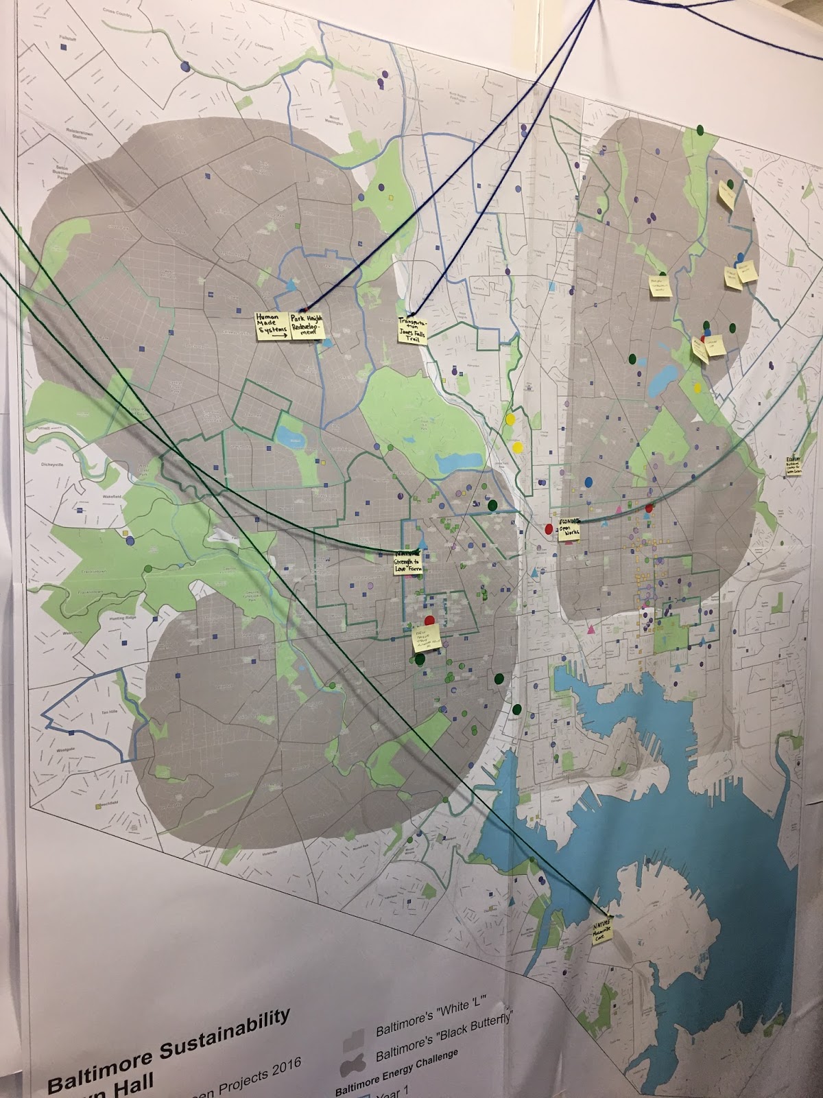
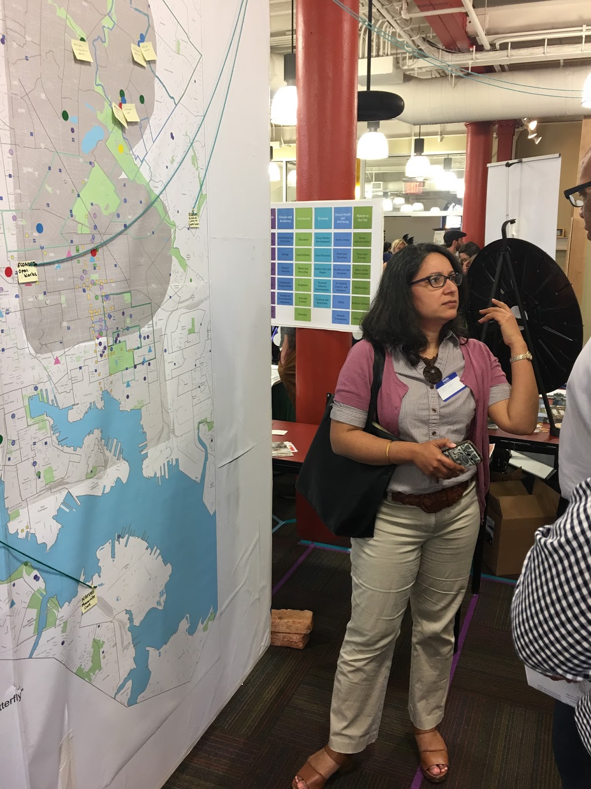
Indicating the new focus on equity Baltimore's sustainability initiatives were displayed on a big map that emphasized the "White L and Black Butterfly" concept that has become a popular way of describing the "two Baltimores" in a compelling narrative which maybe too simple to really be productive. At least that is what BNIA leader Seema Iyer will not tire to explain, at the Town Hall in person and in front of the map.

Planning Director Stosur is very optimistic that his Green Infrastructure Plan will bring amenities even to deeply disinvested areas. The plan seeks to create more green and strategically place it based on demolition. Not everybody is on board with green as the economic development tool for the "black butterfly" areas. Community leader Arlene Fisher of Harlem Park vehemently stated in a conversation with Stosur that she doesn't need more green, that her neighborhood has parks and is green enough, that its problems are of another kind, certainly, she said, not the lack of green. An accurate observation, even when the Tree Baltimore map shows that the most disinvested parts of the city are also those with the least tree cover.
Our priority in this process and for the plan is equity. We want to make sure every story and every voice truly counts. We will focus on our most vulnerable, historically disinvested neighborhoods by leveraging new and existing initiatives and funding sources to help improve conditions where the most severe racial inequities exist. We will address the many facets of racial inequity across the city as well as class, disability, and age discrimination.  (Office of Sustainability)
A map showing the White L and the Black Butterfly(Photo: Philipsen)
The full pivot to equity could easily lead astray, even though equity is, no doubt, part of the three legs of sustainability consisting of the social, economic and environmental leg. Efforts like Every Story Counts which is part of the new plan activities are very "soft" when actual real measurable change is necessary.
"You don’t have to be a climate scientist or city planner to create sustainability + resilience. Everyone has a story to tell about making Baltimore a stronger, fairer and safer place for all of us. (website)
The Office of Sustainability needs to continue to push innovation and enforcement. For example, the building code: Baltimore's Green Building Code was merged with the International Green Building Code. It is one of the most tangible efforts of making the city greener and less wasteful. The code requires more insulation, better appliances and generally higher energy efficiency and is an example of the complexity behind the sustainability effort. The code requires close collaboration with the Department of Housing which runs the building permits. To ensure code compliance, permit reviewers need to be trained in the energy code so they understand what they review. Developers need to see the benefits and learn how to comply without jacking up cost too much so that sustainability stays affordable.
The "Town Hall" with its display boards and exhibits was very well attended
(Photo: Philipsen)

The 2009 Sustainability Plan included 29 goals across seven core themes, maybe too much. Still, it would be good to begin a new plan with where the old plan ended. How successful was it?

The Office issued annual progress reports (the last one was done for 2015). The report is full of Success Stories and even has a data section. But like most city department reports, the data provide numbers for "tonnage collected from street sweeping", "Number of service calls for dirty streets", "city government energy usage" and the like, all data that do not really indicate progress towards specific goals since these raw data could be interpreted many ways. (More service calls could mean a dirtier city or more awareness, for example). There are some good news, average daily water usage has steadily declined, but given how inaccurate the meters have been, even this metric has a lot of question marks.  A list of the tree canopy shows a growing number of trees in the city. But how are these numbers obtained and what do they mean? Everybody knows that the loss of a mature tree cannot be balanced with the planting of one of those new broom-stick trees that are put into sidewalks in great numbers only to die off after a year or two because not even minimum planting standards are maintained.

Progress seems to have been made in expanding healthy food choices into food deserts. But one of the sources, Baltimore's public markets, are in danger of slipping out from public control through private development and private management as you read this. In the transportation section bike-lane miles are counted; those, too, mean little if they are not maintained and regularly re-striped. The actual metrics, what is the mode-share of bicycles today and what is the target are not reported.  Nor are bike and pedestrian fatalities. Other transportation metrics such as Circulator and MTA ridership are already falling leading up to 2015 and probably have fallen even further since then. Here too, the mode share is what matters, not the absolute number of riders, since it needs to be adjusted for population and employment.
From the 2015 Sustainability Report.

The new Sustainability Plan should focus on how a shorter list of less open-ended metrics can be defined which includes realistic targets. It, like all other City Plans, should be monitored by a revamped CitiStat that provides impartial data driven reports. It still remains to be seen what the Pugh administration will do with CitiStat.

The Office of Sustainability's focus on equity is understandable, but it could easily become an excuse fore even fewer hard data.

Poor residents would benefit the most from a greener, more effective government and more environmentally friendly apartments and buildings, but only if its real and not just talk.
Philadephia 2015 progress report (Overview Chart)


Klaus Philipsen, FAIA

See also on this blog: Sustainability Plan 2.0
Sustainability Commissioner Peter Doo studies
a display (Photo Philipsen)


Process Timeline for the new plan:

April – Ambassador Recruitment
May – Ambassador Recruitment and Trainings
June-August – Ambassador outreach and information gathering
September-November – Community meetings and feedback on plan
December – Plan adoption


BNIA's Seema Iyer argues that the White L
is too simplistic (Photo Philipsen)

New Baltimore Delegate Robbyn Lewis poses
with the Green Frog. (Photo Philipsen)


Tuesday, April 18, 2017

Getting lost in Baltimore

In yesterday's article I maintained that Baltimore isn't very good at telling its own story. Part of it is that the city has no useful wayfinding system for its attractions and inner urban destinations. "Get lost" is the message to visitors, and given how afraid some suburbanites are of city driving, those visitors don't have to come from far away to lose their way in Baltimore.
Schaefer's old wayfinding system (Photo: Philipsen)

Former Mayor William Donald Schaefer understood the value of a good story, whether he jumped with straw hat and rubber ducky into an aquarium pool or whether he commissioned a set of inner-urban directional signs specific to Baltimore. Those signs have long faded, some lost their lettering and today they just blend into the general background clutter.

The Downtown Partnership of Baltimore understood the value of wayfinding as well when they installed the pedestrian sign system that dots downtown intersections, dividing downtown in color quadrants and pointing out attractions and history. But those signs don't help drivers.

One can drive for miles on one of the major arteries into the city without a single directional sign pointing out where one is going. Even Schaefer's old signs didn't create a logical sequence. A sign that pointed to the Inner Harbor and Aquarium is followed a mile later by a sign that points to Market Center and the University of Maryland.  Interstate exits may point to inner urban destinations, but once off the freeway, there is no further guidance.

One could argue that in the age of GPS and Google maps each driver gets directions from the on-board system and physical signs are superfluous. But that overlooks the power of the story and is similar to the argument that there is no need for books in the age of computer tablets or no need for theaters in the age of TV. Both proved wrong because that isn't how humans really tick.
Italian wayfinding: White is local, brown are attractions

In Europe, each country has its own national standard for directional signs with freeways, national roads and inner city destinations each having its own color. In Germany the autobahn has blue signs, the national road and inter-urban signs are yellow and inner-city signs are white. In Italy the freeways are green like in the US, the inter-city signs blue, the intra-city signs are white and tourist attractions are brown.

In the US it is left to cities and towns to design their own; some cities have done a real good job in doing it. Most have no system but feature only clutter of random signs put up over decades. Famous for bad or no signs: Our neighbor Washington DC. In spite of the millions that come to visit every year. When it comes to the motto get lost, the District gets the cake since with its many diagonal Avenues it is disorienting by nature. But that shouldn't be an excuse for Baltimore which depends on clarity and transparency much more than "Washington".

Horse-Town Lexington, KY (Photo: Philipsen)
A recent modest attempt of marking Baltimore's entry points stemming from Baltimore's previous mayor was met with the usual cynicism. Who needs that and wouldn't the money be better spent on [fill in the blank].  True, just gateway markers with out additional information is probably not as helpful as a true wayfinding system that would reminds even those who find their way with their eyes closed of what we have and who we are.

Good wayfinding signs express pride, just like a hood ornament on a car.
A high-functioning wayfinding system makes the environment “legible” and enhances the visitors’ experience as it increases their comfort, builds their confidence, and encourages them to discover unique events, attractions and destinations on their own. (ASLA blog)
Phoenix wayfinding
Letting those 30 year old Schaefer signs stand around decaying, outdated and defaced with stickers sends another message: We don't care. Sure, this isn't a matter of life and death. But it is a symbol of what this city "thinks" of itself.

Leading a city to control its own story includes branding, information and reducing anxieties. It is a tall order for a city which induces
a lot of anxieties for a lot of reasons. Why not reduce one fear, that of not being able to find your way?

Klaus Philipsen, FAIA

Baltimore wayfinding:lettering is lost (Photo: Philipsen)


US wayfinding outside Interstates is always cryptic


San Diego wayfinding: Baltimore was on teh right track
with blue and green

Monday, April 17, 2017

Baltimore urban networks: Failing to live up to their potential

"Connective tissue" is one of the things that Baltimore needs more than anything. Anything that can bridge across the black butterfly and the white L, across the rich and the poor Baltimore, bridge between bikers and hikers and those who simply want to walk their dog or stroll with their children, between old and young and various ethnicities. A system connecting urban parks should be an obvious winner. This article is about the value of urban networks and how Baltimore has not yet tapped the full potential of those networks.
Photo: Greenway Coalition 

Fifteen years ago bike advocates associated with the first Mayor's Bicycle Advisory Committee (MBAC), created Tour dem Parks, an annual bike ride between all major Baltimore City Parks. The goal: Promote the Baltimore Park system, get people to come together for a healthy activity and unite the many disparate communities of Baltimore, even if only for a day. At the time there wasn't even a bike masterplan. To create a narrative of bicycling as an egalitarian activity with a low entry threshold, MBAC had regular informal bicycles rides into various neighborhoods with then Mayor Sheila Dixon.  Those rides have since developed into the monthly Baltimore Bike Party.

Greenway Trails

Now activist Liz Cornish of Bikemore, APA and others want to make the annual park-ride experience permanent and eliminate the many dire stretches of dangerous on-street biking or hiking that separate the parks and that Tour dem Parks mitigated with cones and crossing guards. The completion of a connected system is estimated to cost $25 million according to the Rails to Trails Conservancy which is working on the 35 mile loop system. The system isn't a new idea, in fact, it goes back to the famous Olmsted brothers who had their hand in the design of several Baltimore parks and always envisioned connecting greenways. Already bike advocates find themselves at odds with landscape preservationists and community advocates. The ones fearing to compromise green space with a paved trail, the others fearing gentrification and that the wrong folks would benefit from such an investment. And then there a few who see bicycling as an intrusion of wealthy white folks, even though every bike party proves that to be a total misconception.

Those concerns are ironic and telling. Baltimore has a hard time to develop a good story. usually the Baltimore narrative is foisted upon the City from the outside, sometimes good (like in the recent NYT travel guide) and sometimes not so good (Homicide, The Wire). In face of some of Baltimore's dark realities, some may say that telling a good story is not only trivial but almost a sacrilege. True, but nevertheless, if Baltimore can't develop a compelling narrative what it wants and could be, it will be that much harder to gather the resources that are needed to flourish.

Flowering Trail

Jill Jonnes, an arboreal activist and author of a book on city trees "Urban Forest: A Natural History of Trees and People in the American Cityscape," is dreaming of a flowering trail with a a variety of trees blooming year round, each kind in a different season. Washington's Cherry Blossom festival combined with New York's Highline Park as a year-round attraction.

These are all nice ideas but Baltimore has a bad track record when it comes to "connective tissue".


The Waterfront Promenade

Baltimore Waterfront Promenade and Water Taxi stops
One of Baltimore's strongest attractions should be its 5 mile plus Waterfront Promenade, Baltimore's oldest trail network. It, too connects a variety of communities but in spite (or maybe, because?) of the many years in the making, it lacks recognition and branding. Type waterfront promenade into Google and find that this great asset doesn't even have its own website, that it is hard to find a map for it and that it isn't even featured on the website of the Waterfront Partnership. And once one has found the promenade and is on it, it is easy to loose its course. Their is no uniform design standard, no easy to see signage and there isn't even a catchy name for it. Few will notice that the promenade actually extends beyond the Aquarium or the Rusty Scupper. There are still gaps in it and some of the twists and turns in the Fells Point and Canton area leave even locals puzzled about where it really runs.
The planned Baltimore Greenway Trails Network


The Water Taxi 

Closely related to the Promenade is the Baltimore Water Taxi which has a string of nodes along the Promenade. It, too deserves to be something that brands Baltimore like, London is branded by its red buses. Although the water taxi is popular with tourists, it is hard to figure out, the landings are almost invisible and its potential is far from tapped. This may soon become different once Under Armour puts its mark on it, but little is known to date, how the system will develop.

Other attempts of networks of strength also failed to reach a level where they persist as recognizable attractions: for example Baltimore's rich history. A self guided Baltimore Heritage Walk is identified by little trail stickers on the ground. But once installed, they have not been maintained and kept in shape.


The bus trails

The oldest and most important network is of vital importance to residents and visitors: the Baltimore transit system. It is so famous for being hard to decipher and being disjointed that even the current MTA Administrator is using harsh words to describe it. A complete overhaul of the bus trails will occur on June 18 of this year. It has been touted as a transformative step. Nothing could prove better that Baltimore can actually benefit from networks that connect instead of separate, in spite of  the slogan of "City of Neighborhoods" that stresses the individual parts over the entirety. A functioning transit network is one of the great equalizers in any city.


Networks on the Web

Technology helps. Anyone savvy enough to do so can pull individualized self guided walking or biking trails up based on one's specific interest. There apps for architecture, history and everything else. Baltimore's rich urban fabric provides a dense system of overlapping networks that can be found via smartphone, for example on this GPS based app. But this type individualization defeats the purpose, of unification. All the smart phones can't substitute for a few networks that should become famous.
Tampa's Riverfront Walk with transit connection


The success of urban networks elsewhere should be an encouragement: The world famous Highline in New York, Chicago's Lakefront Trail, Philadelphia's Schuylkill River Trail, Tampa's brandnew River Walk. Especially the new Tampa walk shows that Baltimore has to up its game. Tampa's walk has transit connections, signage, mile markers, fitness stations, art, bike repair stations, bathrooms, kiosks , creative lighting of and all kinds of innovative ways to spruce up the experience of looking out to a otherwise fairly mundane water body.

Klaus Philipsen, FAIA

Advocates push for 35-mile trail loop in Baltimore
The Tampa Riverfront Walk spares no effort to create
connectivity where the shoreline doesn't allow it
(Photo: Philipsen)

Thursday, April 13, 2017

Architecture for refugees

Once in a while pride in one's profession is in order and in those who are there to advocate for it. In this case in the Baltimore chapter of the American Institute of Architects and its lecture committee which this year assembled a series of talks around the not so obvious topic of migration.
Refuge camp in Jordan: A "city" of 80,000 
Migration as in migrating shorelines, or people migrating away from rising water, migration as urban suburban commuting, and migration as in fleeing countries of crisis and war. None of this fits the classic concept of what architects do. Exploring the edges of what is the stereotypical job profile is key to survival in the future, a truism pretty much for any profession. And that is where the pride comes in: that the young architects in the lecture committee decided to leave the well worn path of lectures in which famous architects ("starchitects) come to town to present their slideshows of glossy pictures leaving local architects oohing and aahing about whatever design trend. The lectures have slowly pivoted away from this stale concept for years. This year's lecture program shows names that only a few have heard of, people who are trying to address the big issues humanity faces right now; Mass migration, for whatever reason, is one of those issues.
AIA Lecture series poster

The standard response to current changes have been walls and fences, sometimes "beautiful walls". The knewwjerk response is to arrest change and freeze time, whether against refugees or seawater. But since time can't be stopped, a much more thoughtful response is innovation, exploration and recognition of reality. For example this reality:
In 2011, the UN estimated there were more than 42 million displaced persons across the globe, including 10.5 million refugees, many of whom live in camps. Every year fewer refugees are able to return to their place of origin. Today, with the average refugee spending seventeen years in asylum, what was intended to be a temporary setting—the camp—has become a long-term fixture. Because the number of migrants sheltered in camps is growing and the character of protracted refugee communities is becoming increasingly urban, architects and planners are needed to look critically at the process of planning and designing camps.
Of course, the US has insulated itself pretty well from the refugee crisis even under the Obama administration there was just a trickle that now has been turned off altogether. The US took in all of 2016 only 86,000 refugees, about as many refugees as arrived in the city of Munich alone within a week during the height of the exodus in 2015 via Turkey. To understand the extent of the people involved, it is useful to see how many refugees live in the top 10 countries who have the most refugees are:

1. Jordan (2.7 million+) 
2. Turkey (2.5 million+)
3. Pakistan (1.6 million)
4. Lebanon (1.5 million+)
5. Iran (979,400)
6. Ethiopia (736,100) 
7. Kenya (553,900) 
8. Uganda (477,200)
9. Democratic Republic of Congo (383,100)
10. Chad (369,500)

Architects from Ennead Lab in New York City covered Wednesday's lecture along with a Dutch architect who just completed a design task on a 80,000 people Jordanian refugee camp.
Don Weinreich and Eliza Montgomery from NYC spoke to a large crowd that almost filled the Brown auditorium at MICA. The Ennead Lab asks border questions as part of their job description. Such as , "how many ways can a school add value?", "what is the gas station of the future?", "can we reactivate historic infrastructure" and "can refugees improve existing cities?" On the matter of refuges the team described their project this way"
In collaboration with Stanford University and the United Nations High Commissioner for Refugees the project mission is to help UNHCR meet its commitment to “enable refugees to access and live in dignity in secure settlements that improve their social, economic and environmental quality of life as a community.”
In light of the increasing permanence of camps, the United Nations High Commissioner for Refugees (UNHCR) faces a larger challenge. While temporary encampments solve a local problem, how can the agency improve its ability to serve, house, protect and integrate refugees? Can the agency rethink the design and implementation of refugee camps to create more stable communities that improve the health and security of refugees while benefiting the host population as well? 
Ennead created site plan for a Rwanda camp
Their reality check was a refuge camp in Rwanda for which they had just two months time to design for the arrival of 20,000 people. They showed how an assignment like this guts everything architects usually consider to be the design process. Yet this process provides knowledge that could improve the guidebook of the UN High Commissioner and the usual 10 square-meter grid of squares that are endlessly repeated to form a tent or shelter city. The presenters said it is used worldwide wherever camps have to be created. The guidebook doesn't account for terrain, flooding or local cultural preferences.

Ennead created a toolkit that addresses the refuge camp question on various scales, including where in the world appropriate camp locations may be and the question whether a camp is always the right answer. Other options include full integration into existing communities, for example in shrinking cities. The team had looked at Gary, Indiana which made one audience member cringe and request to look at Baltimore and its many vacant houses instead.
The matter of the right accommodation shifts dramatically, once one considers that the average refuge spends 17 years in a camp!
Traditional water supply in the Jordan camps

In the case of the rolling hills in Rwanda, initial bulldozing to allow the flat earth plan immediately caused erosion. The NY based design team used Google earth topo and a computer program to initially lay out the thousands of modular shelters along the contour lines and then modified it to create a more town-like assembly avoiding some of the monotony.

As a "surprise guest" Jaap Gräber, a Dutch architect from Amsterdam talked about his work on a 80,000 people Jordanian refugee camp to which the Ennead team had just made a field visit. (Gräber was in the US to vist Ennead in New York). The desert city didn't even have any lead time to plan, refugees showed up by the thousands every day and the tents where placed per the UNHCR's blueprint with Gräber trying to convince camp managers that rectangular lots would result in fewer streets and that investment in water and sewer lines would be cheaper than an endless fleet of water trucks filling holding tanks a few times a week. Bit by bit the vast camp was rearranged and a real city emerged that was based on a street pattern gleaned from Jordanian cities nearby.
simple geometry decisions: Camp lots and streets: Rectangular
 wins over square UNHCR plats

The transformation of the refugee camp from tents on square plats to modular cabins on rectangular ones arranged to accommodate families and back yards mirrored the history of human settlements from nomadic tent cities to cities with fixed addresses, paved streets built above buried pipes for water and sewer. With this approach the camp stands a chance to eventually become an actual city. 

Gräber paid attention to the infrastructure and not the cabins, a big step for an architect who's natural tendency would be to design the most beautiful shelter structure.
Weinreich and Montgomery at the
AIA lecture

There are not many architects who care about the design of refuge camps Jaap Gräber told me after the lecture, and so it was inevitable that Ennead and he would meet and talk. In his talk he pointed out that even the most organized countries in the world (such as his native Holland) are not prepared to catastrophe and emergency. Not only had the refugee wave already reached many European countries, there would always be the possibility of a chemical disaster or other emergencies that would force the immediate relocation of possibly hundreds of thousands of people, a chance that grows , the more crowded the world becomes. (Just recall the recent dam evacuation in California).

What Ennead and Gräber are doing to rethink the logistics of the refugee camp could, indeed, come in handy for anyone, regardless where one lives in the world. Thanks to the AIA lecture committee a couple of hundred people got a chance to think beyond the usual borders and consider another meaning for the term sanctuary city.

Klaus Philipsen, FAIA

See also my previous lecture article about commuter migration

Plan Modules
Architecture for Refugees open source website


Fictional accommodation of refugees in Gary, IN (Ennead)


Ennead tool kit for UNHCR


From the Ennead Tool Kit


Wednesday, April 12, 2017

Is development in Locust Point a good thing?

In the epic Baltimore battle of "Neighborhoods first", does heavy investment in Locust Point count? Is it good news that Toby Bozzutto and Scott Plank's Warhorse LLC broke ground on another 47 townhouses there after his 275 unit Anthem House nearing completion, Saperstein's 250 completed units at McHenry Row and another 225 under construction, not to mention Turner's Silo Point with its 226 condominiums and 60 townhomes and countless smaller rowhouse rehabs and new construction projects?
Alta 47 townhomes, 2 car garages, $400,000 and up (Rendering: Bozzutto/
Lessard Design Architects, Washington DC)

Locust Point is certainly not near downtown and although located on a peninsula, it is barely a waterfront community;  much of its waterfront is still occupied by industrial uses such as Domino Sugar and large railyards.

When developer Bill Struever bought the large former Proctor and Gamble complex there for $6 million in 1998 he set foot in an area that was to most Baltimoreans as foreign as Brooklyn, another working class Baltimore neighborhood, technically on the water, but surrounded by industry that prevents waterfront access.

Change came with Struever's arrival. Many small investors began scouting out vacant lots and small industrial sites which dotted the community between rows of formstone clad houses. Then  developer Pat Turner did the innovative luxury condos wrapped around old grain silos, Saperstein finally broke ground on McHenry Row, Philips Seafood moved out and development became a runaway train.  Thje site for the new Alta 47 homes was vacated by Perishable Deliveries Inc. which moved to Halethorpe in the County.
Before one attributes Locust Point to Richard Florida's new insight that America's cities have succumbed to a "winner takes all" development system, one has to remember that the two Locust Point pioneer developers, Struever and Turner, both took heavy hits since their successful investments there and are not the big winners anymore they once were, even though, it wasn't Locust Point that did them in, but, what one could call overreach, elsewhere.
The Locust Point community is surrounded by industrial use and barely has waterfront access. Darkened the lots
where Alta 47 townhomes broke ground Tuesday

Locust Point probably doesn't count in the eyes of those who want to see investment in Baltimore's poor neighborhoods because it is lilly white and has been so long before gentrification set in. Like Remington or Hampden, Locust Point started out poor and received plenty investment but are not at all representative of Baltimore's diversity.

Luckily, neighborhood success is no longer limited to the communities located in the much maligned "white L". As Seema Iyer of the Baltimore Neighborhoods Indicator Alliance has pointed out to me numerous times, there is a growing list of diverse communities that also receive investment such as Pigtown and Reservoir Hill and even predominantly white communities such as Highlandtown see a high level of diversity through other ethnicities such as Latino and Asian.
Locust Point (red outline) sits in an area with predominantly white population
(shades indicate % of black population)

Locust Point is still no yuppie town, in spite of the heavy influx of young professionals it isn't even a haven of singles or millennials but has an above average percentage of families with children.

The local public school, Francis Scott ES and Middle has been propped up by Kevin Plank $1 million of investments (he also invested in the Sarah's Hope project in Sandtown). Today poverty levels in Locust Point are low, education attainment is high and so are rents and home prices.

When Catherine Pugh broke ground at the  Alta 47 townhomes on Wednesday she made reference to "these neighborhoods": According to the SUN she said:
"Eighteen- to 34-year-olds, they're popping into Baltimore like flies, and we love it. But they're in apartment buildings, and we know those are important, too, but this is important to the stability of our city — home ownership," Pugh said. "Alta 47 is designed to not only be impressive but to lure people into moving into these communities."
I am not sure about the flies analogy, but neighborhoods that are attractive for families and provide a perspective for urban living with children must certainly be part of the mix of what Baltimore has to offer as a city.

The Locust Point Civic Association saw to it, that the new town homes were not too large and foreign to the otherwise humble setting on Cooksie, Beason and Towson Streets. They negotiated the number down from 51 to 47 and the height of the new townhomes down from 45' to 35'.

Klaus Philipsen, FAIA

Capital News Service about Locust Point (2013)
BNIA South Baltimore Vital Signs

The groundbreaking (Photo: Kevin Lynch)

the construction site (Photo: Kevin Lynch)

the townhomes in the community setting (rendering Bozzutto/Lessard Design Architects)


All statistics from City-Data.com