Friday, June 29, 2018

Who controls Baltimore's public spaces? (Part 2)

 The more successfully a city mingles everyday diversity of uses and users in its everyday streets, the more successfully, casually (and economically) its people thereby enliven and support well-located parks that can thus give back grace and delight to their neighborhoods instead of vacuity.” ― Jane Jacobs, The Death and Life of Great American Cities
Like the German philosopher Walter Benjamin in his 1924 writing about Naples, Italy (see part 1), the American journalist Jane Jacobs had lovingly observed and described a city's public spaces. In 1961 New York and many other American cities were in peril: lively public spaces were threatened by urban renewal, the automobile and autocratically engineered solutions a la Robert Moses. Jacobs suggested as her antidote mixed use, small scale development, physical diversity and less dependency on the automobile. All would result in more eyes on the street. She had concluded all this under the ominous title of "life and death".  Her city New York has since been near death and seen several rebirths. Even though Jacobs was not a planning professional, her views are now widely adopted by urban designers. Yet, the issue of "life and death" is still around for many US cities and "recovery" is far from uniform. Especially legacy cities such as Baltimore continue to suffer from an often lifeless and also deeply segregated public realm.
Via-San-Gregorio-Armeno, Naples, Italy

The French philosopher and sociologist Henri Lefevbre expands beyond Jacob's largely physical analysis of urban space with a wider theory. In 1974 he subjected "space" to the Marxist categories of production and interest, asking whose interest does (urban) space serve?

Integrating the different perspectives into a system he wrote "The Production of Space" in which space is described not as an "absolute" (a geometry) but as a social product with different meanings for those who conceived it (produced it) to those who perceive it (consume it) and those enduring it (living in it). His tri-part theory of space aims to integrate "physical, mental and social space". It allows urban designers and sociologists to go beyond design as a matter of geometric order to consider embedded non-physical aspects such as control and power (hegemony).
"It is not the work of a moment for a society to generate (produce) an appointed social space in which it can achieve a form by means of self-presentation and self-representation - a social space to which that society is not identical, and which indeed is its tomb as well as its cradle. This act of creation is, in fact a process." (Lefebvre, The Production of Space, Intro)
Armed with this more comprehensive understanding of space it is easier to decode what is going on in our urban spaces. It is obvious that Baltimore's transformation from an industrial city to one of service, science and entertainment would inform public space. In fact, the old maker-city didn't have much time for ceremony and display. The front stoop was all that was needed. Baltimore's spaces were mostly formed in an industrial age with strict ethnic enclaves. While residents would walk to their respective ethnic corner stores and churches, they would not mingle with strangers. The city of neighborhoods was also a city of strongly separated enclaves. The city was certainly not seen as a playground nor was it really a mixing bowl, no matter how ethnically diverse it was overall.
“The only thing different between the South and Baltimore was trolley cars. They weren’t segregated. Everything else was segregated.” (Thurgood Marshall)
In the urban renewal phase planners wanted to introduce downtown plazas: Amidst the rubble of demolition that preceded One Charles Center they conceived of three new spaces, strung together by (by now demolished) pedestrian bridges but tucked away from Baltimore's main street: Charles, Center and Hopkins Plaza. One could say that these designs ignored Jane Jacob's observation and the lessons from historic cities. As a result these new urban commons never performed well, exept for large events such as the City Fair. It was the converted waterfront of Harborplace that created the kind of leisure space which characterizes the post industrial city: A place of leisure and fantasy which promises a kind of mini vacation. Except, once discovered by tourists, Baltimoreans grew soon tired of HarborPlace and its growing lack of authenticity. But the vacation theme remains: The latest leisure space is the temporary "Sandlot" at Harborpoint. Erected on top of the Inner Harbor peninsula that was originally entirely devoted to industrial production, this latest creation of space is full of irony. Meanwhile, attempts of giving the Inner Harbor a makeover continue when Rash Field will be upgraded soon as a permanent leisure space, with an eye on serving everybody.
Rededicated street space in New York (Herald Square, photo: Philipsen))

Sensitized by the 2015 unrest and its own analysis, which confirmed that much more planning money had been spent on predominantly white neighborhoods than on black neighborhoods, the Baltimore Planning Department has recently presented a Green Network Plan with a focus on space creation in disinvested communities. While well intended, it is to fear that Jane Jacob's lessons will be once again forgotten.

In segregated Baltimore spaces were frequently not there for everybody, a fact that had found its particularly unpleasant manifestation in the openly racial segregation laws which, Lefevbre would argue, were a social product, reflecting the history of the US production system and its forced labor.

Space can become a tool in the Arsenal of Exclusion. (Dan D'Oca). Exclusion (or inclusion) can go many ways. It can be subtle through monuments which express power through meaning ("expression of space") or it can be explicit through prohibitions which ban begging "loitering" or assembly outright. Exclusion can also come in the form of bad design: it can exclude women, the elderly or the disabled by disregarding their special needs. Even the privileged and affluent can be excluded if they don't feel safe, welcome or able to navigate what they perceive as threats. In whatever form, such exclusions reduce the diversity which Jane Jacobs considered a key ingredient for a successful public space. Nothing makes people feel better than a lot of other non threatening people that are also out and about. It seems to be important for feeling comfortable and secure, though, that everybody can find others in the crowd that look like them. The frequently quoted "eyes on the street" make the public spaces work, the trick is to get them there. Watching the otherness of others in the public roam  is such a basic form of human enjoyment that it has recently enjoyed a renaissance in cities around the world. With the right balance in such a space, otherness is not a threat.
Downtown Detroit (Steven Lewis)

Since 1961, both the civil rights movement and a more community oriented design thinking among planners, have reverted many of the anti-urban trends which Jacobs had observed. Successful US cities, including those noted in part one of this article have once again lively streets and parks to such an extent, that the question of exclusion strikes again, this time as displacement through gentrification. For the most part, though, Baltimore and many other former industrial hubs such as St Louis, Cleveland or Louisville still suffer from empty and sometimes anarchic streets and continued high levels of segregation.

When Detroit design director Steven Lewis and I  talked about the "reinvented American legacy city" with a special focus on equity  at the AIA Conference in New York last week, Lewis, a long time "Angelino" showed a slide showing a lively scene of downtown Detroit, photographed during a special event. But Lewis had to admit, this wasn't normal:
"Sometimes in the morning when I look up Woodward Avenue there is not a soul in sight in two blocks" (Steven Lewis, Planning Department Detroit)
Jane Jacob's object of observation was New York City, by most accounts, a quite unruly place throughout its history as a city. Yet, today the lively chaos of Manhattan is an island of peace compared to the stillness of Baltimore's public spaces.

This contradiction of chaos and peace becomes clear if one considers that one can walk in Manhattan for miles without having to fear much of anything. Yes, there are way too many cars and there is too much horn blowing and the sidewalks are often so thick with a walking and gawking public that getting somewhere swiftly is difficult, but there isn't "anarchy". The sheer mass of people requires a common etiquette. On the subway escalator stand to the right, walk to the left. Drivers usually stop for pedestrians who, in turn, mostly don't walk right in front of moving cars while they have the red hand. There are plenty bicyclists generally contently riding in the many bike-lanes, buses ply their dedicated lanes as "Select" service. To keep an eye on it all the police department deploys an army of traffic patrol officers in small non threatening "smart cars" but they have full police powers and can issue citations when needed. There is also surprisingly little trash blowing around in spite the big ugly trash in plastic bags, black for landfill waste, clear for recycling, still put out for collection, a practice that Baltimore has largely eliminated.
Pennsylvania Avenue, Baltimore (Photo: Philipsen)

In spite of the considerable gentrification, the public in the streets of Manhattan remains very diverse, a mixed crowd of different ages, races and appearances, a jumble of languages hangs in the air. The mix is a bit different in Hells Kitchen than on Wall Street, but whether on the sidewalk, the park or the subway, the bikelane or the bus, no population segment dominates entirely and one can walk feeling safe in any part and almost any time. Given the the national housing crisis, the high cost of city living and the rising inequality across America, New York, Seattle or Boston all see large number of individuals who have fallen through whatever safety system. Since their plight remains unresolved, it may sound cynical to point out that in a lively city the homeless, beggars and addicts don't dominate the space and thus don't make others feel unsafe. But it is an important ingredient of a successful public space that no one group should dominate.
In Baltimore, by contrast, being out and about in the streets is largely limited to downtown and even there only to a brief time during lunch hour that too often the unfortunate urban underclass outnumbers any other group.

The reinvented Baltimore of universities, health industry and tourism is still standing on much feebler legs than the economies of New York, Boston, Seattle or Zurich. In Baltimore, public space has largely been an after-thought, and even where it became the focus of attention, it was largely hampered by a lack of diverse uses which would fill all the surrounding buildings.
Pints in the Park: Event at Center Plaza

A case on point is Center Plaza, When the Downtown Partnership (DPoB) spearheaded a re-design it listened to New York's Project for Public Spaces (PPS) group which is helping around the country to make public spaces work.
IT TAKES A PLACE TO CREATE A COMMUNITY AND A COMMUNITY TO CREATE A PLACE. (PPS)
DPoB traveled to New York's Bryant Park, a national posterchild of a reclaimed public space, which once had also fallen into a state of neglect and unsafe emptiness of the kind which still plagues so much of Baltimore. Center Plaza was then beautifully redesigned and rebuilt, but to this day it lacks, what PPS considered the key to success: Active uses around the plaza and a lot of programs taking place on it. In spite of thousands of new downtown residents populating converted downtown retail and offices spaces, surrounding ground floor space remains vacant, underused or used without benefit of the plaza. Outside of programmed events mostly homeless use the space.

The Center Plaza problem is being repeated in Baltimore's neighborhoods in the name of Project CORE and the Green Network Plan. Here demolition is slated to create urban squares such as Druid Square, once again without ensuring that enough people and active buildings face and frame the space to put eyes on the square. Druid Square will never look like Lafayette Square without the stately structures which make that West Baltimore square so beautiful. But even it struggles under the weight of vacancies and the absence of people to populate it. Baltimore public space will get a large boost once Ryan Dorsey's complete streets bill passes and becomes official policy. Its entire purpose is to elevate streets to a level where they serve people and not just cars. Even though, while public spaces help to solidify the public consensus which every city needs, the people to populate the streets are still needed.
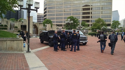
Police protecting HarborPlace at the  free speech area
of the now demolished McKeldin Fountain in May 2015 (Photo: Kim Stark)

The solution to scarcely populated public spaces in Baltimore is not a strategy of reduction which bans or further discriminates against the less fortunate. Instead, what is needed is a strategy of addition: More people, more uses to make spaces inviting and safe for even more people to go out into streets, parks, and plazas.

Although neither Jacobs nor Lefebvre talk about it, I would suggest to add the theory of the tipping point. The obvious conundrum that empty spaces would benefit from more people, if there only were sufficiently many people to begin with, requires a dynamic view in which a system is fueled with energy until it tips into a self feeding positive feedback loop. To achieve such a tipping point, a lot of things have to be calibrated just right. One of them is the right balance between control and freedom. Another is a redirection of resources away from the big projects which create even bigger dead zones such as a Convention Center. Full focus on reviving depleted Baltimore neighborhoods would most likely create the critical mass needed to fill Baltimore's public spaces and make everyone feel safe.

Klaus Philipsen, FAIA

See also  see part 1 of this article

Thursday, June 28, 2018

Where are your people, Baltimore? Part 1

Buildings are used as a people stage. Everybody uses them for a myriad of simultaneously animated play areas. Balcony, forecourt, window, gateway, stairs, roof are the stage and box seat at the same time. Even the most miserable existence is proud to be, in spite of all the depravity, a participant in one of the never repeating images of the Neapolitan street, and to enjoy being able to leisurely follow the great panorama. Walter Benjamin: "Naples", 1924
Holiday shopping at Howard and Lexington Streets
( Photo SUN, Robert Mottar)
Where are all your people, Baltimore? Anyone coming back from travel to cities such as Boston, New York, Seattle, San Diego, Zurich or Naples will ask this question. Public spaces in this city seem mostly deserted except for cars, even in downtown. In the few places where people routinely assemble, such as near the Lexington Market, police see them as "loiterers" and are doing everything to make their life of  miserable. Benjamin had admired the "porosity" of Naples which he saw then  of not having hard borders of confrontation and separation.

Its hard to see such porosity in Baltimore. In more affluent neighborhoods, such as Mount Vernon, special security details canvas the streets. In poor neighborhoods, such as on Pennsylvania Avenue near North Avenue, the sidewalks are busy but most city residents wouldn't  dare to go there. Parks, one of the classic urban commons,  such as Leakin or Druid Hill are beautiful, but remain devoid of people most of the time. All this stands in stark contrast to familiar photos of Baltimore's history depicting downtown streets bustling with life.

The urban park as a commons: New York Bryant Park
(photo: Philipsen)
Even refurbished urban spaces such a Center Plaza, remain mostly deserted, no matter the inviting public chairs and tables the Downtown Partnership placed there. How different things could be, becomes manifest during Baltimore's many festivals and events, such Light City or Pride Parade, but the day after the city goes dormant again.

Not even Harborplace with its peculiar semi-private status is always lively. In spite of its managed status and limited public rights it has recently lost its status as a perceived "safe space" (as seen by suburban whites) due to some small skirmishes with black youth which were quickly blown out of proportion by certain media. The "safe space", like much of the city's vitality, has moved east. For now "Sandlot"at HarborPoint, an artificial beach with volleyball, food, drinks and a fantastic view of the water, accessed via the promenade easement, is the most convivial space in town, legally not entirely public but busy and popular across class and race.
Sandlot, HarborPoint (Photo: Philipsen)

Public spaces in any city are subject to a thick set of rules. Ideally they strike a balance between rights and obligations. Many would say that the increasingly popular private-public security arrangements infringe on public rights such as free speech.
The city itself should arguably be treated as a common: a collective physical and cultural creation by and for its inhabitants. However the range of activities permitted in urban spaces is becoming increasingly narrow. Many streets and squares are now managed by private owners and those held by the state are too often sanitised by public space designs that serve to enhance local property values and business rates. This leaves little possibility for the urban public to be used productively by its communities to sustain themselves materially or culturally. (Theatrum Mundi, London)
Others would say that in spite of all the management, there is also a pervasive sense of anarchy in Baltimore's streets, even in the downtown area:  Delivery vans or pizza services stop in travel lanes or in a bike lane for extended periods, cars speed up like on a race-course, run red lights or block intersections. The rare pedestrians amble aimlessly into traffic any time they feel like it. Dirt bikers pop wheelies in the middle of all the cars. Traffic management by lime vested "officers" employed by City DOT who aren't allowed to give out citations is noisy with whistles but ineffective.

Outside of downtown and the waterfront where the Downtown and Waterfront Partnerships patrol  keep streets and walks clean, trash piles up on sidewalks and along the curb supplemented by the banned plastic bags put out on any day even if it isn't collection day. Hawkers offer legal or illegal items in plain view, loudspeakers blare the sermons of self appointed preachers, carcasses of spindly trees planted with an aspiration for a greener city live out their last days, squeegee boys or beggars harass motorists on all major arteries day and night.
Midtown patrol vehicle (Photo: Philipsen)

All this may seem petty in light of capital crime and police corruption roiling Baltimore. Yet, this particular combination of emptiness and unruliness is a curious state of affairs in a time when cities compete over being walkable, exciting and attractive places in which to move around on foot, by bike or transit.  When the vitality of the public space has been recognized as a symbol for the viability of a city and its functionality as a community and as a litmus test of democratic expression it matters that a large number of the 2 million residents of  the greater Baltimore Metro area don't seem to consider the streets and plazas of their largest city as a place where they want to go.

The pulse of public spaces is like a canary in the mine-shaft: Deserted public spaces, whether abandoned for fear or by exclusion,  are indicative of a larger problem, they signal a rift in the social compact which makes a city work.

Empty public spaces aren't a good thing, whether ones look at it from the prevailing single-lenses of economic development or healthy retail, from the idealized architect-planner perspective of the "public roam" and the urban commons, from the perspective of those policing it, or from the standpoint of the community itself seeking to increase their quality of life.
Pennsylvania Avenue: Where many don't dare to go (Photo: Philipsen)

History informs about how public spaces were produced, perceived and experienced. In the post-war suburbanization of America, privatization of public space contributed to emptying out the central cities not only by robbing them of residents who could afford to move but also by taking away importance and meaning of mingling in public. The park loses meaning when green space is atomized by single family homes with private front and backyards. The urban plaza loses its attraction as a space of gaining information (knowledge) when each living room has a TV. The outdoor space loses importance of escaping the heat when everyone has air conditioning. Walter Benjamin and Jane Jacobs pointed to the essential human function of mingling, observing and producing.

Historic Pennsylvania Avenue in the so called hey-days 
Planners, designers and developers have long reverted those car-centric destructive sprawl trends in favor of principles straight form Jacob's book. What's up, then, with Baltimore?

In part 2 of this article (published next) we will look at exclusions and rights in the public space, see why Baltimore feels so often empty and what Jane Jacobs and the French philosopher Henry Lefebvre (the "Production of Space") may have to offer not only for a deeper understanding of the problem but also for developing multidimensional solutions.

Klaus Philipsen, FAIA

Lexington Street at Liberty Street, now and then (Internet Commons)

Center Plaza while a daycare center makes use of it (Photo: Philipsen)

Harbor Promenade: Pretty but often empty (Photo: Philipsen)

North Charles Street at afternoon rush hour: Empty (Photo: Philipsen)

Aliceanna Street at Harbor East: Zumba on Saturday morning (Photo: Philipsen)


Tuesday, June 26, 2018

Hogan and Trump one step closer to the destruction of the historic B-W Parkway

Robert Moses is now considered to have been an authoritarian planner who plowed his grand visions ruthlessly through the fabric of communities displacing especially black and poor people in favor of roads and new housing high-rises. But Moses also created beautiful New York parks and parkways in his role as metropolitan Park Commissioner, appointed in 1934.
Robert Moses: Historic Northern State Parkway, Long Island
wide medians, gentle curves following contours, natural stone bridges
and walls 
The fruits of the New Deal and of Moses' organizational genius were evident all over the city. In these first years, hundreds of playgrounds were built. Three zoos, 10 golf courses and 53 recreational buildings were completed. [..]
Parkways, now defined as modern highways isolated in a ribbon of parkland, were an important part of the new parks system. By 1936 the Grand Central, Interborough and Laurelton Parkways opened. The Triborough Bridge, the heart of the city's new arterial system, opened in July. The Henry Hudson Bridge and the first sections of the Henry Hudson Parkway opened on December 12, 1936.(NYC Parks website)
82 years later, our governor still shares with Robert Moses the love for the automobile; however without Moses' appreciation for design and beauty which characterized his many New York parkways.  For Hogan the now 54 year old B-W Parkway is merely another conduit for cars which needs widening. He is is not bothered by the long history with early concepts going as far back as L'Enfant, route planning from Charles Eliot (1910), and real planning started by the National Park and Planning Commission which was created in 1926. The B-W Parkway is the only fully developed parkway in Maryland.
Baltimore Washington Parkway (NPS)
The Governor wants to buy the 19 miles of Parkway currently managed by the National Park Service from the feds so he and his road addicted Secretary Rahn can turn it into another eight lane commuter night-mare like I-95 as part of his $9 billion "traffic relief plan". The State sure has extra money, after the Baltimore Red Line was tabled and the increased gas tax keeps flowing. (The State actually envisions much of the road cost to be covered by private consortia who get to collect tolls). On the other side, the National Park Service under Secretary Zinke and President Trump is eager to offload a costly "burden". A deal made in hell.
Shifting the B-W Parkway to Maryland — and then widening the highway in Prince George's and Anne Arundel counties, also known as Maryland Route 295, and tolling it — is key to Hogan’s three-pronged $9 billion “traffic relief” plan. That controversial plan also calls for adding toll lanes to Interstate 270 in Montgomery and Frederick counties and Maryland’s portion of the Capital Beltway. The I-295 agreement was signed by Hogan on Friday and Interior Secretary Ryan Zinke on Monday. It formalizes “the Parties’ interest in evaluating future operation and ownership alternatives for the portion of the Baltimore-Washington Parkway that is administered by the National Park Service.” And it acknowledges that the transfer cannot take place without federal legislation(Washington Business Journal)
Graphic: PIRG report
Given Hogan's past insensibility to the subtleties of transportation, it is not likely he or his secretary would pay attention to the fact that the B-W Parkway was carefully placed along the geological fall line between the Atlantic coastal plain and the Appalachian Piedmont. (NPS website) and as part of a regional park system explocitly designed as a contrast to the ugly commercial corridor of Route 1. Nor would he care that the Parkway has maintained green buffers on both sides which make travel on it a pleasant experience in spite of all the sprawl that has filled much of the land between the two metro areas. The extra lanes would kill tens of thousands of trees and expose much of the ugly stuff that has sprung up near the route.

The Governor doesn't care that the Parkway runs along the Agricultural Research Center, the Patuxent National Wildlife Research Refuge, Greenbelt Park and Fort Meade, all precious large green open spaces. He doesn't care that it touches a number of places with historic significance, all reasons which landed the Parkway on the National Register of Historic Places.
The Parkway maintains original integrity of setting, design and associations characteristic of the earliest parkways designed for pleasure motoring - the preservationof natural topography and vegetation for scenic purposes coupled with "high speed" elements of modern freeway design (National Register)
The realized Parkway suffered from the beginning from the fact that the critical gateway into the Nation's Capital, a key original motive for the early concepts,  was never integrated into the actual parkway, even though the National Arboretum sits right next to the freeway entering DC. Even less considered was the manner in which the parkway would arrive in Baltimore. By the time it was actually constructed in 1954, traffic relief and economic development had long trumped the loftier aspirations of the 1920s and 30s. Today Baltimore's southern gateway is dominated by the incinerator's smoke stack, Baltimore's largest polluter.

Still, when in the pre-construction debates of the 1940  funding through a Maryland toll road was considered and legislated in Annapolis in 1940, this approach was nixed by Congress.
Endangered: B-W Parkway, recently refurbished 
"Congress found it unwise to give State rights through federal property which composes so much of the parkway's right of way". (NPS)
By 1950, though, Maryland had already completed 7 miles of the project leading to its Friendship airport, the portion that remained in the responsibility of the State ever since.

Today, the real opportunity the Parkway offers, is to redesign these two termini so they are worthy of the parkway's initial aspirations. Instead, the Governor's plan is to make the 19 mile centerpiece just as ugly as the two ends. This is a crime against history, historic preservation and the future of sustainable transportation all at the same time. It should not stand.

Klaus Philipsen, FAIA

Washington Business Journal: Hogan has a deal with the Trump administration
US-PIRG report: Highway Boondoggles

Related on this blog:
Why the Baltimore-Washington Parkway needs to be protected

Tuesday, June 19, 2018

A breakthrough on Roland Avenue?

Bicycling, even more than transit, is a mode of transportation for which users are far fewer than those with strong opinions. Thus improvements for bicycles are caught in a vicious cycle, namely that people with a different interest dominate the discussion wondering aloud what all the fuss is about. As soon as a bicycle facility threatens to take up some of the precious road space, those critics like to observe how few bicyclists are out there and that Baltimore isn't Amsterdam or Copenhagen. Which is kind of like saying Baltimore is not Munich and asking everybody to drink Coors Light even though it surely has been demonstrated how micro-brews, coffee-shops and bakeries can shake up common assumptions on how an American city has to be. And sometimes the solution of the future is something that Baltimore had plentiful in its past, such as breweries, bakeries and, yes: bicycles.
Even the Wall Street Journal reported: Existing bike lanes on
Roland Ave (WSJ photo

Naturally, to observe those who swim across a river to determine the need for a bridge is defeatist: No facilities, no bicyclists. Bad facilities, are good as fig-leaves but they don't really promote bicycling either. At times they are worse than none because they provide fodder for epic conflicts that don't serve a more holistic approach to transportation either.

Roland Avenue is a case in point. It boasted the first protected bike lane in Baltimore ("protected bike lanes" are those which are physically separated from moving traffic, in this case by parked cars), but slapped together too quickly in response to tragedy, it didn't work well as a result. Neither the bicyclists nor the residents who drive cars or park cars were happy.  And, unlike in politics, a compromise usually not a useful solution in transportation. To prove the point, the Roland Park Civic League even hired a bicycle facility consultant to look into the matter.  Alta Planning and Design issued a memorandum in which they accurately described the issue this way:
Current Bikelanes weave at intersections
While Alta was not involved in the decision making process, we assume the implementation of a cycle track was in response to existing challenges along the corridor: non-compliance with the speed limit, a wide travelway promoting
speeding, vehicular dominance, and speed affecting pedestrian safety and experience. Implementing a cycle track can remedy these challenges. In addition, this corridor has recently been identified as an important connection within the City’s bicycle network in the recent 2017 Low Stress Addendum to the Bicycle Master Plan. When the corridor was slotted for resurfacing, it created an opportunity to fast-track bicycle facility implementation in late 2015. While this
presented an exciting opportunity to incorporate complete streets design tactics, the community feels there was not sufficient involvement in vetting the actual engineered design solution. 
Alta Section: One travel lane and a bike-lane behind parked cars
resembles BC-DOT's preferred option
As a result of skimping on standards, drivers on the right lane of Roland Avenue felt squeezed between the cars on the left lane and those parked in a tight parking lane. The too narrow parking lane put sloppy parkers either into the bike-lane to the right or into the travel lane to the left. There was no margin of error for opening doors on either side. Area residents reported damaged cars, clipped mirrors and bicyclists reported that vehicles were blocking the protected lane way too often. Many residents wanted the earlier curbside parking back with a striped bikelane alongside two travel lanes, the condition that was in place when a intoxicated and texting driver ran into a bicyclist in that lane and killed him. It was that crash which demonstrated in a tragic way that simple paint lines provide no protection to bicyclists, no matter that cities around the country had opted for this cheap and easy way of demonstrating bike friendliness. After the crash the bikelane was moved to the curb so that the parked cars would provide a barrier.

While the rest of America discusses the inequity issues related to bicycling and bike sharing (Bikeshare still has a Race Problem) Baltimore focused on how to rebuild this bikelane in an affluent area for a second time. That seems like a colossal waste to some, but it shows that the idea of making streets work for more people than just drivers isn't as easy at it appears.
BC-DOT Option 1: One lane of traffic, wider parking

After years of bickering, stereotyping, and a lot of foot dragging from the responsible department, Baltimore City DOT, to its credit, has now emerged with a set of carefully considered options  which will be up for comment until June 28. To boot, the "preferred option" appears to be not only a wise solution, but Director Pourciau also took a clear stand for it (Option 1). It gives all modes a safer space and maintains the major standards for road design.   It resembles one of the options Alta had developed in its memorandum. In total, DOT worked out five options, all but one take away the second travel lane. The only solution with two travel lanes remaining returns the status quo ante, i.e. a non-protected lane, clearly not equally valuable. Removal of a protected bikelane shown in masterplanning and already constructed opens up potential liability for the City, Jed Weeks of Bikemore explains.
Option 1 is supposed to cost less than $250,000. It includes some curbside loading near schools as well.
Option 2 (the original state, unprotected lane)

The department studied speeds, traffic volumes and delays. The analysis shows that two travel lanes are not needed for handling the traffic volumes on Roland Avenue. However, they are useful for throughput at signals, the capacity choke points in any road. A one lane road creates some longer queues and delays at signals. According to DOT this increases the trip time in the 2.5 mile segment from 5 minutes to an estimated 6-7 minutes and drops the "level of service" on some intersections by one grade. The intersection with Cold Spring Lane already operates at level F in the "pm peak" and will remain so since there is no lower grade available.
"We find there is an amount of delay during the peak times which is usually the opening and closing times of the school. But we know that once people slow down and respect each other that we can tolerate the level of congestion on this road." DOT Director Pourciau on Fox 45 TV
Option  3 (buffered bikelane, cars at curb)
Some local residents still like to get the familiar curbside parking back, as the June 14 public meeting showed. However, there is also a petition of residents with children who ride bicycle underway, petitioning DOT to stick with the new preferred option.

Together with the recent resolution for a pair of protected east-west bike-lanes on Centre and Monument Streets, and the temporary pop-up installations of the "Big Jump", which connect Remington and Reservoir Hill, one can get the impression that after the protracted battles on Potomac Street and Roland Avenue BC-DOT has regained its footing when it comes to bicycles. To remove the still present threat of the Baltimore Fire Department of nixing any single lane traffic solution under 20' width,  Councilman Dorsey introduced this week a Baltimore City fire code amendment which removes the excessive fire-lane requirements for public streets.

Baltimore has a long way to go to become a city that really respects walking, transit, bicycles and cars, but recent steps are going in the right direction. With about 30% of the city's overall footprint, the design of public streets really matters. Just like accessibility laws made facilities more usable for a whole lot of people, complete streets will make a better city for all.

Option 4 (two way bike lane on the left)

Klaus Philipsen, FAIA

Wall Street Journal: Creating Bike Lanes Isn’t Easy. Just Ask Baltimore. 

Option 5 (one way bike lane on the left)

.


Monday, June 18, 2018

Link anniversary:Fact and fiction of Baltimore transit

Transit can be a geeky affair in which esoteric metrics are batted around way over the heads of a largely indifferent public which consists of a minority of people who actually use transit and a vast majority of car drivers who care about transit usually as much as fish care about bicycles. Yet, they quickly chime in when people call transit performance poor. Transit bashing is almost like an obligation in Baltimore, especially now during the campaign.
The interior of a bus: a view rarely seen by most
(Photo: Philipsen)

On occasion of the anniversary of renaming all Baltimore transit "LINK" MTA offers a video celebrating "Take Transit Week" under the slogan "dump the pump".
Starting on Monday June 18, thru Friday, June 22, MDOT MTA is celebrating "Take Transit Week" by encouraging riders to Dump the Pump! Whether you’re coming from north, south, east or west, BaltimoreLink can get you into and out of Downtown Baltimore. #DumpthePump #mdotnews pic.twitter.com/Meddct9Dz1
In the video a voice says "find out why everyone is excited about "LINK".  So, what is really going on? Is Baltimore transit as terrible as the political candidates and some transit advocates make it or are people "exited about the new LINK"?

Well, when the SUN did the usual street interviews to gauge public sentiment, they didn't find much excitement, at best they found careful optimism. Even MTA Administrator Kevin Quinn is avoiding to call LINK an unmitigated success.  Noting some of the obvious improvements, such as some dedicated bus lanes and some signal priority and more buses being able to report their location via GPS he told the SUN:
“Taken together, we are certainly headed in the right direction,”
“We’re measuring things better,There’s generally been a culture shift in the agency, a real culture change toward data-driven accountability.” (Kevin Quinn, MTA Administrator)
This is a lot more related to reality than his predecessor's pronouncements in the spring of 2016 when LINK was still a project and not a reality:
“We’re going to have a safer and cleaner system, a unified system of new high frequency routes that connect seamlessly to light rail, Metro, MARC, commuter bus and other services. It will change how people get around in Baltimore because they’ll be able to rely on the system to get there, on time, to where they want to go.” Paul Comfort to GBC
In spite of all the talk about data, it is still hard to figure out how well LINK performs except for transit ridership and on-time performance, two metrics which the agency reports on its own website "performance improvement". The graphs posted there end in February 2018 and they don't look too good.
Green is on time, the change from 2016 is only about 1% (MTA website)

Bus ridership is tumbling with a slight recent uptick. (MTA website)
The SUN posted a different graph provided by MTA. It shows May 2017 almost on par with May 2017 thanks to an uptick in the spring, possibly due to rising fuel prices.

Data are hard to find when it comes to more qualitative comparisons which are not included in the annual APTA report or data published by the MTA. The Central Maryland Transportation Alliance's Brian O'Malley told the SUN for its anniversary article that he doesn't know whether the bus system is really improving:
“But my confidence in the number they’re reporting has been shaken by the series of changes they’ve made in how they measure and report the number, especially because the changes have always been convenient for making BaltimoreLink come out looking like an improvement [...]
the only way to show that the system actually is improving is to make more data public. They say it’s gotten better, but we don’t know whether to believe them. We can’t confirm or deny it.” (Brian O'Malley CMTA)
It comes handy that the Office of Budget Management (OBM) prepared a MTA review and analysis for Maryland lawmakers earlier this year in the context of bills which affected MTA. This little known document gives a fairly comprehensive view of the current performance of MTA's existing transportation systems. It gives also a partial answer to the question whether LINK Bus was a success.
Big trains, few riders: Baltimore light rail (Photo: Philipsen)

The document indicates that Core Bus Ridership has declined precipitously in 2017 from an annual ridership of 75.619 million riders in 2016 to 69.587 million, a decrease of more than 6 million riders, or 7.9%. (By comparison, the bus ridership loss at WMATA was 4.5%). While the MTA bus rider loss  continues a decline that has been going on since 2013, it roughly doubles the previous percentage loss. 2017 was the worst performing year in eight years. Maybe this isn't a surprise, given the extent of this reform which resulted in lots of initial confusion. The real test will be the 2018 numbers. The OBM is not optimistic and projects another 5.4% loss for 2018.
MTA self reporting about rail ridership: flatlining with a downwards trend,
operating far below capacity (except for MARC)

Light rail ridership remained almost exactly the same between 2016 and 17, mobility service had a slight increase. Less riders means, of course, higher cost, especially if service remains constant and operator salaries, energy prices and such would go up. The 2017 cost per passenger trip is with $3.67 the lowest for bus and the highest for the mobility service with a whopping $40.94. The cost for Metro and Light Rail is $4.56 and $6.20 respectively, for MARC it is $16.63, in part because the rail services have longer trips. The commuter rail fare is also higher than the bus/LRT/Metro fare. Thus the farebox recovery rate for MARC is actually the best with 45% and the lowest for Light Rail with 17% with the bus in the middle at 27%. (The mandate to recover 35% has been eliminated by the legislature in 2016). By comparison, WMATA's farebox recovery for buses is 21% and for Metrorail a whopping 57% (Anybody who has paid fares for the DC subway knows, riding it ain't cheap). Not included in the OBM report are the data that were used in the modeling of the alternative bus system. Those model numbers which include average commute times, % of people with 1/4 mile walk access to transit, and % of jobs within walk access of transit were given for early LINK system concepts but were not provided by MTA for later iterations or for the actual system in operation.

It is relatively easy to find  quantitative data which compare the MTA to transit in other metro areas, for example in the MTA open source data or the annual APTA report which puts the 50 largest transit systems into easy to understand side by side comparisons for a number of fairly obvious metrics. In those, MTA always looks pretty good because there is comparatively a lot of transit on the ground in this metro area.(see recent blog article). Even with reduced ridership, the MTA moves some 300,000 people a day on their various modes, not something one can dismiss as irrelevant. Not only is it impressive to move that number of people if one considers the logistics that are necessary to do this day in and day out, mostly on public roads with all the vagaries they offer, not least it is congestion which gums up the cogs of the MTA transit machinery. 300,000 riders is also a lot of people who are seriously affected when transit doesn't work as expected, especially in a region where so many have no other choice of getting around.

Tolerated on a shopping center parking lot:
Suburban transit (Photo: Philipsen)
Among the nation's large cities Seattle stands out with vastly improved bus service and ridership increases that exceed population growth. Otherwise the picture for transit usage and especially bus ridership is bleak, not just in Baltimore. And there is hardly a company that doesn't draw the scorn of its riders and derision of a public that mostly doesn't care.

What is to be done? Governor Hogan's response of paving ever more lanes on chronically congested highways is no better than giving an alcoholic schnaps for a cure. Even if all vehicles would be electric tomorrow and self-driving the day after, cars cannot be the solution for urban and metropolitan transportation woes. There simply isn't the room for them, nor do wider roads make good cities, no matter what car technology is used.

Although it seems so un-American, the long haul of more, better and more frequent transit by bus, rail in tunnels or on the surface will have to be undertaken. If anybody thinks, that Elon Musk can provide the magic solution with cars in tunnels, wake up! He won't. As hard as it is for a country that considers itself as more advanced than any other, it is worth looking at France, Spain or China. All those countries have embarked on high speed long distance rails, high density development near rail infrastructure and a radical departure from reliance on the automobile long ago. So long ago, in fact, that they already have much of the networks which we still ponder for a distant future.

Much could be done to utilize our existing trains, subways, commuter trains and buses better, mostly not by magic tricks in operations but by creating a land use pattern around the systems we have, instead of against them. When we go to the ballot box, we should consider this. As long as we don't want to pay the taxes which are needed for a decent infrastructure, as long as too many people still want to live in remote areas and drive 2-ton vehicles to work, we can beat on the MTA as much as we want, we will continue to see not only a decline in transit ridership but also a decline in our economic resilience.

Klaus Philipsen, FAIA

Baltimore SUN article for LINK anniversary on June 18, 2018 
Video about GPS on buses and the Transit App.

related articles on this blog:

Baltimore's Transportation woes
Let's get the Quickbus back
Is Baltimore LINK a smart service model? (2017)
Ten ways to improve bus transit (2015)
What it takes to provide a bus ride for 250,000 people a day (2013)


Sunday, June 17, 2018

State Center stunts can't replace action

The State Center complex is an interesting case study in urban planning. 

Conceived as far back as 1954, State Center falls into a period in which Baltimore had resolved to do "slum clearing" under the "Baltimore Plan" mostly through rehabilitation. This was later followed by "urban renewal" in which entire sections of the city were wiped out in a series of attempts to make traffic move better, remove "slum and blight" and make the city more modern.
Hogan at State Centre in 2017 (Daily Record)

Today those large-scale urban renewal plans are generally seen as colossal failures, in part because of the motives behind them, in part because of the outcomes, and in the case of the State Center area, because the clearance was disruptive and to this day the site  remains way underutilized in a strategic location: Disconnecting neighborhoods instead of connecting them.

While it was a great idea to concentrate State office functions in Baltimore, the State's largest City, and provide State workers with modern light filled office built to the latest standards of that time, the thinking of the time created so many of the problems Baltimore has today.
The State Center area 1869, long before urban renewal

For one thing, massive amounts of housing had to be removed for the new vision, destroying history, human and physical connections and displacing many people from then stable communities. State Center reflects the economic reality of 1954, namely that the City needed to have more and better office space than the historic downtown could offer, an insight that also fueled the Charles Center urban renewal. It also reflects the suburban mindset of the area with its focus on the automobile and how suburbanites can quickly get in and out of the city. State Center as an urban renewal concept is hinged to the idea of the urban freeways that was hatched in those days as well, only partly realized in Baltimore, but the Jones Falls Expressway, the East West Expressway, in which Robert Moses had a hand as well and which later became the disastrous "Highway to Nowhere", the downtown bypass (Martin Luther King Boulevard) as well as the abundance of parking were all signature ingredients of the essentially suburban office campus.

But  it became clear as early as the 1970's and even before the first oil crisis that the automobile could be a bane for cities if not accompanied by great transit. President Johnson's Great Society plans gave Washington its Metro, San Francisco its BART system and eventually also Baltimore and Atlanta their respective skeletal Metro systems. State Center got its own subway Station which opened in 1983. Then as today a period of reform ended in a phase of reactionary policies with Richard Nixon in Washington and Spiro Agnew first in Annapolis and later with Nixon. 
The mid-20th century modern buildings of the State Center office complex, give few hints to the long and rich history of the diverse neighborhoods that surround the site. Just looking at a present day map gives clues to the unusual character of the area – where the north-south street grid of old Downtown Baltimore meets the diagonal street grid of the later residential neighborhoods. For this reason, State Center is situated at a unique historic and cultural crossroad. It is here that older early 19th century neighborhoods of Mount Vernon and Seton Hill and the younger late 19th century residential communities of Bolton Hill, Upton-Marble Arch and Madison Park eventually grew together. (PB Planning study 2005)
This strategic location matters. Today other assets count: The area is considered to be Baltimore's cultural center thanks to the Meyerhoff symphony hall, the Lyric and the proximity of the Maryland College of Art. Bolton Hill is a stable community showing the beauty of Baltimore's historic architecture in the best light. Mount Vernon is thriving and Murphy Homes public housing towers have been redeveloped into  a smaller scale mixed income community called Heritage Crossing. Only State Center remains as if time had stood still. The suburban office park is even dead in the suburbs, it is intolerable in the heart of city neighborhoods.
Martin Luther King in Baltimore, 1964

This has been recognized for quite some time. Comprehensive studies have been conducted since 2004 under a variety of governors and mayors. Citizens were involved, consultants hired, paid and released until a consensus plan emerged. A plan with private and public uses, new office for State office workers and plenty of new residential and commercial spaces to fund the endeavor. Connectivity would be restored, the subway station would get better use and the adjoining neighborhoods would have a vibrant neighbor with a rich mix of uses instead of the dull single use assembly of today. But just as Spiro Agnew as Governor in 1968 never understood the Baltimore uprising that followed the assassination of Martin Luther King, suburban Governor Larry Hogan doesn't understand the real reasons for Baltimore's unrest of 2015 nor does he really care for what a big city tick these days. He hasn't even taken the lessons of the oil shock of 1972 to heart and still promotes the transportation policies of the 1950 with the automobile uber alles. Just like Agnew easily dismissed the new black majority in Baltimore and actively catered to the fears and aspirations of suburban and rural Maryland, Hogan's electorate doesn't sit in Baltimore City and he can easily yank the two largest investments the City had aspired to under Governor O'Malley: The Red Line and State Center. The bus reform for 4.6% of the Red Line budget and the much touted project CORE for demolition of empty rowhouses can't disguise the fact, that Baltimore just isn't this governor's priority.

When he last week assembled State workers around himself in front of their outdated offices at State Center and proclaimed that he would do something about the sad state of affairs, it sure sounded like good news.:
“After more than 15 years of inaction and failure I am pleased to announce that we are finally able to move forward on the redevelopment of State Center,”
Except the pronouncement was wrong in both halfs of the sentence. Neither was there "inaction" during the last fifteen years, nor was there any way to move forward. He, the Governor himself had created the roadblocks that ultimately lead to inaction of years of planning and consensus building. Inaction is what best describes his years in office, not the 11 preceding years.
Slum removal, the 1950's (Martin Millspaugh, "The Human Side of Urban Renewal", 1960)

Hogan's request that the development team that had been selected by his predecessor and successfully battled two lawsuits from Peter Angelos who didn't like competition to his downtown real estate holdings, simply pack up and leave, no matter their investments and their efforts over the years is as unrealistic as it is unreasonable. How hung up he is to clean the slate is obvious from this blunt statement last week: “We put a very generous offer on the table just to get rid of these guys.”

As a real estate professional himself Hogan knows very well that years of planning and creating entitlements (A Planned Unit Development plan has been adopted by Baltimore City) is not nothing. In today's world of very slow planning the past 14 years or so are very valuable and can't be simply tossed away, neither by him nor by those who made the investments that enabled the process. Naturally, the lawyer representing the development team that had been working on the project since 2009, immediately denied that there has been any kind of breakthrough. Given that the team doesn't just consist of Struever Brothers successor Ekistics but of nationally well know entities such as McCormick Baron Salazar and reputable local minority firms should give a governor pause who proclaims that Maryland is "open for business". His "just to get rid of these guys" phrasing is insulting to companies that want to invest in Baltimore and sounds much more like the US President than Hogan should like who usually likes to keep his distance from that man. But his assertion that the State Center deal is terrible and "illegal" sounds just like Trump talking about the Iran deal that the rest of the world would like to save.

Hogan who likes to show up in Baltimore to confess his love for the City proves incapable of comprehending that the State Center deal he has tossed out by suing the development team in 2016 is not about some specific people he apparently doesn't like (but never sat down with to negotiate) but about the blood. sweat and tears that this site represents: First as an example of bad urban renewal carried out on the backs of the displaced residents and businesses and then as a place of hope bringing about an all-out effort by hundreds of people to forge a consensus plan for the future.

Stunts like his media spectacle on Thursday of last week will do little to move forward. The key to getting out of the stalemate is entirely in the Governor's hands. Instead of his overblown rhetoric about how bad a deal the State Center project is, he should employ his skill of looking somehow bipartisan, eat his pride and engage in a real serious negotiation with the development team.  If Hogan doesn't like the deal, he should sit down and improve it in a fair negotiation that doesn't begin with insults. Exactly, what one would expect from a Governor who wants to be elected for another four years. The last thing anyone affected by the bad current conditions, neighborhood leaders or State office workers, want to do, is to start from scratch. Especially not studies and investigations that are as useless as what the Governor had ordered last year and received early this year "as a new State Center Plan", a quickly thrown set of unbaked ideas which nobody took serious as useful blueprint.

Klaus Philipsen, FAIA

Baltimore SUN about O'Malley punting on the project in the last minute.

Related on this blog:

New State Center study adds insult to injury