Thursday, August 29, 2019

Another Bay bridge is insanity

It so happened that the shortlist of options for another Bay crossing along with Governor Hogan's stated preference were announced on the same day Greta Thunberg arrived in the US sailing from Europe. She is the 16 year old climate activist who founded the international high school student movement Friday's for Future.
Greta Thunberg, climate activivist arrives in NYC (NYT)

This coincidence highlights better than anything how stuck in an almost forgotten past our Governor and his transportation Secretary are; how entirely unencumbered by any insight or thought the idea is to build another bridge crossing.

A new bridge isn't just a wasteful boondoggle, it would create irreparable damage to all the systems that are already teetering at the brink. It is irresponsible of  Maryland's transportation officials to have even kicked off a planning process for this ill fated idea and wasting valuable planning dollars on it, even though the realization of such a project would be far beyond the the point this government is in office.
More roadways to the shore? Full steam into the 1950s (SUN photo)

The additional Bay bridge idea is nothing than an extrapolation of the policies of the 1950's, the time when the first span was built in 1952. Eeven the second span, opening in 1973, seemed awkwardly out of its time when it fell into the same year as the OPEC oil embargo that became since known as America's first oil shock.  (Two more followed but had no impact on many decision makers, a fact Ms Thunberg never tires to point out. Especially Maryland's transportation officials have not learned these lessons since then:

  • The bridge and the added span have opened the Eastern shore to unprecedented sprawl and destruction of valuable farmlands. By now it takes a full 10 miles to get out of the jumble of gas stations, fast food places and shopping centers lining a bloated US50 before one can even get a sense of the Eastern Shore landscapes. Vulnerable coastal wetlands near Stevensville and Chestertown have been paved over, sprawl mansions sit were framers once tended to fields.
  • All the new capacity and development has added congestion not relieved it. Now many people think nothing of it to live on the Eastern Shore and work in Annapolis, Baltimore or DC, a completely unsustainable commute.
  • Sprawl, development and endless promotion of a quick journey to the beach brought about more driving, more gasoline consumption and more air pollution, all premier contributors to climate change, the very issue threatening the Eastern Shore more than most other landscapes in the United States
  • Added capacity can come in other ways than building more road lanes: New technologies will bring to better manage existing road-space with less congestion. It is estimated that autonomous connected vehicles of all types will increase existing roadway capacity in freeway conditions by at least 30%, just about what a new bridge span would provide. This in itself could spell calamity if not properly managed. But this and a third span is  lunacy. No matter who does the forecasting, those autonomous vehicles will be certainly everyday occurrence by the time a new bridge would be complete.
  • More access points to the Eastern Shore can dilute the negative impacts if they are done by lower capacity solutions such as hybrid ferries.
    Gas shortages in 1973: Even two oil shocks are not  enough
No matter where the location [of a bridge], make no mistake, it will have an impact on the entire Eastern Shore. What is at stake is the Eastern Shore’s quality of life, heritage, and highly productive farmland. Should Kent County be the selected location, our small agrarian rural county with the smallest population and landmass in Maryland would be swamped with traffic and our open space littered with fast food chains. Our unique identity would be ended. (Op-Ed, Chestertown)
Defying all those reasons, the juggernaut of a transportation study will run its course, once it is kicked loose. It will be the duty of any responsible citizen who cares about the environment, about climate change, or about fiscal responsibility to come out (see meeting info here) and tell this administration that the study has to be stopped. The old mantra of unfettered growth, no matter what kind, and no matter how damaging, has to come to an end.
Reach the beach come hell or highwater: MDOT corridor alternatives
Funded by toll dollars, the Bay Crossing Study Tier 1 began in 2016 and is expected to be complete in 2021. The next steps are to publish a Draft Environmental Impact Statement and hold public hearings in fall 2020. The final steps are to identify the preferred corridor alternative and publish the Final Environmental Impact Statement/Record of Decision in collaboration with FHWA in summer 2021. (MDOT website)
Greta Thunberg, still essentially a child,  sailed over the ocean to tell the adults to finally grow up and plan for her generation and those following her. There is hardly anybody who needs to hear her message more than Larry Hogan and his MDOT Secretary Rahn. 

Klaus Philipsen, FAIA

Related posts on this blog:

How the State gets to spend $1.1 billion on I-95 toll lanes

Heavy timber office building comes to Baltimore

The Collective at Canton: Site plan (Moseley Architects)
Washington DC has one, so does Minneapolis, Denver, Portland and a growing number of other places. If everything goes as planned, Baltimore will be next with a 5 story office building made not from concrete or steel but wood, cross laminated timer (CLT) to be technical. The new technique is the result of laminating timber strands until one gets hefty solid beams and columns that combine the best properties of concrete (compression strength) and of steel (tensile strength), an ideal condition especially where good seismic performance is needed. Plus, like heavy timber, CLT beams and columns don’t easily burn while not requiring the logging of substantial trees as traditional heavy timber. However, Currently, the International Building Code (IBC) only permits at most a six-story building using Type IV construction, a limit that may soften according to new code comments earlier this year. A especially permitted exception is a 12 story CLT in Portland, the tallest in the US.
The industrial past with tank farms and the signature curve at the
top of the image

Baltimore’s first engineered lumber building will be part of what Pavlina Ilyeva called "a whole new neighborhood" rising on what used to be an old Exxon tank farm across from what is now known as Canton Crossing.  The new development goes by the name the Collective at Canton and entails 12 acres total, bifurcated by a curved rails to trails greenway that roughly follows what would have been the Red Line alignment. The developer, Sapperstein is looking to bring a mix of retail, residential and office projects to the former industrial land. 

The architect for the timber office building is the Richmond based firm of Moseley Architects which has a large Baltimore presence after merging with  Marks Thomas Architects. Moeseley's design tries to make the
The proposed 5 story office building in its revised version (Moseley)
unusual construction method not only an interior feature of their exterior design but let it come through on the outside. To this end one corner has open decks with exposing the floor above on each level and timber supported protrusions on the facade which the Urban Design Advisory Panel (UDAAP) reviewed Thursday for the second time. 


For the longest time, Clinton Street was the eastern edge of what had already been dubbed the "gold coast" after the Anchorage, American Can Company, Tindeco and Canton Crossing had opened up the formerly industrial waterfront. Too unlikely the chance that the polluted old tank farms should ever join the golden parcels to the west. Ed Hale, who bought land east of Clinton for his trucking business might have
Sapperstein's Wheelhouse in Federal Hill (Philipsen)
had other thoughts. He certainly jumped the old barrier when he built the First Mariner tower, essentially one of his branch buildings on steroids.  Today, the odd tower is surrounded by new development which year after year becomes more urban and better architecturally, a trend heavily pushed by UDAAP member Pavlina Ilieva who demanded that the new Collective complex become far more walkable and pedestrian friendly than the Canton Crossing shopping center also developed by Mark Sapperstein. He understands the new market. His Walker development is just about to open the WHeelhouse in federal Hill, a building without any parking. Residents attracted to the co-housing offerings (up to three bedrooms per unit with bath around a kitchen and living room) will get a free bicycle instead. 


Klaus Philipsen, FAIA


Heavy timber in Portland's Clay Creative  building (Columbres photography)

Friday, August 23, 2019

Connecting the dots: Working from strength in West Baltimore

The West Baltimore MARC station area is not included in the four Impact Investment Areas of Upton/ Druid Heights, Park Heights, East Baltimore and Southwest as noted  in the City's brochure "A new era of neighborhood investment". Impact Investment Areas work from anchors of strength. This article shows how the MARC station, the Ice House next to it, the Highway to Nowhere and Metro West can be knitted together as anchors.
One of many visions for the Highway to Nowhere
(Peter Tocco, Plainview Graphics)

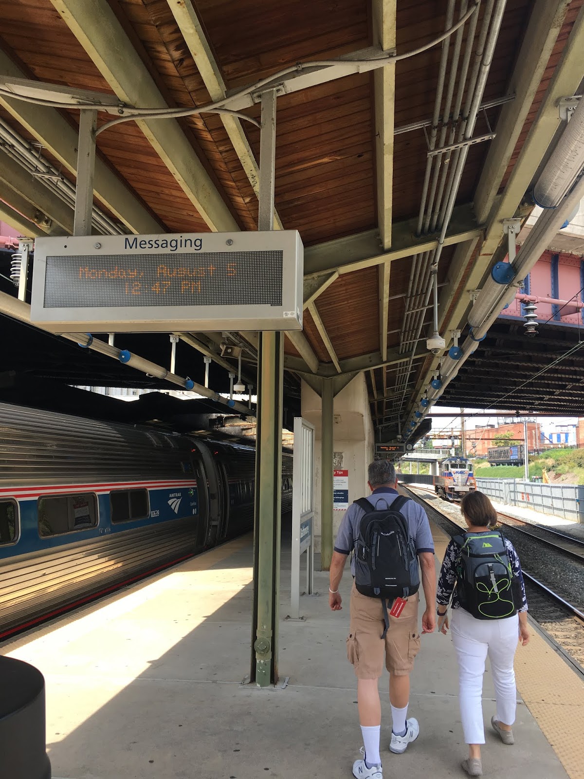
The West Baltimore MARC station sits on the edge of several surrounding communities (Rosemont, Midtown/ Edmondson, Penrose) but it should be a focal point because it is a popular commuter rail station and Baltimore's transit gateway to DC. Because of that it has been the locus of redevelopment ideas for decades. The Red Line Planning would have turned the station into a rail hub, the planning effort yielded e a City approved masterplan. A more ADA compliant rebuilding of the commuter station itself is on the books of MTA and delayed  because Amtrak investigated various B&P tunnel replacement alternatives which would affect how the tracks would run through this station area.

Not all is just on paper. Real investment came  with federal TIGER grants which transformed the end of the highway with its abandoned ramps and retaining walls into an MTA parking lot extension.  Then, with the new Link bus system, the MTA built a bus transit center next to the commuter rail train station. $3.75 million in federal funds through the Ladder STEP program allowed upgrades to several streets surrounding the transit hub including landscaping, ADA compliant sidewalks and crosswalks, lighting, and bike/walking pathways. Rehabilitation is taking place in nearby Harlem Park along the freeway.
ULI TAP diagram of Metro West on the east side and the MARC station on
the west side of the "Highway to Nowhere"  (ULI)

Most recently, the BBJ reported that  the owner of the Ice House (see video) Ilya Alter had teamed up with Bill Struever of Cross Street Partners to redevelop it as a brew-pub. A construction dumpster is already positioned on the site.

Finally, this week Dan Rodricks presented an idea in the SUN ("Here is a big idea") which Caves Valley, the developer who owns the complex of the former Social Security West, had revealed to him: A linear park constructed in the ditch now occupied by the highway to nowhere. Baltimore's "Low Line". (New York has the world famous "High Line" park). Arsh Mirmiran, partner at Caves Valley explained for the purpose of this article:
As we have looked from the upper floors of the Metro West building out to the west, it has become evident to our team (CVP and B&B Realty) that the Highway to Nowhere (a) has very little utility as a highway, (b) serves as an example of bad urban planning and is a major impediment to potential redevelopment efforts and community revitalization efforts in West Baltimore, and (c) provides a legitimate opportunity to create a transit link to the relatively nearby West Baltimore MARC Station, as well as recreation opportunities for existing and
future residents and office tenants in the area. As such, we have studied it and recommended to others that it be studied further and in detail. (Arsh Mirmiran)
A more fanciful vision for the Highway to Nowhere
(Peter Tocco, Plainview Graphics)
The linear park idea came out of a Technical Assistance Panel (TAP) conducted by the Baltimore chapter of the Urban Land Institute (ULI) in May of this year.
The solution to the problems of the study area is to end the culture of division, and create a culture of connection. This requires us to re-engage with the public spaces that our communities now retract from, and to find new ways to activate them in the public interest. (TAP report)
The park is one of many ideas proffered for the useless freeway over the years, for example by Gerald Neily on his blog InnerSpace. The freeway and all proposed uses for it end right at the West Baltimore MARC station in the west and at the Metro West complex on the east. All other parts of Baltimore's freeway plans had been defeated. Right before the highway fragment ends it engages with Martin Luther King Boulevard with a typical freeway set of overpasses and on and off ramps, creating an inhospitable environment for Metro Center West and making MLK at US 40 even more of a barrier than it is elsewhere. The removal of the overpass and ramps has been suggested by Caves Valley before and was endorsed by the TAP. It would be part of the greenway plan along with intensified uses at the corners of a future normal intersection. Rodricks in his column gave the park idea some of his own twists:
The Highway to Nowhere as seen from Security West (Photo: Rodricks/SUN)
The Westside Greenway, a proposal to turn the whole corridor into a green, people-friendly park connecting West Baltimore and its neighborhoods with downtown. Think of New York City’s Highline, or Citygarden in St. Louis. Imagine a 1.2-mile corridor of green, with bike lanes and promenades, space for pickup basketball and soccer games, fields for youth sports, dog runs and sculpture gardens. Imagine some of the massive concrete walls set aside for mural artists and rock-climbers. Imagine a series of stairs and elevators connecting Mulberry and Franklin Street, and all the cross streets, with the new park below. (Dan Rodricks)
As for the Ice House: Ilya Alter has waited for many years that the area would turn and his purchase of the burnt out former Ice House complex would turn into an opportunity. After Alter participated in years of community based deliberations about the area, those hopes were dashed with the cancellation of the Red Line in 2015. Various attempts of finding a development team which would want to get something done at the historic site even without additional transit failed until Bill Struever and Alter finally found each other this year.
A renewal of the American Ice Building off the infamous "highway to nowhere" is in the works by Ilya Alter, a Washington, D.C. developer, and Bill Struever, whose transformations of several abandoned industrial sites in Baltimore have led to community turnarounds. "It is a diamond in the rough," said Alter, whose Dacha Beer Gardens in Washington, D.C., have become popular gathering spots in Shaw and the Navy Yard. (BBJ)
It isn't hard to connect the beer garden idea for the Ice House and Cave's Valley's linear park towards a big plan. Through the eyes of the surrounding communities, though, it could look like another big thing to be dropped onto the dis-invested communities of Baltimore's western inner city neighborhoods which are currently especially hard hit by violence.

It is necessary to remember that it was Robert Moses and various transportation planners who came up with the East West Freeway idea right after the war, and their plan had little to do with benefitting the communities. For better or worse, Baltimore has rarely been a place of fast action and so it took until the 1960s to get one portion of the East West freeway actually constructed all the other city pieces were defeated (except the JFX). I have written about the huge impact this brutal act of displacement had on the communities of the west side of downtown. To this day community leaders and residents recall all the broken promises that had been made to make the freeway somehow attractive to the affected communities. All they got  was the harsh reality of this dividing trench and the demolition of thousands of homes, a blow from which west Baltimore never recovered. Any vision for the future of the ditch and the station area must, therefore be community based. The ULI TAP panelists were very cognizant of this history. They say in their report:
Our TAP panel believes the success of this strategy depends upon a process which assures that all stakeholders are at the table and includes neighborhood residents in shared leadership. The legacy of planning the “Highway to Nowhere” and the nearly fifty-year scar it created illustrates the pitfalls of excluding residents from the planning process.
The key connections of the West Baltimore MARC station:
Downtown, 3 min., Gwynns Falls, 5 minutes, DC, 45 minutes
(graphic: ArchPlan)
On the other hand, the community has expressed their needs and demands many times since then. The residents who have stuck it out in neighborhoods with up to 30% vacant homes want to see investment, better homes, better transit and most of all, the kind of services every healthy community takes for granted, especially grocery stores, service retail and facilities that cater to the needs of

Any investor who considers to build anything needs to take a look at the documents compiled to date before making too many plans. Clearly neither a beer-garden nor Rodrick's climbing walls are likely be on community priority lists. But if seed investments change the image of the area and open up connections, trigger other investments for vital services and bring back more people to the area, then these are things that are sorely needed and would warrant starting another conversation.
East West Freeway Plan at MARC station: partially executed.
(1960 D.O.P. Plan)

The City's Impact Investment Areas are born from the concept of "building from strength", a strategy that tries to bundle and focus public money not only where its needed most but where anchors and other seeds are present to latch on to. From the Gwynns Falls to Martin Luther King and even beyond, west Baltimore is part of the giant wing of the now well-known black butterfly. Its eastern mirror image, the right wing, has seen large investments at Hopkins, Oliver, Greenmount West and EBDI. That wing may well take flight soon. On the Western side, things look much more grim. In the vast area the UM Bio Park, the housing investments of Bon Secours hospital and projects such as the current renovation of the former Hebrew Orphan Asylum are only small islands in a sea of disinvestment. In other words, concepts that build on other strengths are badly needed.
I-70 interchange at what is now MLK (not executed quite as grandiose)

The MARC station is a untapped point of strength, probably stronger than Pimlico in Park Heights. Allowing an easy 45 minute commute to DC' Union Station and a much shorter ride to the growing BWI employment area, the station creates a significant draw for folks who seek jobs outside of Baltimore but live in the metro area. With some additional MARC stations in East Baltimore, the commuter trains could also become a viable urban rail connection, tying West Baltimore with quick links to Penn Station, EBDI and Bayview. Currently commuters drive to the West Baltimore station and park there. This is a solution that does nothing for West Baltimore and which is also very ineffective in terms of bringing riders to the MARC trains. Especially in urban settings, it is up to five times more effective to intensify use around a station than waste the space on cars parked all day.
This graphic by Cross Street Partners shows the Ice House in the foreground
and the large space available behind it. (Graphic CSP)

The MARC station is only 1 mile away from downtown, 3 minutes by car, 5 minutes by bus on the Blue Line or the 150 Express, a bit longer on the #78 which doesn't use the expressway.

Imagine a taller apartment building built behind the Ice House and surrounded by renovated rowhouses on Pulaski Street and Edmondson Avenue. From an upper floor, one could see that downtown is in spitting distance. Looking the other way, the fictional future resident could see the Gwynns Falls valley, a very exciting natural urban greenway that few know about and visit.

The "Low Line" in the ditch could be an attractive greenway to bike or even walk downtown, and Caves Valley partner Arsh Mirmiran has not forgotten transit. He told Dan Rodricks that he sees a rapid bus line running in the green space with a quick connection to the Central Light Rail Line, Lexington Market and the Metro subway.

Once Amtrak has finalized its tracks and tunnels (the Environmental Impact Study is complete and a preferred alternative has been selected), another connecting greenway could be built along the tracks with a direct connection to the Gwynns Fall Greenway. An intense Ice House development built on a "plinth" that makes it level with Edmondson Avenue could also accommodate most of the parking needed for development and commuters under such a lid. That would free up the City owned, State leased parking lots up for additional development without displacing anyone. Much more development could happen west of Warwick Avenue where a former lumberyard and various extremely low level uses present a large contiguous development opportunity, once again without demolition of any residences.
From the official WB MARC masterplan. (Graphic: ArchPlan)

Some of these ideas are already included in the adopted West Baltimore MARC station masterplan that had come out of the West Baltimore Station Advisory Committee.  It makes only sense to work towards realization of those concepts even without the Red Line. So when developers float ideas in the media, they should think in this larger context.

All of a sudden,  new affordable and market rate housing, some retail and services and an uptick in filling the many vacant  buildings between the MARC station and downtown don't seem so far fetched anymore. If Caves Valley can find a large employer for the vacant Security West complex, many new jobs could be just minutes away, so would the rejuvenated Lexington Market.

Klaus Philipsen, FAIA

Related on this blog:

How MARC commuter trains could become premier urban transit (Oct 2018)New bus hub taking shape in West Baltimore (May 2017)
Taking the "Highway to Nowhere" back, one step at a time (April 2016)
The reverse approach to transit: TOD first (Sept 2015)

Tuesday, August 20, 2019

The region's transit is in a hole

With a sinkhole shutting down the central section of MTA's  Light Rail Link for weeks, the Streetsblog headline that "Maryland is in a huge transit hole" gains additional meaning. The headline was originally referring to the transit agencies own backlog of deferred maintenance, not that of the City's infrastructure which caused the LRT platform to fall into a sinkhole in front of Camden Station.  Unfortunately the two deficits seem to conspire in dragging transit service in the area down. Buses navigating Baltimore's decrepit streets fall apart sooner and need repair more often, the eternally unreliable City signal system slows buses and light rail down and so does the perpetual digging for water and sewer breaks which requires detours and re-routing of bus lines.
Pratt Street sinkhole swallowing LRT platform (SUN photo)

The sinkhole road closures and ensuing traffic snarls brought MTA service nearly to its knees, far beyond the light rail shut down. Some bus lines such as the Brown dropped below 40% on-time performance according to  MTA's own Performance Dashboard. Buses were stuck in total gridlock over several days until things began to sort themselves out. Downtown light rail was closed for over a month and opened only this week again.

But MTA has its own unfulfilled maintenance, as per their own analysis the needs are huge. Baltimore area residents know: The state of poor repair has sidelined MTA's Metro system which had to be shut down for emergency track repair and also plagues MTA's bus performance due to higher than average numbers of buses being out of service on many days, even though the fleet is not particularly old. DC's nearby WMATA transit system, even more plagued by system malfunction, had prepared a detailed needs analysis which allowed them to squeeze the District and the States of Maryland and Virginia for a record $500 million contribution a year for three years dedicated to fixing the ailing Capital metro system.

Maryland's legislators learned from this and not only stipulated extra funding for MTA's transit system but also the requirement that MTA prepare a similar unassailable needs assessment. That requirement was added to the requirement of the Federal Transit Administration that transit agencies do  better in cataloging  the state of repair of their assets. MTA had never done this before.
Every agency must develop a transit asset management (TAM) plan if it owns, operates, or manages capital assets used to provide public transportation and receives federal financial assistance under 49 U.S.C. Chapter 53 as a recipient or subrecipient. (FTA)
MTA's first report results came in this July under the title 10 -Year Capital Needs Inventory with stunning numbers that were promptly in all the news:
MTA bus bridge stuck in traffic on Eutaw Street (Photo: Philipsen)
Between 2019 and 2028, MDOT MTA’s total capital needs are expected to reach more than $5.7 billion in year of expenditure dollars, including an inflation rate of three percent. The largest category of total needs over the 10-year period is vehicles (30 percent). Stations comprise the next largest category of total needs (25 percent), followed by systems (19 percent), guideway (14 percent), and facilities investment needs (12 percent).
"State of Good Repair" (SGR) needs for MDOT MTA’s current asset inventory drive 81 percent of total needs. Enhancement needs to meet system performance goals as well as current and future service demand, make up 19 percent of total needs over the 10-year period. [...] Ten-year SGR needs are estimated at $4.6 billion while SGR funding is forecasted at $3.6 billion for the same period, equating to a gap of just over $1 billion to meet SGR needs.
With 10-year total needs reaching $5.7 billion and a total funding forecast of $3.7 billion, an estimated funding gap of just over $2 billion remains to fund all SGR and identified enhancement needs. (MTA 10 year capital needs analysis  2019 - 2028)
Aside from the astonishing shortfall of $2 billion over 10 years (or a $100 million each year) the report includes an number interesting insights that didn't make the headlines:

  • MTA's Metro transports only about 9% of its daily riders but with its elevated guideways, tunnels, escalators and everything else a real subway requires, the system represents with 45% the single largest asset in the MTA's inventory.  Nothing comes even close, MARC represents only less than  half of that (21%), light rail 17% and buses, the workhorse of MTA's system with 66% of all riders 15%.

MTA Asset inventory: Most of the money is in the subway
One might conclude from this inverted ratio of  replacement cost to actual ridership benefit that the Governor was right when he called the planned Red Line a "boondoggle" and that rail systems just cost too much money for what they provide.

But one could also come to the opposite conclusion, especially if one compares Baltimore's rail to that of other cities. Then the reasoning would go like this: LRT and Metro both perform far below capacity and provide only a fraction of the benefits the particular modes should provide. (Metro transport as all day fewer rides it could haul in a single hour).  The reason for those shortfalls are specific to MTA, because these rail modes stand alone and are not part of a larger system. In several cities of Baltimore's size rail is  the backbone of local transit service. In those cities buses are an adjunct that rounds the system out instead of being the main provider of transit. That is the situation in DC at WMATA and also in all cities with high transit ridership such as Boston, San Francisco and Philadelphia.  By depriving Baltimore's  two local rail lines which represent valuable existing assets on the ground, the connectivity a third line would have brought, MDOT has condemned the assets to orphan status and to being only a shadow of what their actual potential. It isn't part of a capital needs analysis to compare performance of systems with each other or how to determine how much a system performs below its capacity.


  • Another interesting insight is where the value in each mode resides. We learn from MTA's analysis that most of the money sits in facilities (28% in the maintenance shops, operation centers and garages) closely followed by the vehicles themselves. (26%). Guideways make up 24%, this item, again being specific to rail since buses run on public surfaces. The smallest values come from stations and systems. 

Where money is needed beyond repair (MTA)
Not noted is staff. In spite of the the saying that the employees are a company's biggest asset, operators, maintenance workers, and dispatchers are not capitalized in an asset analysis focused on capital needs, even though some might argue that MTA's workforce isn't in the best state of good repair either given high rates of absenteeism and frequently reported poor morale.

MTA's report includes a nice graphic which shows that all these components are interdependent. If one fails, the entire system fails.  State of good repair is a low bar as we have seen, it never gets to needs that would lift a system out of its current straight-jacket. While the MTA analysis accounts for "enhancements", i.e. betterments beyond just "good repair", those are quite modest and include legally required things such as accessibility (especially at MARC), station renovations, parking and sidewalks at immediate station areas or stops. More ambitious enhancements are not included, in part because they were already funded and planned during previous administrations. Maybe this explains why MTA's enhancements show 0% enhancement needs for vehicles and only 10% needs for facilities. Light rail's vehicles are currently going through a long planned "midlife overhaul" and MTA has already procured an all new fleet for Metro, even those coaches are still in the process of being manufactured. An also long in the making brandnew Kirk bus division facility is half complete with the other half funded and under construction. All those new items are not anticipated to need big capital or enhancements any time soon. Most glaringly, the total $1.1. billion enhancements over 10 years do not anticipate any system expansion, not even in the form of additional buses for added capacity.
Interdependent but not connected: Modes, vehicles, guideways, systems
(MTA)

The fact that the MTA needs $5.7 billion over 10 years but gets under current policies only $3.7 billion is alarming enough. That expanding services beyond its current reach or type of service isn't even included, makes the problem even bigger. Hence the big hole!

At the State level no help is in sight. The Secreatry of Transportation likes to complain how much of his budget goes to transit operation and his boss, the Governor constantly sounds the fiscal alarm bell, lately in light of high demands form the education sector which clamors for funding of the Kirwan Plan. 

MDOT secretary Rahn indicates regularly that he doesn't believe that transit solves mobility needs and, instead, pursues road widening projects derided by some as stone age transportation. 

The State legislature certainly is aware of that condition. So they did not only require the capital needs analysis from MTA but also demanded the preparation of a Regional Transportation Plan to be completed by the fall of next year. The hope is, that whatever system expansion the capital needs report doesn't include will be part of that plan. It is currently in the works at MTA but with oversight of the Baltimore Metropolitan Council and a regional RTP Commission. One can expect that the commissioners will explore the issue of governance. Specifically, how regional transit can be wrestled away from the State and be placed in the hands of a regional authority. This won't make the funding challenge less daunting, but it will shield transit from being willfully deprived of the investments it really needs to thrive.

Klaus Philipsen, FAIA

Baltimore SUN: Maryland Transit Administration forecasts $2 billion shortfall over next decade
Business Journal:  State report finds Maryland transportation funding faces $2 billion shortfall
Streetsblog:  Maryland Is In A Huge Transit Hole

Thursday, August 15, 2019

Design selected for new Center for Architecture & Design at One Charles Center

AIA Baltimore announced  the Baltimore architecture firm Quinn Evans as the winner of a design competition for the new Architecture and Design Center today. The center is to be established at the former Staples store in One Charles Center facing Fayette Street and is scheduled to open early 2020
Mies van der Rohe tower One Charles Center
(Photo: Philipsen)

The selection of this space was the culmination of a several year long effort to give Baltimore a stronger place in which architecture and design can be celebrated than the current AIA headquarters at 11-1/2 West Chase Street allows.

With a design selected AIA now can convert the 3,600 square feet space retail area below the iconic Mies van der Rohe tower which has stood vacant for years after the office supply store left. Also vacant is the former Hamburger clothing store across the street which owner Peter Angelos has transformed into the Hopkins downtown center. Hopkins has since moved to Harbor East.

AIA's move will consolidate architecture oriented functions and give this area of downtown an important boost. The Center will be AIA Baltimore and the Baltimore Architecture Foundation’s new headquarters, and will provide collaborative administrative and program space for allied professional industry, advocacy, and education organizations, including Baltimore Heritage, Inc., the Baltimore Chapter of the National Organization of Minority Architects (Bmore NOMA), the Baltimore Chapter of the Urban Land Institute (ULI Baltimore), the Maryland Chapter of the American Society of Landscape Architects (ASLA Maryland), and the Maryland Chapter of the American Planning
The retail area at the base of One Charles Center will become the Baltimore
Center for Architecture and Design  (photo: AIA)
Association (APA Maryland), and the Charles Street Development Corporation. The Center will also include flexible program and gallery space, and a small retail space for books on Baltimore architecture.

AIA Baltimore and the Baltimore Architecture Foundation will be relocating from their Mount Vernon headquarters to the Center for Architecture and Design in early 2020. AIA Baltimore plans to sell its current building that it held since since 1988.

Nine firms submitted qualifications in response to the Request for Qualifications (RFQ). The design jury, comprised of AIA leaders from other AIA chapter and foundation centers for architecture and design, scored the submissions according to the criteria set forth in the RFQ, and made the determination to shortlist 4 firms (rather than 3 as originally planned). Each shortlisted firm was provided with a stipend of $5000 to prepare for the 45 minute presentation and Q&A with the jury on August 1. Documentation on the project was also shared with each team, including the report from the visioning session.

Quinn Evans Architects was selected to design the Baltimore Center for Architecture and Design following a visioning process for programming the space held in May of this year. Quinn Evans Baltimore office used to be Cho Benn Holback and is located in the Mies tower at One Charles Center above the new AIA space. 

AIA states in its press release this Thursday that 
"the proposal from Quinn Evans Architects fulfills AIA Baltimore’s vision to make the Center for Architecture and Design serve as a high profile and visible space to showcase the important role of architects and design, and as a dynamic hub to engage professionals, students, and the public. The design meets the goals of the AIA Baltimore membership to create a center that represents the forefront of design thinking and be a model for sustainable design best practices. The jury recognized the adaptability of the Quinn Evans design and praised its emphasis on community identity and outreach in built form, the use of locally sourced fabrication, procurement and installation, and its spirit of citizenry and community sustainability."
Survey results from visioning session (AIA Baltimore)

The design concept of Quinn Evans can be seen here. The following other firms were selected to take part in the design competition:

Hord Coplan Macht – View Design Proposal // Fly-Through
Quinn Evans Architects – View Design Proposal (Winner)
RM Sovich Architecture – View Design Proposal
Ziger|Snead Architects – View Design Proposal

Jury members were:
Suzanne Frasier, FAIA, Morgan State University School of Architecture + Planning | President, AIA Baltimore, Rebecca Johnson, Executive Director, AIA Philadelphia/Philadelphia Center for Architecture and Design, Dawn Taylor, Executive Director, Kansas City Center for Architecture & Design, Kim Yao, AIA, Architecture Research Office | President-Elect, AIA New York,
Richard Miller, FAIA, LEED AP BD+C, Hoefer Wysocki | President, AIA Dallas/Architecture and Design Exchange.
Architecture Center: Quinn Evans floor plan proposal  (AIA) 
Susanne Frasier, FAIA the 2019 President of AIA and a Morgan professor of architecture said in a statement:
Thanks to everyone who made this moment happen. Our new home at One Charles Center will inspire our membership to be part of something larger than ourselves, even larger than our profession and—with our allied organizations—we will be stronger as a group than we are individually.
Design or architecture centers have been magnets for those interested in design providing an opportunity for the public to appreciate design and buildings in cities such as New York, Chicago, Philadelphia, DC and Denver among other cities. 

Klaus Philipsen, FAIA

Wednesday, August 14, 2019

Penn Station: A huge opportunity not yet captured

The former University of Baltimore moot court room was packed by Baltimoreans curious about what's next with the Penn Station redevelopment plans which have inched forward at a snail's pace.
Amtrak Vice President DJ Stadtler assured the audience that he cares about Baltimore. He even proposed to his wife here, he said. Thirty years ago. Almost as far back reaches Amtrak’s attempt to do something with its Baltimore station, after all it is the one of the busiest stations in the nation.
Station redevelopment massing diagram:
Overpowering height as a backdrop (source: Amtrak/Beatty)

Over a year ago, and after Amtrak had selected a development team in 2017, the first public workshop had been conducted. Now expectations were high to see the progress. But from what was presented, not much design work has happened since 2017 in spite of the high caliber team including Gensler Architects and a British firm specializing in modernizing stations. The development team leaders Tim Pula of Beatty Development and William Struever of Cross Street Partners heaped praise on Amtrak which is spending a $90 million chunk of its $2 billion Northeast corridor budget on Baltimore for additional platforms and to rehabilitate old ones. Amtrak wants to be ready for the moment when in 2022 the new Acela fleet will roll out.

Bill Struever enumerated everything that is great in Baltimore (including that it has many more trains than Denver) and the progress that has been made along the Amtrak corridor east of Penn Station. He emphasized how much Baltimore can benefit from the Amtrak Northeast corridor with its planned high speed trains leaving every 30 minutes to Philadelphia, New York and Washington. (Currently all trains stop in Baltimore). All very true, but woefully underfunded. Some Baltimore leaders and the governor, instead of focusing on the Amtrak projects, wax poetic about impractical projects like MagLev or even Hyperloop. Meanwhile, there is no money for the replacement of the age old B&P tunnel south of Penn station). Struever cited a $400-600 million funding shortfall for the station area vision plan alone. Surely, such an important node deserves to be the "mother of all transit oriented developments (TOD). But the vision as presented was far from being that impressive. The limited ambition could be the result of the lack of funding, but it can also be its cause.
First in line: Much needed Amtrak platform improvements
(Photo: Philipsen)

The vision plan includes a few nice things: it creates a new north-south connection from Lanvale Street to the area south of the station, an added concourse and a several  new buildings on currently derelict lots, especially, the current surface parking lot along Lanvale Street.
I agree that Denver’s Union Station is a good model for the re-use of our station, and I love the idea of building a new headhouse on the north side of tracks and extending the existing over-the-tracks concourse to meet it.  I even agree that high-intensity development on Amtrak’s various sites would be a good thing.  I would of course have been happier if they’d made it all dependent on my own pet ideas - converting Charles and St. Paul Streets to two-way flow, or building a subway line from Penn Station to Charles Center Station (Charlie Duff, President Jubilee, a Station North stakeholder)
But the plan is limited to the Amtrak property along the tracks and the relationships to Station North. All the universities and colleges, and strong players in the area mentioned by Bill Struever remain only an aspiration, since none of them contributed to the masterplan or were integrated to expand the plan's limited scope.

The team mentioned Union Station in Denver a lot, a station that has only one single Amtrak train a day but has managed to spawn a huge amount of redevelopment around its refurbished station and to redefine the entire city.

In fact, the Penn Station team gets it backwards when they refer to Denver: There the development in the surrounding area was the cake and the train station refurbishment was just the frosting, understandably so, with one lone intercity train a day serving Denver. Lacking significant train travel, the beautiful and large Denver station has become a kind of historic food hall with some adjunct train functions. By contrast,  the smaller Baltimore station is already bursting at the seams from current ridership. Amtrak predicts to double its passenger numbers. Baltimore’s station needs to be a functional transportation hub, not a food hall or mall. As in Denver, the emphasis should be on area redevelopment.
The platform and track area behind PennStation with the
waiting area across the tracks (Photo: Amtrak/Beatty)

Denver's real lesson is that a sound masterplan succeed because everyone in a large partnership consisting of the City of Denver, Amtrak, the transit agency RTD and a development team, committed and stuck to it to for over ten years, no matter the headwinds.

Strategic investments systematically opened up the station area to become a giant transit oriented development. One of the first infrastructure improvements was an iconic pedestrian bridge over freight tracks connecting a previously cut-off area for new development. The new footbridge became the optimistic symbol of the redevelopment that was linked to massive public infrastructure such as the relocation of an underground bus hub, a new light rail train station, two new commuter lines, a large iconic tent structure covering the tracks  and finally the historic rehabilitation of the station itself with all its coffee shops, ice cream parlors and restaurants.
“I am a little disappointed in this design, especially with the extensive curbside drop off zones surrounding the station. I am afraid that the design not only fails to accommodate present and future bicycle traffic, but may also jeopardize existing bike infrastructure in the neighborhood. These folks need to visit Western Europe or East Asia to see what a real multi-modal rail station looks like. Greg Hinchliffe, bicycle advocate.
The "vision plan" presented on Tuesday includes neither massive public infrastructure investments nor a partnership and the associated large TOD initiatives nor any iconic structure that would set a signal. Team member Struever himself complained that State and City were mostly absent in the planning and have no money in the plan.

As a result, the vision is geographically shortsighted, constrained  to the narrow strip of  Amtrak right of way instead of casting the net far and wide as Denver did, redefining the entire center city in the process. Denver's strongest aspect is how the various modes of transport from bus and light rail to commuter rail and intercity trains come together in one place and how this intermodal hub is embedded in dense development where there was wasteland before. Baltimore has all those transportation modes as well, but the "intermodal" aspect is actually the vision plan's weakest point. 
Connections diagram  (source: Amtrak/Beatty)

Aside from the noted platform improvements, no transportation improvements are envisioned at all. The light rail link still consists of the barely used orphan spur, buses are still relegated to regular bus stops along the curb, the intercity Bolt bus stop isn't even shown at all. It is unclear where taxis would line up since traffic has been banned from the front of the station and the much touted rideshare services (TNCs) get only a token curb space on Lanvale Street, the stations new north access. The plan assumes that other uses on its own property somehow will make transportation more attractive, a fairly unsupported assumption. The concept plan doesn’t realign a single street or walkway notr does it create additional space for taxis, buses and pick ups, for example by covering more of the sunken track or JFX area. Sure, such moves would cost more money, but they also would make for a much more exciting and functional project, potentially attracting funds.

Most troubling is that the plan doesn’t work well even in its core focus area, the station and adjacent Amtrak property. For example, the quite pleasant but at times already crowded historic waiting area above the tracks. In the new scheme it becomes a connector between the great old station hall and a second train hall on the north side shown as a glass box. It isn't clear how the bridge area can be a connector and a waiting room at the same time without being widened, something that would destroy its historic exterior and interior. It is here where passengers queue up with their luggage before they are let onto the platforms to board their trains. For example the front plaza. Disliked by many for its sculpture and the occasional traffic chaos and almost unlimited car movements that make walking hard, it is still simple in terms of orientation. No question where the door is, where to get a taxi or where to be dropped off. With its additional entrances, clarity of access and movement will be diminished in the suggested plan, especially since all taxis and drop off and pick up have been banned from the front, leaving those functions far less resolved than they are today,  even if the front Plaza is frequently hopelessly congested, which is actually quite expected at a central station in a big city.
Diagram of intermodal connections (source: Amtrak/Beatty)

One can only hope that the design team sits down with MTA, the City, the taxi companies and TNCs (Uber, Lyft etc.) as well as the area’s stakeholders to hash out what space is needed for all the transportation functions and what additional space can be created to allow spacious bus and taxi functions.

Tim Pula of Beatty Development pointed out correctly that TOD needs density. But the suggested solution of the two massive chunky buildings towering over the smallish Beaux Art station and burying the new Nelson Cole apartments on the north side of Lanvale are not a convincing design yet. 

Improving circulation would certainly reduce the space the team has envisioned for income producing uses, at least on the ground floor, but a train station has to function foremost for transportation, not for retail. Amtrak’s Union Station in DC has been cluttered with retail to the detriment of riders. But the recently added bus transit center and a nice bike facility present the right idea of  integrating other modes. 
Development block plan (source: Amtrak/Beatty)

Even more importantly, the State and the City have to realize how vital this project is for Baltimore. They must come to the table with their own planning teams and concepts for economic development and intermodal connections. It is unconscionable to leave all the sins of current conditions such as the dead-end Oliver Street, the dangerous anti-urban I-83 on and off ramps and the sad state of Lanvale Street west of Charles Street untouched. Baltimore has a huge opportunity of playing a strong role along the Northeast rail corridor. The proposed vision falls short of tapping into itt, even if it would be funded which it isn't.

Klaus Philipsen, FAIA
  updated

The full presentation and a survey (until 8/30) can be found here

Thursday, August 8, 2019

The mysterious case of 262 completed apartments standing empty for 9 months

One should think that a gigantic brand-new apartment complex covering two entire city blocks of a struggling inner-city neighborhood should draw plenty of attention, if it remains completely empty a full nine months after a much celebrated ribbon cutting and building tour and if 262 apartments and 17,000 square feet of retail remain frozen in time like Sleeping Beauty ever since.
262 Units completed since Nov 2018 still sit unoccupied (photo: Philipsen)

This morning the eerie quiet around the entire complex was only interrupted by a dark unmarked Sprinter van that furtively backed into one of the alley side parking garage entries before the gate closes again. The scene could not be any more mysterious.

The project in question is La Cite's CenterWest phase 1A apartment complex on Poppleton's Schroeder Street, a project that had been 14 years in the making. At the ribbon cutting on November 2, 2018 Housing Commissioner Braverman said about it: "this is what [Mayor Pugh's] new era of neighborhood investment looks like."  Today, he probably wonders about that.

In all the time since November 2, 2018 only one article in the Baltimore SUN tried to shed some light on the mystery. In May of this year, six month into the hibernation period, the paper headlined "Major Poppleton redevelopment drowning in delays".  At the time, the title seemed to play on the topic of water that the article brought to light: "Major water damage" was quoted from a report that the developer had filed regarding municipal bonds. Those are in play, because the city had to sell them to fund $58 million of tax increment financing (TIF) for the project.  “Due to the failure of these insurance carriers to begin funding the approved scope of [remediation] work the project has been delayed by 6 months at this point", the report was further quoted.

The TIF itself had a somewhat tortured genesis with opposition from Board of Finance member Larry Silverstein after city officials conceded in 2015 that the project was highly problematic and might never get built. In a second session the spending board approved the TIF anyway.
Groundbreaking in February 2017 with Mayor Pugh
(photo: Philipsen)

La Cite's project has been in the making since 2004 when the City had issued a request for proposals and subsequently awarded initial site control to La Cite in 2006.

The course from there was anything but a straight line to success. The entire project had been in question, for example in 2012 when the City and the developer threatened to sue each other for non performance on the awarded sites and Housing had notified the developer of defaulting on the agreement.

But eventually La Cite developer Dan Bythewood and his partner Ian Arias produced. At the ribbon cutting speaker after speaker seemed to have forgotten all past headaches and sang the praises of the project and the entire development team. Development team member Susan Taylor of the magazine Essence closed off with “job well done” and something about “doing God’s work”. The developers also noted that the completed portion was just "8% of what we will build", referring the full 33 acre $800 million project they have in mind for Poppleton.

What could possibly go on right now? Why hasn't been there much visible activity? (In May a few contractors could be seen sitting in one of the retail spaces surrounded by rolled up drawings and papers.) Today furniture in the lobby remains wrapped, doors locked and the garage empty.
Wrapped furniture remains untouched in the
lobby (photo: Philipsen)

Where would water damage come from, in both of the large buildings at once? The note about “extensive water damage to all the project’s cabinets in the kitchens and bathrooms, portions of the cabinets must be removed, replaced, and all surfaces treated, repaired and/or replaced” in the bond report seem mysterious in itself: No roof leak would extend over two large buildings which are separated by a street. Nor would sprinklers go off all at once to cause such damage. Rumor has it that the HVAC system was adjusted incorrectly and caused too much humidity and subsequent condensation. That also appears unlikely during the winter period after the ribbon cutting when heating usually causes air to be too dry. If the heating and cooling is water based (hydronic), a malfunction could cause damage or even bursting pipes from freezing.
Two city blocks rebuilt from the ground up. (photo: Philipsen)

The worker who let the unmarked van into the garage was adorned with a tiny sticker on his shirt that spelled PBI. There seem to be two construction companies in the country under that name. The man was tight-lipped when I asked him what was going on. "Construction issues" he said. When I  asked "mold?" he responded "no". When I pressed on further and asked "structural?" he nodded "yes" and added: "it will be done soon". When I asked about a date, he responded "I can't say that" .

Dan Bythewood, the developer,  responded equally curt to my email inquiry:
"We are building ductwork for HVAC and we are really far along in building 201, with 101 being the larger building and needing more time to complete, but it looks great" Dan Bythewood in an email on 8/7/2019).
This seems to pint towards an HVAC problem but doesn't sound like completion in August as was quoted in the SUN article in May. Further requests to elaborate remained unanswered. So did an inquiry to Housing Commissioner Braverman who is on vacation, two inquiries to the architects at Gensler and an inquiry to Councilman Bullock.
Ribbon cutting Nov 2, 2018 (CharmTV screenshot)

The wall of silence and the difficulties in obtaining public records in the wake of the Baltimore computer outage could explain why the traditional media have not reported on the mystery apartments. They hardly can report rumors.

Not having been able to unearth the hard facts myself, I feel ambivalent about writing this article. But maybe it can help to bring out the truth, at least as far as what happened in terms of basic facts.

The root cause of whatever shortcomings that blocked the buildings from obtaining an occupancy permit are likely mired in some controversy among the many parties involved in construction. In the case something big goes wrong, it is typical that the design team points the finger to the construction team, which in turn may point right back to the design team, whether it is the architect or the engineers. 
The only sign of life: Papers on a table in an
unfinished retail space with gravel floor
The construction team could also point towards errors in the post construction building management if the damage occurred after substantial completion and "turnover" to the owner. However, it isn't clear if that step was ever completed. Apparently no "use and occupancy" permit was ever issued, a fact that saves the owners taxes. Within each of the player teams (Architect, general contractor, owner) there are a slew of subcontracts, each with its own set of responsibilities and liabilities. It isn't surprising that nobody wants to talk.

Meanwhile, cost is racking up. The cost of whatever remediation work itself, the cost of lost rent, the cost of loans and upkeep and the cost for the community for having a white elephant sitting in Poppleton, a community which hoping for a turn-around that 262 households and new retail would bring.

Kitchens and cabinets seemed complete and fine during
the tour at the ribbon cutting
The tax-payers of Baltimore are on the hook, too. The bonds which funded the TIF must be repaid from the increased tax benefits this project would flush into City coffers. But classified as vacant, the project is not yielding the expected property taxes nor the tax benefits from new residents living and shopping in the neighborhood. I don't have the information how much of the TIF has been drawn to date and when the bond service becomes due.

All this is very unfortunate in the long string of hardships that seems to befall this City on a regular base. But whatever happened, it should not be another occasion to gleefully point fingers. However, I think everybody would be better off with more daylight on the indisputable basic facts.

Klaus Philipsen, FAIA

The article has been updated