Monday, August 31, 2015

North Avenue - Baltimore

On this glorious late summer Saturday the indefatigable Elijah Cummings stands once more on North Avenue, the ground zero of the unrest in April. The occasion this time: a $13 million street-scape projects on the eastern end of the five mile avenue for the blocks around Broadway (Asquith to Washington Street). Half of his talk was celebration, half complaint that something as this urgently needed repair and maintenance wasn't simply the normal course of action anyway.
SUN photo of Cummings speaking at East North Avenue

By luck or by foresight the city can launch this shovel ready project just after the unrest. North Avenue stands end to end for the problems of disinvested, poor and black Baltimore.

"I want our children to grow up with high expectations," he said. "When we beautify our neighborhoods and maintain them, it's about respect." (Elijah Cummings)
Much of the money is needed for invisible utility repair and the fixing of crumbling pavement. Construction is scheduled to start today.

Together with NDC's streetscape project further west and the resolve of key stakeholders like UB, MICA, Coppin and the Central Baltimore Partnership and with the support of Senator Pugh and Congressman Cummings the stars seem to align to give North Avenue a big boost,  that may allow this once grand corridor to gain back some luster and become the undercarriage of neighborhood reinvestment spanning east to west.

For this to happen, though, the streetscape approach has to be deepened and to be extended to include transportation and land use. The Neighborhood Design Center, CPHA and AIA Baltimore have already met to see how such a bigger, more comprehensive corridor approach could be managed that would achieve systematic re-establishment of viable commercial nodes that are more than pawnshops and convenience stores. The section of East North Avenue from Greenmount Ave to Belair Road is also included in the Mayor's new corridor approach dubbed LINCS. How it will work will hopefully be fleshed out in the coming months.

From NDC's West North Avenue masterplan

In addition to streetscaping and commercial nodes the cancellation of the Red Line calls for strengthened east west transit. North Avenue should be one of those priority transit corridors with transit improved much beyond what is included in NDC's masterplan.

Flickr photo of West North at Pulaski


Klaus Philipsen, FAIA


Sun article about the east end streetscape project
NDC's West North Avenue streetscape project


The infamous corner of Penn and North


North Avenue is dominated by multi-lane automobile traffic
(Photo: ArchPlan)

Abandonment and past glory go hand in hand along most of the 5 mile corridor
(photo: ArchPlan)

Saturday, August 29, 2015

Henry Kay leaves the MTA

Henry M. Kay is probably the closest thing to the [Red] line’s architect. (Baltimore Brew)
MTA's Executive Director of Project Delivery, Henry Kay who had previously the Deputy Administrator of Planning at MTA is leaving the agency. His last day at the desk was Friday 8/28/15.

Henry Kay had been in this position since 2011 and was instrumental in seeing MTA's three New Starts projects through the stages of federal approval, environmental review and engineering, the Baltimore Red Line, the Washington area Purple Line and the Corridor City Transitway. MTA Administrator said that Kay initiated the leave himself and that he, Comfort would have loved to keep him.

Henry Kay at his desk in 2013 (Photo: Mark Reuter)

Kay had been Planning Director at MTA from 1998 to 2003 until he went  for a stint as the transportation and transit specialist at the Greater Baltimore Committee during the years of the Ehrlich administration. From there he returned back to MTA under the O'Malley administration.

In spite of the apparent retreat from functions at the MTA during Republican governance he has maintained amicable relations to both political parties and cooperated cordially with the Hogan transition team and Hogan's new Secretary of Transportation Pete Rahn. As his colleagues noted at a farewell event in the former Red Line offices on Lombard and Charles Streets, there is nobody who dislikes Henry. He was always interested in balance, the best solution under given circumstances and the right give and take between different views. With a Bachelor in political economy from Berkeley and a planning degree from Cornell he was equipped with the skills to see a broader picture for transit that extended beyond the technical issues on which his engineering consultants usually focused, or the operational concerns his MTA colleagues brought to the table. There had been many occasions when a consultant would have wanted to despair about the one or the other design issue during the Red Line Planning process and it was always Henry Kay who called for reason and resolved matters so everybody could go on feeling to have been heard. Even those who strongly opposed the Red Line respected Kay as someone who represented matters fairly and factually.

Before his time at MTA, Kay had been principal planner at the Maryland Department of Transportation from December 1993 to September 1998, where he was charged with statewide, multi-modal, long-range transportation planning. Before that, he had served as a planner for the Maryland Department of Planning from 1990 to 1993.

In a brief note to his colleagues and consultants that had worked with him over 15 years on bringing the Red Line to fruition (including the time it took to get to the Baltimore Region Rail Plan), Kay said about his long career in government, "Time to leave the government sector and try something new" . His tendency to do things right and, for example not cut the Red Line project to the bone he quipped that that was obviously "hugely successful", referring to the fact that the project now had been cancelled for good. "It is dead, really dead" as Comfort put it in his remarks.  The Administrator added that "the Purple Line is going full steam ahead".
Kay addressing the former Red Line team
(Photo: Klaus Philipsen)

Henry Kay wants to stay in the Baltimore area and is seeking employment in the private sector. Kay will be missed at the MTA by colleagues as well as consultants except for those who may soon welcome him in their midst. Which firm that may be is yet unknown since Kay was legally prevented from seeking out new jobs until he cleaned his desk on the 7th floor of the Project Delivery Office.

Klaus Philipsen, FAIA

This article is an unplanned but apt conclusion about this week's series of articles about the future of transit in our region.

Here the Links to all of them:
The Future of Transit in the Region 
Even without the Red Line - these things need to be done (East side)
Community Compact projects to be done (west side)
The Future of Regional Transit: Money

Friday, August 28, 2015

The future of our regional transit - Part 4: Money

Money, of course, is at the core of cutting the Baltimore area Red Line. So in this article about the future of transit in the region, we have to talk about money. The MDOT budget and the Transportation Trust Fund are very complex matters, so we will just focus on two issues: the roads versus transit split in the capital budget and the three billion dollar price tag of this particular transit project.  Or the official reasons for the cancellation of the Red Line:  "We simply can't afford it" and "it is not fair to spend 50% on transit with so much of the revenue coming from cars and driving".

Baltimore is not alone with those questions. Bostonians may be asking themselves the same after their Green Line extension project was three days ago announced to cost a newly estimated $3 billion as well. Their line is only 4.3 miles long, adds only six stations, has no tunnel segment just a new maintenance facility, a spur and some bridges, so it is actually much more expensive per mile than the 14 miles scrapped in Baltimore.
Boston Green Line expansion: 4.3 miles for $3 billion?

Are these new rail transit lines simply not affordable, a bad investment and all around boondoggles of rail-happy romanticists who just can't get over their hang-up with streetcars when with the same money one could build roads all across Maryland?

Or is the opposite true, that we can't afford not to invest in better transit? Are expensive intensive rail investments even including tunnel long-term strategies of maintaining mobility in the region's heart?

Different people will answer this in different ways, obviously there isn't one answer that applies to all transit systems and there may not even be just one right answer for the Red Line.

The way the two issues of affordability and fairness are usually posed, though, they are too open ended to be answered, there are too many variables to have a solution. At a minimum we must define what is "affordable" and what is "fair". For that it is necessary to put the expense in the context of
  • the overall available transportation budget
  • the annual revenues and their sources
  • the annual capital and operating expenses
  • other obligations of the agency (in the case of Maryland and Massachusetts the state transportation agency is  multi-modal and in charge of metropolitan transit as well as roads and airports)
  • the transportation needs and alternatives to transit to meet the needs
  • external costs and benefits that don't show up in a transportation agency budget but in the overall health of a region
What can we afford?
From the report of the 2012 blue ribbon panel on
transportation funding in Marylanmd

With  an annual operations budget of about $700 million and estimated annual revenues of $4.9 billion (MDOT) an expense of $3 billion (RED Line) is comparable to a household with an annual income of  $60,000 buying a $37,000 Chevrolet Impala. Doesn't seem overly frivolous, does it?

Chances are good that a car dealer or a bank would easily provide a credit for that expense because the expense can be divided into manageable chunks over several years (the car payments). And indeed, the feds DID buy into the deal and private companies had expressed a great amount of interested in the possible public private partnership as well. With about one billion coming from federal and local sources and another chunk coming from private equity, the State exposure would have been much lower than the full three billion, even if cost would have gone up further.

With the 2013 transportation investment bill, Maryland had increased its annual transportation revenue by about $660 million annually with the sole purpose to finance the large "New Starts" projects on its plate and still properly face the large challenge of maintaining the existing transportation network.

On the other hand, it is true that the additional rail line would have create additional annual operation costs for a long time and also true, transit doesn't recover its full cost at the fare box anywhere in the world. (In Hongkong, where the transit agency makes a profit, it is due to its large real estate holdings). For the investment to be consiered effective, there would have to be large external benefits, i.e. benefits that don't show up in the transportation budget. Which gets us to the second question:


What is fair?

A look at the revenues clearly shows that the bulk of them comes from the motoring public. So how can it be fair to spend about half the revenues on transit? (per the capital budget inherited by the current administration). This looks like a reasonable question on the face of it, until one realizes that fairness in transportation cannot mean spreading the expenses around until each County in the state gets the same amount of money per square mile, or per mile of roadway or per resident. Such an approach makes as little sense as giving your one year old the same allowance as your high-schooler, no matter their age, needs or contributions. But that is exactly what happened. The transit share was dropped to 35% so roads can be built in every corner of the State.
·         More than 20% of registered vehicles in Maryland are registered to households in Baltimore City or Baltimore County.
·         More than 20% of Vehicle Miles Traveled in Maryland in 2013 was attributed to Baltimore City or Baltimore County.
·         Roughly 25% of the population of Maryland resides in Baltimore City or Baltimore County.
·         Roughly 26% of the jobs in Maryland are located in Baltimore City or Baltimore County.
·         Roughly 23% of the total income in Maryland was reported by residents of Baltimore City and Baltimore County. (CMTA)
Money allocation cannot ignore where the bulk of the economic output occurs, where the transportation needs are the largest and where the jobs and the growth are located. And that happens to be the Baltimore and Washington metro areas. Most transportation experts would argue that mobility in the economic heart of the region cannot be maintained with roadways alone. Even the beltway around Baltimore has reached the limit when it comes to adding lanes and it is still congested. Inside the beltway opportunities for added roadway capacity is mostly entirely absent unless one would want to return to the failed policies of large scale demolition and urban expressways which have wreaked havoc in so many cities during the seventies when those policies were popular.

Even car-centric cities and regions such as Houston, Phoenix, San Diego and Denver have turned to rail transit as the mobility solution for better air, smaller footprint, more social justice and better, more vibrant and economically successful cities.
"The governor is shifting the funds to more highway projects. Building more roads in a congested region like Metropolitan Baltimore and the Washington, D.C., suburbs is not a sustainable plan. Maryland needs more mass transit, not more roads." Pam Beidle, chairwoman of the Sub-Committee for Motor Vehicle and Transportation
As long as transit is funded in cities and towns across Maryland and as long as the maintenance and upkeep of the roads and bridges is not neglected, the several hundred million dollar that were set aside in the annual State expenses to cover the annual capital costs of the Red and Purple Line projects were fair expenses. They were quite in line with the economic product generated in these areas and with the revenues generated in the areas based on motor vehicles, residents and miles traveled without short-changing other regions.

In conclusion, the seemingly shocking sticker price of the $3 billion Red Line and the $2.5 billion Purple Line would not have sunk the MDOT budget. You don't have to take my word for it, it was the federal government that approved Maryland's funding scheme. Base on thorough review the feds offered their own about 30% share to these plans. It would not have done so with hundreds of applications to choose from, if it were convinced that the financing of these projects was nothing but a house of cards.

Bottom line: Once the context of the available budget context and some criteria are applied, "affordability" takes on a very different meaning. Same for "fairness": Considering where wealth is created in this State, it makes little sense to build big roads in places where those will do very little for value creation and nothing to make the poor any better off.

Klaus Philipsen, FAIA

Links:
Governors Blue Ribbon Panel on Maryland Transportation Funding
Brief Economic Facts, Maryland

Thursday, August 27, 2015

Community Compact projects to be be done even without the Red Line(Part 2)

This is the third article about the "future of transit in the Baltimore region" after the termination of the Red Line and the second half of a ten point list of projects that should be done anyway.

As I wrote in  my article yesterday
With the transit dollars gone, community needs in the Red Line corridor remain as much as the transit needs themselves, and so does the urgency for them to be met. Originally thought to be "leveraged" by the transit investment, it is now time to reverse the logic and make these investments first so they then can leverage transit later.
The events of this year have brought back into focus the urgency of investing in the western inner city communities of  Poppleton, Harlem Park, Edmondson-Midtown, Rosemont and Edmondson Village, all communities that would have been served by the Red Line and which met for 18 months in countless evening meetings to develop a vision and a design concept for each of the areas around the planned stations.
Even out in Baltimore County, Security Square Mall is ailing and residents in surrounding communities would appreciate investment, upgrades and a good selection of stores and services instead of the current discount mall with all the wasted space around it.

Here the second half of the list of projects that came out of the community based station area planning process or subsequent discussions with stakeholders. This list covers the corridor from downtown to the western end of the Red Line corridor in Baltimore County.


6.     Healing around the "highway to nowhere"
The so called “highway to nowhere” is a vestige of misguided freeway plans thwarted elsewhere. It has placed irreparable harm on the surrounding communities and destroyed thousands of homes. Running the Red Line in the depressed freeway median area supposed to transform this mile long stretch into a “highway to somewhere”. Station area development plans called for knitting the two sides together across the scar through development in the vacant grass strips and improvements of the bridges. That work remains critically important.
Weaving the "highway to nowhere" together with edge development and
redesigned bridges

7.     West Baltimore MARC station improvements and TOD
The current MARC Station sits in the center of the now famous West Baltimore neighborhoods surrounded by abandonment and parking. The station itself is poorly equipped. It received some cosmetic upgrades in 2014 but remains non compliant with ADA. It was assumed to be an intermodal connection point to the Red Line. Even without the Red Line it is still Baltimore's station closest to DC with the potential of attracting residents who can't afford DC real estate. As the drawing shows, there are vast opportunities for development near the station. The MARC station upgrade included in the MARC masterplan should proceed as well.

 TOD areas stretch between West Baltimore and Rosemont.
Possible redevelopment areas (yellow) near the West Baltimore MARC Station and Rosemont


8.     Edmondson Village transit hub and village center
The historic, now ailing Edmondson Village shopping center was supposed to get a shot in the arm by the construction of the near 1000 dwelling Uplands. However, only the early phases of this development have been realized. The Red Line station was supposed to be located right in the center between the new development and the historic Edmondson Village communities. Here, as in Highlandtown the station was supposed to bridge across the dividing traffic artery with the station as a “place maker”. Turning the area into a true village center serving the neighborhoods to the north as well as those new ones to the south remains vitally important. Here is also space for a true transit hub for high efficiency/frequency improved bus.
Edmondson Village area re-imagining the Skill Center and the
shopping center 


9. I-70 Park and Ride

This portion of the abandoned I-70 connector to I-95 currently is a pretty dysfunctional park and ride lot temporarily established on parts of the interstate surface. The Red Line was supposed to have started a process in which a part of I-70 would have been decommissioned and turned into an attractive urban bouldevard. The cloverleaf  of ramps would have been converted to green spaces and a park and ride lot. These concepts and what surrounding communities and the Friends of Leakin Park have developed as great ideas on how to transform the gained road and ramp surfaces into an extension of Leakin Park and the Park and Ride area into a trail head for the Gwynns Fall trail leading into downtown remain attractive and should be realized adding value to the entire area.
I -70 location and bike-ped connections


10. Security Square Mall mixed use TOD center

This ailing mall in Baltimore County was supposed to be served by the Red Line with its last station before the terminus at CMS (The Medicare complex). The glory days of the mall long gone, the vast parking lots are barely used and their periphery serves the QB 40 bus as a pedestrian unfriendly ill designed staging area. Even without the Red Line, a conversion into a dense mixed use center similar to Clarendon (Arlington County, VA) would be highly desirable. A high efficiency/frequency improved bus could serve it).
Interface of the Red Line at Security Mall. No TOD was shown here because
the mall owners could not agree to it


The Clarendon town center is a good example of dense mixed use inserted
into a low density suburban setting near a transit station


Klaus Philipsen, FAIA

Part 1 see here

My firm ArchPlan participated in the community based station area planning for the Poppleton, Harlem Park, West Baltimore, Rosemont and Edmondson Village station areas and has worked on various West Baltimore TOD plans. 


Wednesday, August 26, 2015

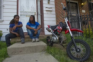
Dirt-bikes - Scourge or Urban Culture?

Once again Baltimore thinks that only it has the problem and fails to look around to see, the problem is, if not universal, at least national.

This problem is the urban use of dirt-bikes. For those who don't know what we are talking about, dirt-bikes are all terrain mopeds with screaming 50cc engines that make them fly under the radar of motor cycles and the requirement for licenses but makes them also illegal on public streets in many cities. Since there is little dirt in cities, the bikes are used in other ways.


Few items have fired up my Facebook page as much as this one. People fall neatly into two groups: Those who see the dirt bike cult as part of urban culture, see wheelies and bike acrobatics as art and compare it to many of the other illegal activities in cities that are either part of a certain counter-culture or underground economy.

And then there are those who are terrified by dirt bikes, their riders, their law defying acrobatics, angered by the noise, the fumes, the unruliness and the dangers these bikes and their riders pose to motorists, bystanders or whole neighborhoods.

Few see a middle ground such as a legalized court or concourse for the bikes that would take the activity off the streets.

For anybody who is still puzzled what this is all about, here a few newspaper quotes from cities around the country:

Baltimore:
Maj. Marc Partee, the Northwest District police commander, called the dirt bikes a "scourge" that need to be removed from the streets.
"What I really would like to talk about is the danger that this reckless sport, as some would call it, is posing to the community," Partee said. "I would also encourage the community to continue to call, to continue to email, and let us know if they see these dirt bikes being stored in homes and sheds and things of that nature. A number of these dirt bikes are stolen, and they pose a very immediate and extreme danger to the community."
Many in the crowd and on social media complained that the weekly bike rally is harmless and gives people something to do on a Sunday afternoon.
Cleveland:
"You hear them before you see them, the loud bursts of buzzing growing close like an angry swarm of bees heading your way — bzzzz.
And then they come into view, a pack of 20, 30, 40 young men on dirt bikes and four wheelers whizzing by, winding through curious onlookers and cars on the streets of the near-eastside, with complete indifference to traffic laws and, seemingly, their own safety.
The riders lift up their front wheels, leaning back as far as they can, cruising on rear rubber while peeking their heads out to the side to see what's coming. Wheelies, after all, reign supreme for the Mt. Pleasant Wheelie Kings."
Washington DC:
"Riding a dirt bike on city streets creates dreams of YouTube glory for 16-year-old Jacquan Brown. Joseph Wilkinson cruises for stress relief. And Terry Cain finds brotherhood when a pack of riders falls in line, suddenly free from the petty beefs of neighborhood rivalries. All of them have a problem — the rides they love violate D.C. law."
New Haven:
In the war against the scourge of illegal dirt biking, the city may have unearthed a new weapon—the ability to seize bikes and impound them.
That was one idea to emerge from a brainstorming session last week with three aldermen, a police lieutenant, and a lawyer with the city’s corporation counsel office. The group convened in City Hall as part of an ongoing effort to explore legal options the city might pursue to make it harder for dirt bikers to tear around the city frightening neighbors, flouting traffic laws, and even hitting children.
New York:
The young man tore down the asphalt, the roar of his dirt bike trailing like a comet’s tail. When it seemed he could not go any faster, he went higher, hauling the bike into a near-vertical wheelie but never slowing down. A dozen other riders crisscrossed his path, their own front wheels aloft to the perfect fall sky.
The dirt bikers were not blasting through the Bronx and Upper Manhattan neighborhoods where, over the past few years, the noisy bikes and riders who flout traffic laws have provoked increasing public ire. Instead, that late October afternoon, they did their tricks on a desolate road on Long Island that ended at a quarry.
NPR Movie Review:
"This is our tradition, our culture, our release."
So says one of the 12 O'Clock Boys — a large group of dirt bike and ATV enthusiasts who, depending on your perspective, either grace or terrorize the streets of Baltimore each Sunday with acrobatic feats on their motorbikes. They weave through the city traffic, popping extended wheelies, the line of their bikes almost at vertical, approximating the hands of a clock at noon.Lotfy Nathan's documentary seems, at first, to be something we've seen before. Over the course of three years, he follows Pug, a sweet, small-for-his-age 13-year-old who aspires to two things: to parlay his love of animals into a veterinary career, and to one day ride with the big boys.
This last quote, finally gets us to the culture aspect of the phenomenon, which Baltimore's Mayor Stephanie Rawlings Blake used aptly in Wednesday's Midday Radio show with Dan Rodricks. She spoke of the two interests, culture versus danger, and how they "butt heads" in the debate and that following either view could make things worse. On the idea of providing dirt bike parks she said: "It depends what the people who ride those bikes think of it. I could find this the best thing out there, but if the people that ride around out there have no interest in it we would have an empty park".

I am reminded of urban debates we had some twenty years ago about skateboards which many equally saw as an urban scourge. Today real hip places flaunt their skate parks as hip assets. This isn't to say that dirt bikes aren't a few notches up in terms of noise, nuisance or real danger, but still, this discussion is being had in a city that just recently promoted Indy car races downtown.

I am not in the position to propagate a particular solution, just to point out that this isn't a   problem special to Baltimore, as much as we like to claim things to be authentically our culture, even the things about which we are more than ambivalent. Further, I'd like to say that in the debate of what to do with a large urban, African American male subculture in which jobs are rare and "records" common and in which about half of whole age cohorts has served time in a penitentiary, a haughty approach about legal and illegal and just enforcing the law doesn't get us anywhere.
Maybe dirt bikes can be one of the few bridges the mainstream culture could build to reach out to those forlorn youngsters that have so little future to hope for.

Like the NPR movie reviewer says:
Nathan's film defies easy categorization; he's interested in neither telling that fairy tale nor painting issues in broad strokes. He leaves the latter to the characters in the film, characters who excel at presenting the rigid, dueling perspectives on two sides of a wide divide; Nathan is more keen on challenging the viewer to jump into the gray area between.
Maybe his review, the other newspaper articles and my comments can engage the one or the other in a similar manner to see that there is a territory between fully engaging dirt bikes as fun and culture and demonizing them as deadly weapons. In the post Ferguson and post Baltimore riot mode we need those extra efforts on all sides to see more than we have learned to see growing up.

Klaus Philipsen, FAIA

Baltimore Mayor Rawlings Blake:
For every suggestion, it does not come without costs,” Rawlings-Blake said. “You know how dangerous dirt bike riding is. If we say, ‘Let’s close down the Highway to Nowhere and let them do whatever they want on Sundays,’ what happens when there’s an accident? I think there’s a lot of great-sounding ideas. I think the solutions are much more difficult to reach.”

Links:

On the Road with the Wheelie Kings of Cleveland 

Smoke and tires


Even without the Red Line: These things need to be done!

This is the second article about the "future of transit in the Baltimore region" after the termination of the Red Line and the first half of a ten point list of projects that should be done anyway.

What is easily forgotten, now after the Red Line was cancelled, are the corollary improvements that were supposed to be "leveraged" through the nearly three billion dollar investment.

I mean the stuff to the left and right of the "right of way. It was mentioned in the Community Compact: Stuff not budgeted in the transit project itself: Improvements to communities, transit oriented development, community development, walkways, trails, services, landscaping and new community gathering spaces. Items hundreds of residents had had distilled from visions, aspirations and deficits in countless community gatherings.
As MTA and local governments decide on a Red Line Alignment, Baltimore City will develop and fund a Red Line neighborhood investment strategy to enhance the quality of life in Red Line station communities.. (Community Compact)
With the transit dollars gone, these needs remain as much as the transit needs themselves, and so does the urgency for them to be met. Originally thought to be "leveraged" by the transit investment, it is now time to reverse the logic and make these investments first so they can leverage the transit eventually.

The Beltline in Atlanta presents a good example of this reversal: After voters turned down the grand idea of a circumferential rail line that tied the four ends of the two Atlanta subway lines into one giant circle, the idea did not die. Not being able to build the transit line, supporters in the Atlanta region created non-profits which set out to build on the "land-side" what would have been transit oriented development had the rail line been approved. With "land-side" I mean all the things outside the right of way for the transit line itself.
Atlanta Beltline: Progress before the transit line

In Atlanta the agencies protected the right of way so that the transit line could be dropped in later. But instead of doing nothing but waiting for a better day, they built trails in and to the corridor, created nodes and built pedestrian and bike access routes all around the beltline. At critical junctures they built affordable housing. Now, some years later and after all those investments, the Atlanta Beltline seems to be so much more inevitable. On their website they even say "the line is already here":
The Atlanta BeltLine is already here – with more to come! Four trail segments are open, six spectacular new or renovated parks are now open for public enjoyment, and new affordable housing is making it easier to live along the corridor. The Atlanta BeltLine Race Series and Art on the Atlanta BeltLine are now can’t miss events, energizing and enlivening the community. Much work remains, however, and it will occur in phases through 2030. Exciting new things happen every day along the Atlanta BeltLine!
The City of Atlanta has partnered with the Beltline non-profit for the construction of the first surface rail line in the Atlanta region since MART built the subway around the time Baltimore built its own (same coaches). By the way, Beltline CEO Paul Morris participated in the initial West Baltimore community visioning sessions.

What can Baltimore learn from this and what should we build, even now after the Red Line was denied construction? What follows is a list of projects and initiatives that had been identified around Red Line stations in careful community review and grass roots planning. I list some after having worked on the project for thirteen years and after years of evening meetings with communities and stakeholders. My list is far from complete, representative or properly prioritized. Some of the graphics don't show the latest state of engineering before the project was cancelled. Just for the sake of a round number I list ten items. These plans shall simply serve as a reminder that there are things that still need to be done, even if there are no Red Line stations! Because of the ongoing angst about traffic and density in Canton, I will begin the list on the eastern half of the Red Line corridor. An additional article will complete the western half.

1.     Bayview MARC station and Park and Ride
The Red Line was supposed to terminate at a new station along the MARC line coming in from Perryville. The station was to act as an intermodal point and transfer between regional and more local travel and was to include a large Park and Ride lot with concept designs commissioned by the City. A MARC station at Bayview is still important for the Hopkins Bayview medical campus. It along with a Park and Ride could become an important element of reducing the influx of automobiles into the fragile road network of Highlandtown, Brewers Hill Canton and Fells Point. It can also be the beginning of making MARC a part of urban transit in the segment from Middle River to BWI.
The Bayview Campus and the area identified for a MARC
station (top) and a P&R lot (top left, yellow)

2.     Highlandtown connection to Greektown
The proposed Red Line Station was supposed to be the element that would begin to connect Greektown with Highlandtown by building a strong pedestrian spine towards the station and by converting the Crown, Cork and Seal company campus into a mixed use TOD area. It was a classical case of using transit to turn community edges into a center. Much of this should proceed even if there won’t be a rail station anytime soon.
Highlandtown and Greektown are separated by rail lines and underused old
factories. The station was supposed to knit it all together

3.     Canton Crossing Park and Ride
The park and ride are envisioned across from the Canton Crossing Shopping center was anticipated as an intercept point where Boston Street drivers could transfer to transit. This function could occur still if a high capacity and frequency bus would stop here and reduce the congestion on the Boston Street corridor by increased transit usage.
The Canton Crossing P&R lot could still serve to intercept
incoming commuters for a reduction of congestion on
Boston Street and in Fells Point

4.     HarborPoint transportation management
HarborPoint with 3.7 million square feet of development was envisioned as the largest TOD development in the Red Line corridor. With or without the Red Line the peninsula or surrounding areas will not be able to handle a large influx of additional automobiles, the misguided planned large Central Avenue bridge to the peninsula notwithstanding. Absent the Red Line strong employer based transportation management strategies are needed to incentivize other modes of transportation than cars
Haborpoint (in pink) is a peninsula slated for 3.7 million
sf of new development including the Exelon tower
currently under construction. 


5.     A downtown bus hub
No matter what the talk about improved bus transit will yield, the geometry of downtown will remain the same without much space for transit hubs or improved amenities. The Red Line would have removed some of the pressure from bus service and moved many riders to rail and underground. With that relief no longer in sight, careful consideration should be given to the areas that act as pseudo hubs today (Saratoga at Eutaw, Fayette at Eutaw, Baltimore at the Arena, Paca at Saratoga, Lexington Market etc.). A potential hub could be built where the current City owned Arena sits if relocation plans become more real. Even if this isn’t imminent, the city should have a strategy for the future use of this area in mind before the situation becomes acute. Another less central area with extra space is the abandoned Social Security West area which may offer opportunities for a Westside hub.


Klaus Philipsen, FAIA

Part 2 see here


Tuesday, August 25, 2015

The Future of Transit in the Baltimore Region


Two very different ways of improving transit

Think Big: One way of thinking about transit in the region is to think big, expensive rail projects, one after another until, after some decades later a whole system emerges. 

This was the vision of the 2002 Baltimore Rail Plan which had mapped out a nearly ten billion dollar investment into a rainbow of rail lines (2002 dollars). This is also the approach that the Denver, Phoenix, Charlotte and Houston regions took. However while those regions open new rail lines on an annual basis, 13 years after the adoption of the Baltimore regional Rail Plan we have not even commenced a single line. After the cancellation of The Red Line no funding is in sight for any of those lines to happen anytime soon or for any variation of them.
The 10 billion dollar 2002 Regional Rail Plan

Think large: Is there another way to envision a future for transit in this region?  The think large approach may be best epitomized by Curitiba which instead of building one subway line built an entire rapid bus system citywide.

Is there such an alternative way available for this region. one without large federally supported and regulated "New Starts Projects", one in which not all the marbles are put in one basket but applied systemwide? A way that does not require years of environmental impact statements and consensus building but works on the base of the needs that have already been identified, quantified and documented? Is there an approach that funds itself through increased efficiency? Is the such a thing as a free lunch? 

Some consultants and certainly the Secretary of Transportation think so. They talk about leveraging, synergies, efficiencies, and partnerships; there is a whole dictionary for the term "free lunch" in the business world. And who would deny that one could get some more efficiency out of the MTA? Who would deny that private side isn't sufficiently engaged in better transit? Who wouldn't admit that there are more duplications than synergies (just think of all the college bus services). The very likable and experienced Transit Guru Jarrett Walker shows with the Houston bus network revamp how an entire system can be redone for little or no money. (The proof is still out since his plans only went into effect a week ago). 

Walker always demands that transit advocates be less mode and project focused and work, instead, on a set of desired outcomes. Who would not want that? Who would doubt that better service and increased ridership could be leveraged  through emphasis on better access to the system via active transportation, last mile technology and intermodal connectivity to other systems? All things on the system level with an effect on the entire system instead of just line or corridor, but none of those are free. 

The two approaches sketched out above, the big project approach and the systemwide refinement approach are not mutually exclusive; they don't have to be either or and they are not alternatives but different ways to achieve positive outcomes. In fact, those two approaches should probably occur concurrently. However, in the absence of the one the other certainly becomes more urgent. But the idea that the one is very expensive and the other, well, "free", is unrealistic.


Current transit in the region 

The good: The Baltimore region moves about 350,000 people per day through transit, its transit ranking in terms of equipment, network and passengers scores above its population ranking nationally. This is to say many people depend on or use transit and improved service and efficiency would affect many people.

The bad: Most area residents, transit users and non-users, give the transit system low scores for convenience, reliability and commute times. In part that has to do with inefficiencies, but in part also with lack of funding and the system being stressed beyond capacity. Additionally several new growth areas are only poorly connected, the transit network was only insufficiently adjusted to new growth patterns and there is no convincing and integrated transit strategy for the region as a whole. Transit travel between Baltimore and the most recognized places in the area, Annapolis, BWI, Columbia, Towson, Frederick to name just the most obvious ones, is obscure, tenuous, infrequent and certainly not 24/7.
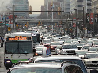
Baltimore downtown congestion on Pratt Street
(Red Line corridor. A tunnel was suggested as a way to
avoid the congestion but was called a "fatal flaw" by
adversaries of the plan)

In spite of being a region with above average influx of “millennials” the region shows poor retention. This highly mobile younger generation has high expectations for transit and even pioneers won't take the abuse for long. The region has good prospects for continued growth and economic development but road congestion and unreliable workforce transit access act like a wet blanket. (For more detail see the report of the Opportunity Collaborative).

While the Regional Rail Plan strategy in its totality would have theoretically addressed those issues, the regional buy-in the plan was shallow at best. This allowed it to erode and eventually be toppled by a simple election result. A true regional transit vision needs a broad regional base and needs to be to be sustained over more than the usual election cycle. No vision can be fully achieved in four years. For sustainability of such a plan transit improvements must spread benefits such as high frequency, reliable transit access 24/7 over a wide geographic area.

What should system-wide improvements look like?

The discussion about the deficiencies of transit is frequently mired into geeky arguments of technology and "mode". The mode centered discussion, trains or buses, light rail or streetcar, surface or tunnel etc. should be replaced by a performance centered debate oriented on user outcomes and hard system-wide metrics which measure actual progress.
Washington DC Priority Corridor Bus Network (PNC)
WMATA plans a drastic Houston style
overhaul of its entire system for 2016

As seen from the residents' perspective the desirable outcomes are not all  that complicated: 
  • Enlarge the area one can reach with transit within a reasonable time ("the transit shed") especially for low income neighborhoods connecting to lower qualification jobs
  • Make all important service 24/7 i.e. transit should be available for the full diversity of activities
  • Design transit so that no automobile is needed at the beginning or end of trips
  • lay out transit lines in such a manner that they follow the geography that people have in their heads
  • Bring transit into the 21st century by making use of current technologies and anticipate coming technologies such as autonomous ("self driving") cars and buses
  • Leverage transit to lift dis-invested communities
Early consideration of a "Rapid Bus Network" for Baltimore (Ben Groff)
 (shown are also the two existing rail lines in green and blue)


The four year implementation list

  • Make buses faster, more reliable and efficient by overlaying local service with an express priority service that has
  • fewer stops, shorter stop times without cash payment with boarding through front and back doors
  • Give high priority to the unmet transit needs in the east west corridor by providing high frequency priority bus service on North Avenue, Edmondson Avenue/Fayette Street and Frederik Avenue/Pratt Streets (or similar)  
  • Engage local jurisdictions to provide bus lanes in strategic places, signal priority, better stop locations and transit hubs where lines connect
  • improve intermodal and regional use convenience through single ticket system for all modes over the entire region (chip cards or better: smart phones)
  • Improve access to the high frequency net work through shuttles, bike-share, safe walking networks, on demand bus systems (line taxis)
  • Fully integrate all modes including Amtrak, MARC, subway, LRT, bus, Circulator, shuttles and water taxi through a system of schedule coordinated transit hubs
  • Eliminate duplication and use College Buses, hotel and apartment shuttles not as competition but as instruments to solve "last mile" access.
    The "high frequency bus network" implemented in
    Houston on a Sunday in August
There is no way that the region can tolerate four years of inaction added to 13 years of planning one single system that was then cancelled. Shifting the approach to short-term, system-wide, state and locally funded improvements is a necessary survival strategy for the region. Whatever motivated Secretary Rahn to ask for suggestions, here are some.

Klaus Philipsen, FAIA

I work with James Rouse Junior's  transit advocate group Transit Choices on creating a regional transit system that is "Comprehensive, Multi-Modal, Integrated, Equitable & Sustainable and User Oriented". I wrote a paper for the group that inspired me to modify it for the above article.

A second article will address visions that were associated with the Red Line but should still be built, even without it. 

Monday, August 24, 2015

Canton Crossing - Why Density is good

The conversion of Baltimore's once industrial waterfront into a recreational area attractive for housing and business has steadily crept forward. From the Inner Harbor to Harbor East, from there to Fells Point, then to Canton. It leaped across the Inner Harbor along Key Highway (the Propeller Yard is now Ritz Carlton) to Locust Point.

Each step a new frontier and each a repeat of the same questions: Will this harm what we already have? Will this kill the last industrial jobs by pushing out too much industrial use? Do we really want this glitzy stuff or is this too much gentrification and finally: Will the roads be able to handle the traffic?

The latest new frontier has been for some time Canton Crossing. It pushes across a long-held boundary reserved for heavy industry: Clinton Street. Beyond Clinton Street in the wastelands of Exxon Oil tanks, the jungle of freight tracks, salt and coal piles and the oceans of vehicles unloaded from huge container ships Baltimore's industrial heritage was still alive under the rumble of trains and big trucks and the clanking of freighters.
When the First Mariner Tower was the only thing out there
(2006)

When Ed Hale's version of his trademark First Mariner Bank building on steroids became the areas landmark people ridiculed the architecture and the location but Hale saw himself as a visionary.
Presiding in his old money imitation board room high in his tower he submitted suburban style development plans that came under attack from two sides: from those who fought the incursion into the industrial domain (Hale himself, before becoming a banker had once owned a trucking company) and from those who thought his vision was way too suburban.
this Elkus Manfredi rendering of the COPT development shows
how close it sits to tank farms

The development area now submitted by COPT who bought the land in the most recent twist of a long tale had been in play for a cruise ship terminal, for mixed use and for offices, but it never really possessed any urbanity in any of the previous incarnations and in spite of interventions from even the State Office of Planning. It had always looked more like the part of Hale's early vision, that was actually built, the Canton Crossing shopping center, an actual traffic generator.

But now the new owner, COPT, has hired Elkus Manfredi archirects of Boston, the same firm that also dazzled UDARP with the Exelon Tower and they presented a real dense, urban design that appeared to include reasonable public access and finally solved the connection to the promenade which currently ends right around the corner in a Baltimore City Department of Public Works space that is also a remnant of a different past.

And yes, as predictable as Bubba Gump at the Inner Harbor, the question if the roads can handle the traffic is asked once again. Once more a traffic impact study is mentioned as needed to show how the development would handle the traffic and once more the only possible solutions seem to be either you build more road capacity or you reduce the development.

Baltimore still hasn't come to terms what it means to be a real city. In a real city you don't throttle development through pointing to failing intersections. In a real city you welcome development, the more and the denser, the better the city becomes. The more taxes are being taken in, the more people are out in the streets, the more services and jobs are provided , the more contacts made, the more synergies achieved. In short, exactly what cities are for.
COPT development plan under UDARP review (Elkus Manfredi)

Some in Baltimore still haven't come to terms with the somewhat more complex thought process from which one concludes, the more density, the less traffic! Some in Baltimore still have not learned from Vancouver, Washington DC and many places in between or elsewhere in the world that urban density and rapid growth can bring a reduction in the usage of cars and traffic although upon further contemplation it is

Canton Crossing shopping: Popular but very auto oriented
pretty obvious, how that works. People can do a lot of stuff without getting into a car. Imagine that.

It is ironic, though, that some of those very ones who fought the planned Baltimore Red Line that would have served thriving Canton, Canton Crossing and Brewer's Hill are now whining about congestion. But they can console themselves, I-95 is really close. (They could explore non-urban traffic congestion on the way to Bel Air, the lands of Governor Hogan).

Luckily, Baltimore's new development czar, BDC Chief William Cole has the right insight. He said when asked about congestion in conjunction with the dense COPT development:
"We'll work with the developer and all adjacent developers on any and all solutions that we can come up with to help ease traffic issues over there, but we live in a city and I don't believe we should base all of our decisions on traffic," he said. "These are urban areas, so density is generally a good thing."
Good for him. He got it!


Klaus Philipsen, FAIA

Baltimore Brew article about the congestion and traffic debate
Baltimore SUN article about the COPT project