Wednesday, March 31, 2021

Keough High: From Holy to infamous to banal - Is it inevitable?

The BBJ reports that the former Seton Keough High School campus located smack at the exit ramps from I-95 to Caton Avenue could soon be home to warehouses and distribution facilities under a plan by MRP Industrial. At stake are 43.5 acres (including two out-parcels) that have a combined assessed value of over $15 million.
From holy to scary to banal: Holy Angels Keough school (Photo: Philipsen) 


The all girls high school gained dubious fame for its role in the abuse documentary "The Keepers". The catholic school also made headlines when its closure was announced by the Archdiocese of Baltimore in 2016.  The SUN wrote about the Archdiocese's decision to close the school:
Among the affected schools, Seton Keough High School in Southwest Baltimore is likely to attract the most attention. It was formed in 1988 after the merger of Seton High School and Archbishop Keough High School, two all-girls schools that once boasted enrollments of more than 1,000 students each. Seton Keough now serves 186 girls, which limits the opportunity for the kinds of educational and extracurricular opportunities that would be available at a larger school. (SUN)
This shift from the holy to the scary to the banal would seem like a logical thing, since distribution warehouses along major transportation arteries are a hot thing in the northeast real estate market, while large Catholic girl schools in shrinking Baltimore, well, not so much. 
The setting from the north with the school complex on the
left bottom quadrant of the I-95 interchange (Google Earth)


But a closer investigation requires more complexity than just holding a finger into the air to check from where the market winds blow. 
  • Baltimore is famously a landlocked city, i.e. it has no space to grow, in fact, the City is even  prohibited by Maryland law to annex any land from the surrounding County. In light of this predicament, one has to wonder whether space consuming low labor distribution is really the right ticket for a strategically located 43 acres site in post industrial Baltimore. 
  • Baltimore has committed to sustaianbility, livability and equity including all aspects of combatting climate change and environmental degradation.  This begs the question if a largely green and wooded site which is traversed by a stream doesn't deserve more consideration than what may fetch the highest price for the land in the moment
  • Baltimore is known for its historic architecture. The about 60 year old school is a formidable example of mid-century modern architecture with some considerable qualities that only now start begin to be appreciated by the general public.
  • Baltimore has committed to improving the quality of life in its disinvested communities. The small residential pocket communities  of Violetville, Wilhelm Park (of which the site is a part) and Morrell Park, the latter located on the other side of Interstate 95 surround the Keough site all could use a shot in the arm; they especially need to be freed from the isolation imposed by the Interstate, Caton Avenue, the large St Agnes Hospital complex and the industrial uses that keep expanding in the area, including warehouses on Desoto Drive to the east. Those probably represent a precedent for the imagined new use of Seton Keough High.
But these larger aspects are not on the horizon of the current decision making process which is focused on the fact that the land isn't zoned industrial and would need to be reclassified for warehouses. The existing uses in the area provide an eclectic mix of precedents from the St Agnes hospital complex to the warehouses to the traditional Baltimore neighborhoods with rowhouses and alleys. Even a conversion of a former highschool (Cardinal Gibbons) into a mixed use center (Gibbons Commons) is planned next door. This reuse of a former high school presents a far better example than the nearby warehouses.

However, the future viability of the nearby neighborhoods with a median home value around $64,650 (Live Baltimore) doesn't seem to be on the radar this time. Not on the radar either any type of network plans: For example, how the communities could best benefit from the Gwynns Falls park to the east and the Carroll Park Golf course, elements of  the much touted Baltimore City "Green Network Plan", a work still in progress. 
Zoning Map, the pin shows the EC-1 property (Baltimore City)


Morrell Park had been in the news when the Port of Baltimore and CSX considered Intermodal Container Transfer Facility there for containers be loaded from trains to trucks to avoid the low Howard Street tunnel. After massive protests MDOT withdrew from the project in 2014. The SUN reported that "the Morrell Park facility would have been served by about 150 trucks a day delivering containers, a key reason residents opposed the facility. Another reason was that it would have operated 24 hours a day. Community activists in Morrell Park and surrounding neighborhoods, who began organizing against the project as early as 2012, said they feared it would bring few jobs but too much noise, pollution and truck traffic". Morrell Park was spared the intermodal facility, but it has apparently been forgotten again. 

With the transfer facility now off the table because the Howard Street tunnel enlargement has become an actual project eliminating the need for a truck to train transfer another set of warehouses with its mostly barren surfaces and its associated truck traffic won't improve life in the adjoining communities, even if it doesn't represent a direct burden. 
School entrance (Photo: Philipsen)


Could the high-school site be a key ingredient for the stabilization of the fragmented residential neighborhoods? The Department of Planning staff  recommended to the  Planning Commission  a rezoning resolution which was unanimously adopted. The staff report doesn't discuss alternatives, the environmental conditions or any other masterplan goals than "retaining and attracting businesses". This is what the staff report says (for full report see link):

1. The Plan: This rezoning will support the Comprehensive Master Plan’s EARN Goal 1,
Objective 1: Retain and Attract Businesses in all Growth Sectors.
2. The needs of Baltimore City: This rezoning will provide an opportunity for the
development of new light industrial uses that will replace inventory lost elsewhere in the 
City in places where residential development has displaced older industrially-
zoned land that has outmoded buildings, or properties that are either too small or that have an unusual shape.
3. The needs of the particular neighborhood: There is no current demand for schools or
additional educational programs in this area. The applicants have met with the
Violetville Community Association, and are keeping them informed of progress.

Leafy with a stream, in parts forested: The 43 acres Keough site 
(Photo: Philipsen
)


Such re-zoning must be justified either as a "mistake in the existing zoning classification" or "as substantial change in the neighborhood." The staff report states "The most recent developments in the area are on the campus of St. Agnes Hospital, and the mixed-use development around the Babe Ruth Field at Cardinal Gibbons. The surrounding neighborhood has been stable, with little other development in recent years". This would suggest no significant neighborhood change has taken place. The report still makes "significant change" argument based on the closure of the school itself: 

Staff recommends that the Planning Commission find that there has been a significant change in the character that would support the requested rezoning. The closure of the Seton Keough High School occurred just at the end of the Comprehensive Rezoning process of the City, which was voted through Council in December of 2016. 

The zoning change for educational to industrial still needs to be approved by the City Council. A public hearing of the Economic and Community Development Committee hearing is scheduled for April 13. The change to industrial use is likely going to be affirmed. In the big scheme of things, it won't make any waves. But it is exactly in the grand scheme of things, that this is not only a somewhat unusual quirk in the ever ongoing transformation of the once mighty industrial city of Baltimore, but decidedly a step in the wrong direction if sustainability, stabilization of poorer neighborhoods, equity and quality of life are the metrics. 

Not a bad composition: Mid century modern architecture (Photo: Philipsen)

The quirk in which an industrial use replaces education, reverses the more common pattern, which is the other way round. 

It would be nice to see this once holy mid-century modern example of architecture in its leafy setting rise to become an opportunity rather than seeing it eradicated and replaced with the dullest of all architectures: The distribution warehouse with its low wage jobs, its huge impervious surfaces and its additional truck traffic. 

Klaus Philipsen, FAIA

Friday, March 26, 2021

Is Downtown Baltimore doomed?

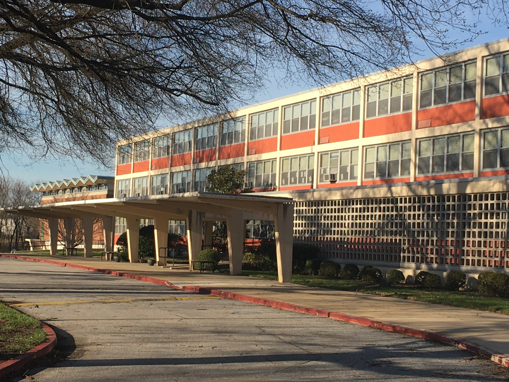
Standing in Federal Hill Park on a sunny spring day, downtown Baltimore looks as scenic as always:  The peaks of glass, brick and stone towers form a gleaming skyline, mirrored in the waters of the Inner Harbor and its boats in the foreground: An iconic image of Baltimore that is known around the world.

Picture perfect: Downtown Baltimore 

Downtown is in serious trouble

But on the ground, the impressions change and the moldy scent of decay and abandonment isn't any longer limited to Baltimore's once gleaming retail district on Lexington Street but wafts far into the financial district and beyond all the way to Harborplace. 

What if vacancies won't magically disappear at the end of the pandemic when the heavy toll of hotel, restaurant, office and retail closures or restrictions will be lifted, and everything that defines downtown can breathe again? In fact, downtown is being clobbered by a multitude of factors:

  • people being tired of focusing on downtown instead of neighborhoods 
  • the ongoing loss of corporate headquarters 
  • the steady decline of retail 
  • violent crime has now penetrated the previously safe central business district
  • COVID with everything at once: work from home, restrict or close restaurants and attractions

The barrage on downtown comes when Baltimoreans are fed up by Police misdeeds and singularly focused on equity,  with attention centered on neighborhoods which lacked investment for some time, not downtown. The sense of of a division between downtown and the rest of the City even found its way into a business paper, traditionally a downtown booster: Melody Simmons of the BBJ says in a recent article of the series "the future of cities":
The lopsided focus of developing and maintaining a work, live and play vibe on the city’s waterfront has usurped energy and investment from outlier communities and left an infamous and visible divide (BBJ) 


The past responses to retail and office vacancies may not work any longer

The pandemic makes it very clear that Baltimore never had a cogent answer to the slow erosion of retail and office and the geographic shifts in our post-industrial city that moved the center of activities towards the water and ever further east, other than pumping more residents downtown. To be sure, that is a good strategy, but ultimately not sufficient as we will discuss in this article.  

the moldy scent of decay and abandonment isn't any longer limited
to Baltimore's once gleaming retail district
  (Photo: Philipsen)
Baltimore never successfully replaced the lost retail hub of Market Center with a new shopping area. Neither were there consistent, coordinated ongoing, strategic efforts of placing regional corporate headquarters inside the City. Corporations that did locate in the City did so because their employees demanded urbanity, not because there was a consistent policy. With the unabated series of buy-outs and mergers, headquarters may well be a lost cause.

Scattered attempts of establishing shopping on Pratt Street (Best Buy, Filene's Basement) failed and even Harbor East's streets never became true urban shopping destinations. For City shopping, residents drive to the suburban style Canton Crossing. 

The Baltimore Business Journal recently compiled a list of office vacancies and ruminated ominously about companies considering moving or reducing their downtown presence. The paper writes:

Transamerica's order to its 550 workers to clear out their desks by Feb. 28 posed the latest ripple in the downtown market. The move left in limbo 125,109 square feet of space at 100 Light St. in a marquee property near Harborplace. It also followed an announcement by T. Rowe Price in December that it planned to vacate 450,000 square feet at 100 E. Pratt in 2024 for a building yet-to-break-ground in Harbor Point. (BBJ)

The BBJ then notes several other companies which are "probing whether to downsize or relocate in the coming year or so", including Bank of America, Wells Fargo and Pandora. 

There can be no doubt, that the very American way of shaping a city with tall financial office towers huddling in downtown surrounded by low level density has come to an end, not only in Baltimore. The decline of downtown began when department stores and retail empires decamped in favor of suburban malls. When small mom and pop stores first became the victims first of departments stores, then of malls and finally online purchases. The ongoing consolidation and merger of corporations made the departure of corporate headquarters inevitable for many cities not running in the A league except when they positioned themselves as tax heavens such Charlotte, NC or Wilmington, Del.  
A tall crowded downtown surrounded by low level neighborhoods
(Photo: Philipsen)
But right before COVID downtown seemed to be on the mend with trendy  restaurants, downtown living and millennials opting for urbanity.

But the sudden reality of the long discussed "remote office" has made the question what defines downtown urgent again, not only in Baltimore, but all across America and even overseas. 

For example, booming San Francisco, which just had completed an entire new set of downtown towers around the "Salesforce" transit center, named after a company that serves the flourishing online services, was shaken at its core when Salesforce announced it would not lease  325,000 sqft in the yet to be built parcel F of the new Transbay neighborhood. Half  of Salesforce's workforce would continue to work from home, the company announced.

Can downtown be just another neighborhood?

Baltimore's downtown's success story is that "tract 401" has become "Baltimore's fastest growing neighborhood", recognized as such at least since 2012. With the One and 412 Light Street glass towers, and the repurposed historic NationsBank building, the downtown skyline now includes residences and is no longer the domain of banks and corporations. But all the residents that moved into high-rises or one of the apartments carved out from old class B office buildings, garment factories, or even churches, have not been able to support retail or fill the sidewalks sufficiently for coffee shops to remain open, not even before COVID. The streets became entirely deserted as soon as  office workers stayed at home in the pandemic, a clear sign that downtown remains highly dependent on the office worker. 

The remedy of converting offices to apartments will become harder and harder to realize. The transformation of vintage office icons such as the NationsBank Building, the old BGE headquarters, the Standard Oil or the Munsey Building into apartment buildings wasn't easy but proved successful and may be simple compared to the challenge of finding an appropriate future for the much more recent and numerous generation of office towers. 
Downtown residents (Photo Amy Davis, SUN)

These buildings either have floor plates that are too large for residences (which need to be strung along windowed facades for light and ventilation) or their lower floors may be crowded against busy streets with little daylight or sun. There is also this: Many of these buildings are plain ugly with their cold and uninviting imitation modernist architecture, which is  not readily suitable for residential use without a drastic makeover. Practical issues include badly insulated, fixed, sometimes tinted, glass curtain walls and lack of nearby green spaces. Baltimore has begun to tackle those conversions with the Baltimore Harbor hotel south tower and the former PNC tower, both on Baltimore Street. But is there sufficient demand for more downtown living? Is an entirely residential downtown which is sprinkled with a few restaurants and shops really still a "downtown"? 

Downtown as a "Third Place"

In his latest commentary in a March edition of the BBJ, former Baltimore Development Corporation CEO and architect Jay Brodie mused about the question of downtown. Aside from describing downtown still in terms of Petula Clark's 1964 song "Downtown" and giving friendly nods to the urban renewal he accompanied in leading roles for 50 years or so, he brings up an important point when he defines downtown as our "shared neighborhood". This term is similar to the notion of downtown as a city's "living room" or a "third place" (urban sociologist Ray Oldenburg) or the "commons". Architects also love to talk about the "public realm".
It is precisely in these categories where Baltimore's downtown and waterfront long had deficiencies that would become even more noticeable if  downtown would become just another residential neighborhood with tall buildings. 
Mount Vernon's Washington Square (Photo: Philipsen)

The pandemic has highlighted a concern that sociologists have had for a long time about the condition of the shared space in America's cities. The book and research titles of  "Bowling Alone", the "Tragedy of the Commons", the Tragedy of the "Privatization of the Commons" or Henry Lefevbre's “The Right to the City” highlight the concerns. 

As noted, in spite of the waterfront promenade, lovely parks and great historic architecture, Baltimore is not well positioned when it comes to attractive "third places" or "commons". What the British urbanist Peter Hall called "the Rousification of America" in a chapter heading describing "the city of enterprise", Hall takes issue with making the US city a "stage" for entertainment, mostly trough undertakings by private companies, such as the Rouse Company at the Inner Harbor in Baltimore. Hall and I both grew up with the European city for comparison.

To answer what a public "third place" could mean, let's take a quick look overseas: Many European and some Canadian and South American cities never segregated downtown quite as much from the rest of the city fabric, didn't create separate financial districts or put all their cultural institutions into a "cultural district".  Even the old segregation of uses through zoning has been less stringent there. My hometown of Stuttgart, for example, about the same size as Baltimore, also experiences failing retail, failing department stores and a reduction of office demand, but that isn't all there is. 

Smack in the heart of downtown Stuttgart are two historic castles, several churches, museums and a very large central park which culminates in a giant formal square in front of  the newer of the two castles. The square is the go-to place for events, demonstrations and urban people-watching, even during a pandemic. Car traffic has long been eliminated from the area, there is a tramway hub located underneath the square and city hall, the main train station and the urban university campus  are only one or two blocks away.  This particular heart of downtown can also be a stage, but it is a public stage, under public control, it consists of many layers of history and is not simply the expression of one fad of urban development  such as the private "Festival Marketplace" that was invented in Boston and Baltimore, has since failed so many cities and still dominates HarborPlace.

The combination of history and many different uses will be resilient enough to survive the pandemic, the decline of retail, and the decline of the office. The "third places" in Stuttgart are "shared" by and attractive to everyone in the city, the region or the nation.  For any real downtown, those "third spaces" are urgently needed, just as Brodie, Oldenburg or the Project  for Public Places (PPP) organization point out.
Center Plaza: Not Bryant Park (Photo Philipsen)

Why Baltimore's "commons" have a hard time

Let's see why Baltimore doesn't fare so well in that category: Instead of Times Square (New York), the Mall (DC), the Commons (Boston), Independence Hall Park (Philadelphia) Embarcadero Plaza (San Francisco), Charm City has a series of spaces that could be some sort of commons, but none of them is clearly the most important one. 

Spaces that come to mind include the historic square in Mt Vernon (Washington Square), City Hall Plaza, (those two a result of the City Beautiful movement), Harborplace and, yes, Center and Hopkins Plazas (all the result of urban renewal).  Such multitude could be an asset but is a liability if it creates uncertainty and vagueness about where the heart of this city really beats and if no space is really suitable as the dominant space. This absence of an indisputable heart facilitates the common refrain to better forget downtown and focus on "the neighborhoods", instead. By contrast, many of Baltimore's neighborhoods have a heart, frequently in the form of a commercial spine, one would recognize as a local "main street". Downtown, by contrast, has, unlike other big cities, no identifiable "main street" anymore.

Washington Square is seen by many as a very high quality public square that could easily be in Paris. Yet, it has suffered from the shift of the center of gravity to the south and the east and the City. After being a strong promoter of the square, the Downtown Partnership did help in making this heart beat less forcefully by taking the Book Festival and First Thursday events away from there and making Charles Street an artery for commuter traffic out of town. 

Then there is the Plaza between City Hall and the War Memorial Building, the subject of repeated re-design that  has done nothing to make this a go-to space except for demonstrations against City Hall. The lack of pulse comes from loveless  adjacent City administration buildings such as 417 Fayette Street and the Police headquarters as much as the many dull garages, freeway elements and surface parking lots one has to pass in order to get to this plaza. Most of the time the space is simply deserted. Now that the redevelopment of Old Town is an actual project, the gulf between Jonestown and City Hall in shape of the JFX is a looming problem to be solved.

Center Plaza and Hopkins Plaza (once the locale of the City Fair) had also various redos even enlisting the help of PPP, but unlike Bryant Park in Manhattan, neither space is a serious candidate for being our "central commons", as long as there are no active first uses surrounding them. The decades of dereliction at the site of the Mechanic Theatre radiates neglect, not a beating heart.
The beginning of a "commons" at HarborPlace (Photo: Philipsen)

That leaves HarborPlace, once well respected and now deeply troubled because of the neglect by the owner of the pavilions, Ashkenazy, now in receivership. Ever since the Rouse company conceived of the two "market" sheds as the ideal way of defining the reclaimed waterfront, these commons were privatized, which ultimately became their downfall. The same applies to any of the "piers" that could become "third places", including Pier 5/6 where the failed Columbus Center takes up valuable space and where the  prime spots are taken up by a steakhouse and a mostly empty concert tent. Imagine what an attractive waterfront park these areas could make if the uses were fully public and open to all! 

Heart surgery needed

Aside from finding new uses in old downtown shells, and adding "program" to oldretail areas (such as the "Bromo" arts district designation) finding, defining and reinforcing and enforcing the actual "heart of the city" will be one of the central strategic moves that need to be tackled to give Baltimore's downtown a future and a "commons" for all City residents and those of the entire region. 
ASG rendering showing a connected McKeldin Plaza for a stronger
"public realm" (ASG Architects)

Given the ongoing geographic shifts of shops, restaurants and offices, HarborPlace plus Rash Field,  plus all the piers may seems to have the biggest potential for truly becoming Baltimore's "commons".  A great city shouldn't be afraid of creating a big commons.

For this to happen, Baltimore would need to take possession of the pavilions, demolish at least one of them, and reclaim much of the surrounding street pavement for pedestrians. 

The goal would be a large, contiguous public space (connected to the McKeldin Plaza) surrounded by a mix of vibrant private, public and institutional activities and easily accessible from several neighborhoods.  

Klaus Philipsen, FAIA

See related previous articles on this blog:


Wednesday, March 17, 2021

Westport: What is left of the big dreams

The Middle Branch, long a forgotten stepchild in Baltimore known for a giant casino garage, an animal shelter and Nick's Fish-House and numerous derelict industrial sites, has been the target of ideas and plans since at least 1990. It became a field of dreams when investors commuted Westport and Port Covington into the canvas of their ambitious . But as it often happens in Baltimore, really big dreams often evaporate and the pioneers are not rewarded while those who come in after them reap the benefits.

Initially proposed Stonewall Westport development

What is on the table now for actual development is neither Pat Turners multi billion Westport plan nor Kevin Plank's Under Armour International Headquarters. Both projects went poof, the one a victim of the financial crisis and the other a victim of flying just a bit too high. 

First to deflate was Baltimore developer Pat Turner's Westport., He had successfully converted an abandoned Locust Point grain silo complex into a gleaming condo tower. In Westport he scaled his ambitions up: Silo Point's architect Parameter together with the nationally renowned environmental green consultant Field Operations (The High Line, NYC) designed a development with 2 million sq. ft. of office space, 300,000 sq. ft. of retail, and 2,000 residential units. Turner spent a lot of money on clearing the land of the old Carr Lowry glass factory and the BGE substation. It all went up in smoke when Turner couldn't secure enough funding to even hold on to the cleared site. Under Armour's ambitions at that time were still high enough that they not only wanted to develop all of Port Covington but also purchased the Westport land in a foreclosure sale.  Likely as an expansion site. 

As in the story of Icarus, who flew to close to the sun with his waxen wings, Under Armour came crashing back into reality when the company was battling slumping sales and an investigation from the Federal Securities and Exchange Commission. The so far most recent reality check came when the all out last ditch effort of attracting Amazon's fable second headquarters at Port Covington fizzled so badly that Baltimore didn't even make it to Amazon's shortlist. Social impact investment had not been what Jeff Bezos had in mind.

Pat Turner's Westport development 

The current reality is more modest: Spearheaded by Weller Development construction activity right now is limited to a single block on which to date mostly underground utilities have been placed. The proposed new buildings have been already postponed a few times, certainly COVID didn't help. Originally announced as "Cyber Town USA" the block now is now simply a 400,000sf mixed use project still looking for tenants. Meanwhile Plank Industries has liquidated Westport.

That brings us to the second more modest proposal reality, the redevelopment of the Westport site by Ray Jackson's Stonewall Capital which has won the bidding war for the Westport site for which it currently holds an option. Jackson started about 17 years ago with small rowhouse rehabs in Baltimore's trendy neighborhoods of Federal Hill, Fells Point, Locust Point and Canton which he flipped from his space in Sparks. His work scaled all the way to a 600 acre greenfield development called Southfields, a "Transformational Development for the Town of Elkton" which is supposed to convert rural Cecil County "into an industrial, commercial and residential base" as the BBJ put it. The project with its 250-acre industrial park, 1,000 residential units, 250,000 square feet of commercial/retail space and a 50-acre sports complex is underway and, according to Jackson, has not slowed down because of COVID. 

Meanwhile Westport's new developer wasted no time and entered the picture with a very practical development proposal that includes 275 garage townhomes; 300 affordable multi-family units, 1,000 market rate units and 40,000 sq. ft. of commercial and retail space and an 100,000 sq. ft. office building. The development  proposes 11.8 acres of open space including a large park in the center of the development. 

Field Operations competition entry: Rendering

That concept was presented on December 10 of last year and promptly experienced its Waterloo in the initial review of the City's design review panel UDAAP. Below a sampling of the comments the reviewers made:

  • it’s difficult to see what’s being proposed, and the poor quality of the graphics (and spelling) detracts from the presentation
  • Information is vague – it’s difficult to assess the feasibility or desirability of proposed moves; e.g. Mobility Framework Plan on Slide 12: the circulation lines overlaid on the aerial image are not in scale and it’s unclear how they actually sit in the landscape. Also, there is missing information in bullet-point #2.
  • Building massing contradicts stated goals of preserving sight lines, connecting to the neighborhood and creating a cohesive connection to water edge
  • Very little relationship among new buildings, between buildings and water edge, and between new and existing development – needs to be developed more purposefully to feel deliberate

Those harsh verdicts presented an interesting situation, given that the design was presented by none lesser than Doug McCoach, the City's former Planning Director who used to sit on the other side at design reviews and held that office when the first official Middle Branch Masterplan was enacted in 2007. McCoach gave the UDAAP panelists an excellent site analysis. But as the comments prove, the suggested plan concept for a cluster of rowhouses on the west end a bunch of office buildings on the east side of the land, both separated by a park, had little to do with the analysis. Especially the 275 townhomes looked like a copy straight out of some high density suburban builder's blueprint, oddly shifted against the rowhouse blocks of old Westport. 

Revised Stonewall plan with parks and critical area highlighted


Unfazed, the design team went back to the drawing board and showed in January a slightly revised plan with streets that are now aligned with the Westport grid and included responses to earlier UDAAP comments regarding connections and circulation. The comments from UDAAP were milder in the second round but still did don't represent a ringing endorsement:

  • Kit of parts – now that the team has mapped strategies for the site, it’s time to go back and build on the idea of assembling the buildings and public spaces from a kit of parts to help it read as a neighborhood.
  • Study the relationship between the Parcels (A, B, C, D, E) in more detail – open spaces are serving as separators between types of buildings (the overlook park, central park, etc.) Spaces could benefit from a cohesion of typology versus a change of typology. Doesn’t currently convey a feeling that you’re “some place” but rather that you’re between places.
  • Team is encouraged to look at precedents outside of Baltimore that have always been waterfront connected 
  • Important to continue to study the site in section; need to see a north-south section through the centralized park from the rowhouses on Parcel B to the mixed-use multifamily on Parcel C to understand the change in scale.
  • With regard to the townhouse community (Parcel B), it seems to be very built-up with only a very narrow strip of green – feels a bit sterile and hard. Team should study ways to include more relief; could be achieved with pocket parks or with widening the landscaped portions, etc.

The project has been presented as to be built "by right", i.e. according to existing zoning. The implied suggestion is that the developer doesn't need anything from the City and therefore could proceed relatively unrestricted. Still, there are potential snags. The current land use law for this site is the Planned Unit Development which was created for Turner's previous Westport plan. Before the underlying base zoning would be in effect again, the PUD needs to be nullified. The plans show a lot of development inside the 100' Critical Area buffer, incursions the team intends to "mitigate" in its proposed parks. Critical area review can be stringent, even for urbanized areas, which is appropriate given the precarious state of the tidal waters of the Middle Branch and the Chesapeake. Even though the site has been cleared of all surface structures, surprises may loom underground for anybody who starts digging. Plus the site needs all new utilities and roads, in short, the same conditions that made Sagamore ask for the largest Tax Increment Financing deal in the history of the City. So far, Stonewall LLC has not indicated they want any public money. 

Rendered revised plan (Stonewall)

The Stonewall plans emerge while the masterplanning process for the Middle Branch is underway. The site sits at the foot of the community of Westport which had its hopes up and down over a long time, dashed by first failing industries and then deflated dreams. Westport is one of the  partners in the  South Baltimore Gateway Partnership that benefits from Casino proceeds and is part of a community benefits agreement with Sagamore where proceeds were expected from the giant Port Covington development. In its delayed and reduced form the agreement has not yet provided the boost the communities had hoped for. 

Clearly communities are weary but at the same time eager to see actual progress.

It doesn't help that Ray Jackson's Stonewall LLC does not intend to stick around to actually build the project but just assembles the "entitlements" thsat come from an approved development plan and then hand the site over to builders. Kevin Lynch's South Baltimore reported that Jackson has selected Ryan Homes as the builder for phase one and wants to break ground in the next 12 to 18 months for the townhomes, the park, and possibly the first apartment building with its 350 market-rate units and some/retail space. 

In this mix the communities, especially the Westport CEDC, the South Baltimore Gateway Partnership, the Baltimore City departments of Planning, Parks and Recreation and others are currently trying to figure out how to proceed. 

Especially the  Middle Branch masterplanning effort needs to be fruitfully integrated, it just makes no sense to have such a large part of the shoreline taken up and be spoken for before the masterplan effort has even fully gotten off the ground. The South Baltimore Gateway Partnership is in negotiations how to bring in the highly qualified masterplan designers to have a say in the design of the parks and the waterfront design which could afterwards be deeded back to the public.

To recap: The City and the Parks and People Foundation had looked for big-name designers to update the 2007 Middle Branch masterplan with state of the art greenways, trails, and sustainable resilience features appropriate for the shores of  the Middle Branch. Thinking about this "second waterfront", goes back to a report of the Urban Design Committee of AIA Baltimore in 1997 when they looked at the potential of the Middle Branch and its many industrial brownfields. At the end of the Parks and People design competition, Rotterdam's West 8, Urban Design & Landscape Architecture emerged as the winner among four shortlisted firms with global portfolios and received a $325,000 contract. But this dream almost deflated as well when the design team lost the Dutch lead designer West 8, over a kerfuffle about De swarte Piet, a Dutch blackface figure that had made an appearance at a company holiday party years earlier. 

That, too was a typical Baltimore situation, where the volatile mix of inequity, redlining, and segregation didn't take this flap lightly, even though the loss of this strong design firm looked a bit like  cutting off the nose to spite the face. 

The Middle Branch masterplan design team has now been reconfigured with a number of additional names, including James Corner Field Operations (JCFO), the company that had been on Turner's Westport team before, and had already placed second in NDC's Middle Branch design competition behind West 8. 

The Westport site is a linchpin in a continuous public shoreline along the entire Middle Branch and an associated bike-hike trail system that currently is temporarily placed on the old Kloman Street hemmed in between the elevated light rail tracks and a still active freight rail track. The Westport waterfront brownfield is also a key element in a new shoreline that is built to best practice standards for resilience against rising sea levels, sustainability, stormwater and habitat protection. (Reimagine)

Field Operations Competition entry: Trail network

The site further provides the the Westport community an opportunity to regain access to the waterfront and have some urgently needed parks and green spaces. The potential boost from a major investment needs to be carefully calibrated with the needs of a disadvantaged community so it doesn't result in gentrification and displacement, or the demise of commercial establishments along Westport's "main" street (Annapolis Road). 

For all those goals to be met, Stonewall already had numerous meetings with the community. The design certainly deserves broad public vetting with public workshops, lots of "daylight" in the negotiations of the open spaces, and opportunities for all affected communities and stakeholders to build "ownership" in the new development. It must be ensured that the community's and the stakeholders' long-term interests are not only heard but baked into the plan through oversight and control mechanism that persist, no matter who the builders will be, or what the uncertainties of the residential, office, hospitality and retail real estate markets may be. It is time that Westport can see something good becoming reality on this shore of the Middle Branch.

Klaus Philipsen, FAIA

Slightly modified for clarification on 3/18/21