Wednesday, November 2, 2022

What should David Bramble do with HarborPlace?

The implosion of Harborplace

A few years ago when the HarborPlace pavilions showed some signs of getting tired, few people thought it would take more than what then operator Ashkenazy proposed in UDAAP session #216 on November 12, 2015:  An architectural face-lift  for the two pavilions and a few new tenants. The discussion at the time revolved around a few renderings by the architects MG2 showing steel frames, rooftop signs and new wood paneling.

MG2 Architects UDAAP presentation rendering 2015 (MG2)

Fast forward seven years, and it is possible that the pavilions will be razed entirely. No longer is the debate simply about dressing up the pavilions but whether they should be replaced with new structures, or even highrises. 

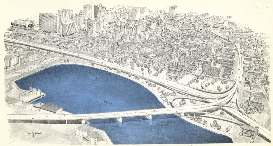
In 42 years the pavilions went from being the icons of Baltimore's waterfront renaissance to being tossed like disposable diapers. This is long in the life of retail structures but nothing in the life of a legacy city such as Baltimore. The Gallery Mall across the street didn't even make it to 35 years. That good cities have much more permanence than retail begs the question, whether it was ever smart to tie the future of the Inner Harbor to the vagaries of retail, or asked even more broadly: Is it smart to privatize "the urban commons" in this way. (In this case, the City owns the land, the buildings are private). There are good arguments for a public waterfront that encompasses more than just a 20' strip of promenade.

How Harborplace get into this rapid downward spiral of decline and obsolescence? Wasn't architect Benjamin Thompson's "festival market place" future proof enough though it had been tested in Boston's Faneuil Hall and repeated all over the country? 


The national failure of the Marketplace Festival Hall

In light of a radical reorientation of the national retail landscape retail in general faces strong headwinds everywhere, especially the festival market places that had been so fashionable as urban renewal tool all across the nation. They went from being the seeds and incubators of downtown revivals to being an albatross around the neck. As one example, we will take a look at New York's South Street Seaport mall which opened in 1985 as another Rouse Marketplace Festival Hall designed by Ben Thompson. It, too, went on the skids, just faster.

The Festival Market Place "Pier 17" at South Street Seaport, NY
(Photo: Curbed)

Just like Baltimore's HarborPlace it transferred  to General Growth Properties (GGP) after the Rouse company's bankruptcy. GGP didn't pay too much attention to the once bustling waterfront destination, and New York City's development agency didn't either. Just in Baltimore the city didn't force the new owners to live up to standards. When GGP also went bankrupt, South Street Seaport was bought by the Howard Hughes Corporation (HHC). It shut the mall down for good in 2013 after hurricane Sandy gave the ailing complex on Pier 17 its last blow. That is one year after GGP had offloaded HarborPlace to Ashkenazy. Immediately Hughes developed big plans for South Street Seaport which didn't leave much standing of the original Rouse/Thompson design. For their endeavor they hire the "starchitects" of with SHoP their designers which had strong opinions about the Thompson design:

"Pier 17 was meant to create a city environment in which one doesn’t engage with the city,” Mr. Pasquarelli said. “It was meant to safely harness tourists and visitors through a historic district and funnel them into a three-story, enclosed shopping mall.” (Gregg Pasquarelli, SHoP Principal)


The similarities and differences between HarborPlace and South Street Seaport

What the SHoP architect said about Thompson's Pier 17 in New York could be said about Thompson's Baltimore pavilions as well, except that Baltimore at the time was considered to be much less dangerous than New York and that Baltimore's mall had only two stories. In Baltimore there was no hurricane Sandy that presented a death blow to the already weakened and ailing South Street pavilion. Baltimore's 2015 Freddie Grey unrest presented a slower storm of its own decisive effects on Baltimore tourism. In the ensuing and necessary debates about equity, it was becoming almost frivolous to think about the Inner Harbor which sits inside the "white L". 

So there is a different timeline: Just a year before South Street Seaport was shuttered, Ashkenzy had bought HarborPlace for $98.5 million, apparently seeing a bright future. That the new owner was incapable of stemming tenant loss or coming up with a retail strategy became alreay apparent in 2013, long before the 2015 unrest. In 2019 Ashenazy's property went into foreclosure after failing to pay its mortgage. 

Baltimore Light Street pavilion (Photo: Philipsen)


It may be important to note that the failure of the pavilions is less one of the architecture and more one of the use or, more specifically, how use was badly managed and deteriorated over time. 

When we look at physical redevelopment, Southstreet Seaport in New York can be a warning sign as well. 

Hughes quickly settled on a complete overhaul including the demolition of the festival hall on Pier 17 and centered its redevelopment on a nearly 500 foot tall residential tower, causing a firestorm of opposition. Amidst the turmoil HHC accepted to work with a Seaport Working Group, which developed guidelines and principles for the redevelopment. HHC eventually scrapped the tower and accepted the Seaport Museum as an anchor. At the end SHoP Architects developed new mall  in a four-story glass-clad building with restaurants, bars, fashion and art exhibits, a 17,000 sf ESPN studio, and a 1.5-acre rooftop that can be used by the public or rented as an events venue, emphasizing open space at the bottom and top of the structure, rather than within an atrium and around a series of balconies. The complex opened in 2018. It can glow in the dark through an innovative, programmable LED lighting scheme.

SHoP Architects redevlopment of Pier 17 in NYC (SHoP)

The New York reconstruction is sitting on a pier, from an urban design perspective a very different setting than the angled pavilions in Baltimore that were created as a low level "frame" at the shoreline, SITTING like the foothills in front of the mountain which consists of the larger buildings forming an outer frame along Pratt and Light Street. Already envisioned in Wallace Roberts Todd's original Harbor Masterplan of 1967, some highrises, such as the USF&G tower or the World Trade Center, would pierce as solitaires the height limits of the frame. The tower now standing on the former McCormick site is the latest addition to the ensemble of towers and fits into the original concept. Should Bramble harbor tower dreams in lieu of the pavilions like HHC in New York, its hard to see how it could fit and would probably create a similar uproar as HHC's tower suggestion did in New York. 

At the verge of a re-incarnation

None less than the Mayor himself  announced the latest chapter of HarborPlace in his State of the City speech on April 5, 2022: Baltimore's fastest growing development firm, MCB Real Estate is the one to pick up the pieces. Since then the matter is hashed out in bankruptcy court while speculation about what could happen next is rampant. 

David Bramble, CEO of MCB  keeps mum about what he wants to do until the i's are dotted and the t's are crossed in his purchase agreement. He confirmed this again for this article. He promises a listening session and public input as soon as there is court approval, a process that will be led by Adam Genn who used to work for Weller Development.. MCB is expected to finalize the deal with IVL, the receiver of the Ashkenazy property soon. 

McKeldin Plaza: Blah after the demolition of the original fountain
(Photo: Philipsen)

The BBJ reported that the appraised value now is less than half of what Ashkenazy. The liquidation value was listed even lower, $27.5 million, only 28% of the 2012 purchase price. This looks like a bargain and would suggest that the City could have bought it, too. Those $27 million would be just a bit more than half of what is envisioned for upgrading Druid Park Lake. For a private investor, though, the question will always be what is the use that promises a healthy return on investment?

Those who recognize the rapid ascent of MCB or simply care about the Inner Harbor are making the pilgrimage to Bramble's office at Clipper Mill to submit their ideas for reuse of the pavilions or for ways to move what was once the incarnation of Baltimore's renaissance into the 21st century. 

Bramble himself called HarborPlace Baltimore's front porch", a somewhat awkward image considering that nobody could ever tell exactly what was front and what back on those pavilions which face Baltimore's main boulevards (Light and Pratt Street) but also the water.  From what I hear the pilgims come away with the impression that Bramble has little appetite for maintaining the pavilions in any shape. He is thinking bigger. How much bigger?

Rendering of what could happen on 300 East Pratt Street, another
MCB site. (HKS Architects)

Thinking big isn't necessarily a Baltimore thing, but here at HarborPlace thinking big is now necessary after all the old luster is gone. And big shouldn't be confused with large. Big should mean comprehensively casting a wide net that considers the region, the city and specifically the larger setting at the Inner Harbor:

  • The current pavilions are not only underperforming, they have fallen into a state of catastrophic failures dragging down the entire retail scene in the area. The vacancy rate is now around 75%
  • the new Constellation museum, ticket center and water taxi terminal right across from the Partt Street pavilion just opened even though the Constellation is now in the dry-dock and the water taxi is hardly running at all
  • The historic walkable fountain at McKeldin Plaza was hastily demolished with no proper new plan in place. A lame transitional design is now in place, the biggest problem, the insular location between a sea of traffic lanes remains unresolved. 
  • Most elements of the Harbor Vision Harbor 2.0 prepared by ASG Architects in 2013 remained unfulfilled except for the MRA designed Rash Field which is a wild success as a neighborhood destination. 
  • Bramble's MCB also owns the News American site on Pratt Street which has been a vacant lot since 1990 with a series of redevelopment proposals that came and went. 


What options does Bramble have? Ideas from experts 

The inner and the outer frame of the Inner Harbor
(Photo: Philipsen)
Lehr Jackson who once worked for the Rouse Company as their chief leasing and development manager is still interested in Baltimore's development and comes up with ideas in his own private think tank. Unsurprisingly he still likes Thompson's pavilions and wants to re-purpose them, maybe one in a hollowed out form as a shell for markets and events. An opened up structure would allow better views of the water from Light Street and Pratt Street. 

True, the original concept of pavilions as a small indoor mall may be functionally obsolete, the buildings themselves stand strong, their slight postmodern design is a bit dated, but the idea of second floor terraces overlooking the water is still a good one and so are the slight nautical references of the design. The elevated pavilions are also quite resilient to rising sea levels. Dated design is part of a city's tapestry. A full demolition would appear wasteful.

The Urban Design Committee of AIA (UDC) has long supported the idea of connecting the McKeldin plaza by closing the road connection from Light to Calvert Streetand adding the road space of northbound Light Street to the Inner Harbor by bundling Light Street traffic in both directions west of the median. The UDC had hoped to preserve the original fountain on the connected larger open space. Should the pavilions be demolished, any denser redevelopment would certainly need additional space. It may be what MCB will be looking for.

The Wharf development DC (website)

David Benn, a local architect and waterfront expert agrees with Jackson's assessment of the pavilions. He told me that "the Thompson's Harborplace buildings deserve to be largely retained and repurposed. They frame the corner and the small performance space fairly well", Benn says. "They are good examples of reinterpreting older waterfront character for contemporary uses, they are flexible, with large loft spaces and good exposure to the surroundings. Saving the majority of it is sustainable."  Benn once advised about the future of Norfolk's festival marketplace and thinks that Norfolk's approach of reducing the total area and placing a small farmers market, cafes and the like on the ground floor with recreational options or event spaces on the upper level could work here as well. Should the McKeldin plaza become connected, "the whole area" could be reframed which would "have consequences for the Light Street pavilion, Benn says.

The buildings of the Wharf overlaid on the "westshore"
of Harborplace (Fillat Architects)

Baltimore hospitality architect Peter Fillat with a portfolio of national and international projects mentioned to me a hotel use above shops in two new structures within the height and footprint limits of the current pavilions. Hotel rooms are low and a flat roof could become a public event space just like at South Street Seaport in New York. Fillat sees such a hotel as the second convention hotel that is envisioned as part of the planned expansion of the convention center, using that portion of the investment at HarborPlace instead. 

Fillat sent me a slide deck with various illustrations visualizing a host of ideas; one of them modeled on the thriving Wharf District project in DC. Fillat overlaid the footprint and height of the DC waterfront buildings on an enlarged Light Street parcel that would include the McKeldin Plaza to see how it would fit. In that scenario, Fillat's assumption is the Pratt Street pavilion would be demolished just as shown on a competition entry by Baltimore's landscape architects Mahan Rykiel in 2007. Those plans MRA had developed with EEK which is now Perkins Eastman, i.e. the Wharf District  architect.

MRA rendering: A small Millennium Park (Scott Rykiel)

Scott Rykiel, principal at the Baltimore landscape architecture firm Mahan Rykiel in a company blog article said that their 2007 competition entry may have not been radical enough in light of new developments. The competition submission suggested that the pavilion on Pratt Street be demolished in favor a large waterfront park open to Pratt Street and making up for lost built space by connecting McKeldin Plaza to the harbor. He bemoans that the pavilions turn their "back of house" side towards the street and the city. Scott, who also was involved in various designs for the current McKeldin park and designed the successful new Rash Field tells me that the north shore area needs more green space and shaded areas, and that a park facing Pratt Street could be a small version of Chicago's Millennium Park. Scott says people still need places to eat and drink, whether they are locals, visitors, conventioneers, or folks who visited a concert at the refurbished Arena. He sees the best economic opportunity in F&B (food and beverages) and also points to Norfolk's repurposed

A park instead of the Pratt Street pavilion (MRA)

Festival Marketplace as an example. He emphasizes that the establishments "need to be local and about the place". He remembers, that for the original pavilions Rouse had scouted out the most successful local retailers and restaurants and brought them to HarborPlace. "Why is Baltimore's biggest farmers market under a highway", Scott wonders and muses "how wonderful it would be to have this market at Harborplace. 

Barbara Wilks, the New York architect who founded W Architecture and Landscape Architecture, and
designed the new Constellation ticket building and museum and water taxi terminal across from the pavilions has worked on several New York waterfront parks. She sees a "great opportunity for Baltimore". She points to the larger context in which Pratt and Light Streets should be seen as "part of the project. "Harborplace was meant to be a gateway, but it has become a barrier", says Wilks. "It originally had a more three-dimensional public aspect, with overlooks and outdoor seating. It became progressively more enclosed and private. There is an opportunity to “layer” the space—it is not only about the harbor edge", Wilks continues. "Walking along the street edge should be just as exciting. It should be seen as a series of linked edges of varying characters, moving back into the city." She adds: "The topographic change should be used to better advantage. The waterfront should feel like it is expanding up into the city, not like the city is bearing down on it and constricting it". Ms Wilks with Rogers Partners was a consultant for St Petersburg, Fla where studio W designed the 20 acre "pier approach" of the award winning  St Pete Pier

St Pete Pier development (

redevelopment. Wilks thinks that the broad based community participation there could be a model for Baltimore in which "a community [was] deciding how it wanted its future to go and how to change an icon". 

The Pier was integral to the St. Petersburg Downtown Waterfront Master plan, whose vision is “to protect, enhance, and promote St. Petersburg’s downtown waterfront as one of the premier waterfront destinations and attractions in the United States.” (ULI Americas)

Adam Gross, principal at ASG and author of Harbor 2.0, asked about how some of the ideas laid out in his masterplan could now come to fruition, told me that he certainly has opinions, but that he'd rather wait with making them public until Bramble's community engagement process will officially begin. 

Harbor 2.0 masterplan (ASG/Jonathan Ceci)

It looks like all the Baltimore voices share  Pasquarelli view that he had expressed about the old New York Festival Marketplace:

"Being in an enclosed mall that could be anywhere in the United States, yet occupies this incredibly special and precious site for our city, is an unfortunate result of some of those planning ideas.”

Maybe the New Yorker Seaport Working Group which guided SHoP's design would be a proper approach for Baltimore as well. Just as the shops and restaurants should have a decidedly local flavor, a working group that encompasses stakeholders and local planners, architect and landscape architects would ensure that the HarborPlace redesign has local aspects as well.

Bramble's "front porch" expression hints at what HarborPlace should be, if one understands the front porch as a space that transitions from the private to the public, a space with the private space in back, and the public street in front, a place to see and to be seen. Given that the City owns the HarborPlace land and the water itself is public, the image seems appropriate as a guiding principle for redevelopment. 

Klaus Philipsen, FAIA

SouthBmore.com: Phototour of the pavilions

Monday, October 10, 2022

“Stop The Road”: The book that describes how the "Road Wars" changed Baltimore

Baltimore's Department of Transportation is in the last editing phase of an application for $2million design money under the federal "Reconnecting Communities" with the goal to fix the worst effects of the "Highway to Nowhere" (H2N), the 1.3 mile piece of expressway that bifurcates West Baltimore in the US 40 alignment. 

The federal resolve of making up for destroying especially communities of color through highways all around the US germinated under Obama's Transportation Secretary Foxx and is continued by the current secretary Buttigieg. Insiders say, the Reconnecting Communities grant program has "Baltimore" written all over it. 

Evans Paull, author of
"Stop the Road"


Evan Paull's brand-new book "Stop the Road" a detailed account of Baltimore's "road wars" is very timely. Retired city planner Paull's memories and research of Baltimore's fights against destructive freeways spawned a generation of politicians and activists and, in the opinion of Baltimore developer Bill Struever, has shaped Baltimore like nothing else. (The author himself places them in significance after the creation of the B&O railroad). 

The author was kind enough to send me a copy. In the following article I want to share my impressions from the perspective of someone who came to Baltimore just after the road war battles had ended. Many younger folks in Baltimore are in the same boat, the road war stories are part of legends, often distorted and not accurate. The diligently researched book sets the record straight.

Paull's motive for the book was to show how outsiders can win against the establishment, something that happens rarely, he notes in an interview with Baltimore's radio personality Nestor Aparacio. Paull wants us to get to know the unsung heroes, Bob Eney who had Federal Hill and Fells Point placed on the National Register of Historic Places in the spring of 1969. A pivotal move that helped decide the war that raged for over a decade and ended in 1980 when then Mayor Schafer finally dropped the destructive highway plansIt's those unknown heroes, Paull says, who held sway over the engineers and planners of the time. The late doctor Jack Gleason who had invented the Fells Point Fun Festival as fundraiser to cover the staggering legal bills, is another. Many, many others are noted and some I will mention later. Fittingly, the book launch was to happen at the Fun Festival on October 1, but the remnants of hurricane Ian forced it to be rescheduled for October 28-30. 

Poster of the highway
proponents

One interesting aspect is that thanks to the road wars Baltimore has far fewer urban freeways than many other cities. Movements like the Movement Against Destruction (MAD) then chaired by another unsung hero, Art Cohen, Joe McNeily Director of South East Community Organization SECO, or Volunteers against the Destruction of Leaking Park (VOLPE)  as well as RAM in West Baltimore prevented highway design atrocities that would have wiped out Rosemont, Harlem Park, parts of Poppleton, Federal Hill, the Inner Harbor, Fells Point, Locust Point and Canton and parts of Leakin Park.  All the places that were saved are seen today as Baltimore's success stories. The creative naming of the warrior movements is particular evident with VOLPE which makes fun of the other VOLPE, the National Transportation Systems Center, still in place today. The activists envisioned a court case VOLPE vs VOLPE. 

Paull chronicles the wars as far back as 1942, including the short 1945 interlude involving none less than Robert Moses. a guy Paull describes as a master builder but also as “ master race kind of guy”. In the years up to 1957 alone, nine separate plans for a city-wide freeway were developed. So many more should follow that it is actually hard to follow the course of the various battles. At no point did things go smoothly.  Already in 1945 a council hearing on the matter was sunk by 1500 booing protesters, Paull quotes from the Baltimore SUN archives. 

Helpfully, Paull points out that in the 1940s 1.3 million transit trips occurred on any given weekday, i.e. more folks got around on streetcars and buses than by car. Clearly the road builders envisioned another future and, unfortunately, they got it. Today’s total MTA ridership is less than 20% of that historic ridership, even before Covid when transit experienced a slight uptick, even though the region has vastly grown, with a shrinking core City. Paull writes that “Baltimore is now paying for the road not taken”.  This is a word play and could be interpreted as “we neither kept the transit nor did we get the roads”.  In fact, money saved from the not built freeways was spread all around the state in preparation for Don Schaefer’s run for Governor. This failed transportation policy was repeated when Governor Hogan dismantled the Red Line project and spent the gained dollars on useless highway projects everywhere, except in Baltimore. As a result, Baltimore's transit is anemic and its roads and bridges continue to crumble.   

A freeway across the Inner Harbor. One of many crazy suggestions


That just a 1.3 mile freeway fragment was eventually built when the rest of the big freeway dreams conceived by folks like Robert Moses and the roadway mafia had mostly crumbled, sheds a harsh light on the often overlooked racism that was tacitly or openly part and parcel of the urban freeway craze  from the beginning. Baltimore demonstrates with clarity that the freeways were preferably built in black communities not only because the least resistance was expected there but often with the express purpose of "Negro removal" which was often veiled in the official  term of "slum and blight removal”. Although, Paull is careful to point out that Moses' report envisioned the displaced to be relocated in cookie cutter Corbusier style high rises right along the freeway. In Moses' words:  “it is neither necessary nor desirable to disperse this class to other areas”. Not that we are so much more advanced, this is also what the Republican Baltimore County contender for the office of Executive says in the fall of 2022.  But I am digressing.  

Paull’s book reveals many forgotten  details that straighten out some of the narratives and myths that have evolved around the road wars  For example, per his telling it wasn’t Fells Point or Federal Hill that first launched the historic slingshot against the powerful highway Goliath, but it were bohemians on tiny Tyson Street which had evolved into one show-and-tell block near Read Street that had garnered national attention as successful private renewal. Their being in the path of the 1957 freeway connector and their opposition was the first blow that began a long chain of reductions, revisions and delays that eventually should derail the the powerful highway planners.   

I-170 at what is today Martin Luther King Blvd. together with
urban high-rises to accommodate the replaced residents

Interesting insights galore: Paull points to Baltimore Planning Director McVoy as the inventor of a vision for the Inner Harbor as early as 1956, long before Roberts Wallace Todd or Jim Rouse or other "fathers" of HarborPlace were on the stage. That his successor still suggested a giant freeway across the harbor in 1960, was therefore doubly inexcusable. Of course, it wasn't without any reason: Mr Darling, the Planning Director of 1960, thought an elevated freeway would take traffic off the surface roads and would actually help the Inner Harbor vision of his predecessor. Not a totally crazy thought, if one sees today how the heavy surface traffic on Pratt, Lombard, Light, and Key Highway is strangling HarborPlace, a direct result of the existing freeways ending abruptly and feeding into these roadways.  

A kind of bombshell revelation in Paull’s book is that even those who are usually celebrated as the fathers of today's Inner Harbor, Walter Sondheim and Marty Millspaugh among them, initially supported Darling's Inner Harbor flyover. Maybe they considered it as the lesser evil, compared to an even bigger freeway bridge suggested by highway engineers, signaling the beginning of a serious inside feud between engineers and planners that would further escalate as we shall see.  Later in 1963, under Mayor McKeldin, the early Inner Harbor vision was taken up again, but McKeldin, too, initially stuck with  the bridge idea, simply insisting on a beautification of it. Only then councilman Tom Ward argued consistently for transit, for preservation and against all highways ("No highway anywhere"). This makes him a preferred member of Paull's road wars hall of fame. Not one tp paint things in black and white, Paull devotes a separate chapter to Ward and describes him as a crank whose combative manners eventually brought his political career to an end. Still, the man is credited with a string of successes in defeating the egregious road plans. While Ward couldn't prevent the Highway to Nowhere, he helped save Tyson Street by preventing the connector piece of H2N to I-83.

The fracas between engineers and planners about the right bridge across the harbor led to another well known phenomenon: More studies, sometimes on a silly scale.  A study at exorbitant cost and practically no value was conducted in 196.  $7.2 million later (in today’s dollars per Paull’s account) engineers of Wilbur Smith submitted supercharged highway plans that solved nothing but more than doubled the suggested miles of freeway in the City. Barely created, the study disappeared in the dustbin of history.  Wasteful expenses, bribery and flawed cost estimates plagued the entire process.

It becomes clear from Paull’s accounting, that the Baltimore road wars were greatly helped by the national reckoning that took place in the 1960s. A reckoning that yielded the civil rights movement plus powerful national laws protecting historic and environmental assets.  Baltimore warriors used these new laws to great effect. The new awareness also made the racial component of the highway plans more obvious: “White men’s roads through black men’s homes” (DC road warrior Sammie Abbott).

As someone who had spearheaded a less car centric transportation policy through traffic calming in Stuttgart Bad Cannstatt in the mid seventies, I always felt a strong kinship with Baltimore’s road warriors. The concept of "traffic calming" though, would, except for a couple of tepid attempts in Bolton Hill, take another 40 years before it arrived in Baltimore. Many of Paull's hall of famers I had thankfully the pleasure to meet after I came to Baltimore and after the road wars, people like Stu Wechsler, Michael Seipp, Charlie Duff, Joe Neilly, Steven Bunker, Art Cohen, Zelda Robinson, Glenn Smith Joyce Smith and Arlene Fisher to name just a few.  

Another intriguing item is a interdisciplinary planning group that Baltimore's highway planning yielded: The Urban Design Concept Team (UDCT) that contributed several almost tragic chapters to the story. The acronym shares three letters UDC with the still existing AIA Urban Design Committee (UDC) which I chaired for years and which got involved in the preparations of the Reconnecting Communities Grant by recently organizing an event in which stakeholders of many arenas presented their concepts of overcoming the scar that is the Highway to Nowhere. 

A 1970 rendering of the UDCT that shows three blocks of cover of the 
sunken expressway (now H2N) with mixed use

The historic UDCT  was a creation of the Federal Highway Administration half a century ago. It was installed in Baltimore as an experiment in recognition of the turmoil that a pure engineering approach brought when it applied to freeways in cities. Baltimore became ground zero for an interdisciplinary experiment of complementing the freeway planning with urban design that was supposed to add some bottom up planning elements and responsiveness to community needs. Reflective of the activist spirit of the times and the new legal landscapes from preservation and environmental laws, UDCT was supposed to look also at the "social, economic and historic impacts so that the road could become... a part of the city"(Transportation secretary Boyd). 

Baltimore architects Archibald Rogers and George Kostritzky (whom I would later meet ), founders of RTKL which became Baltimore's largest architecture firm, were part of these almost impossible attempts of influencing the mad roadway plans from within so that they would be less destructive. But soon the engineers felt "relegated to draftsmen" and pushed back while several UDCT members became double agents, frequently leaking documents to highway opponents and becoming activists themselves. Thus the UDCT approach became part of the road war itself and the actors were ground up between suspicions from the engineers and the community alike.

The chapters of the book that deal with the politics, the intrigue and the machinations especially in the three years between 1967-70 when the UDCT was active, are sometimes difficult to follow with all the variations of alternatives numbered all the way to 10A with 3A being a plan attributed to the UDCT planners. (3A laid the groundwork for the Fort McHenry Tunnel we see today which spared all historic communities and eliminated all harbor crossings).  Paull gives the 3A option a lot of credit, because it was the first case where the planners had successfully broken out of the straitjacket of the solutions they had been given by engineers.

As noted, all this fell into a period of great national turmoil with Martin Luther King's assassination and the 1968 unrest that followed. The modifications that the UDCT achieved were not big compared to the scale of the epochal change of that period. The multidisciplinary attempts of architects and advocacy planners to make the atrocious highway plans more palatable appeared more like lipstick on a pig, even if they were undertaken with heroic gestures at the time. 

It is notable that sticking with Highway to Nowhere segment was publicly announced only days after the 1968 unrest, in the same callous way as the Baltimore Red Line transit project in the same corridor was killed only months after the 2015 unrest following the death of Freddie Gray in police custody. Moreover, when construction of the H2N began in 1973 all other parts of the connecting system were in serious doubt. When it was completed 10 years later, it was obviously obsolete, connecting on neither end.

Today's best practice thinking in planning pretty much represents the same mindset that the UDCT had in 1967. This either attests to how progressive the UDCT idea was or how little progress we have made since then as a profession.  The method of enhancing a transportation project with amenities was advanced by then Mayor Dixon in the Red Line "community compact". It is largely still what DOT envisions for the "community input" after they would receive the "Reconnecting Communities" grant. In fact, one of the UDCT renderings (never built, of course) shows a mixed use redevelopment on a three block cover over the expressway. A remedy that closely resembles what is sold as the cat's meow today in "reconnecting" projects over urban freeways like the one in Rochester. 

More than 50 years later, the US is still on course of building more and wider highways, still has no high speed rail network and is now facing the fact that transportation is the largest climate change contributor. These observations are mine not Evan Paull's. He touches on those issues in his chapter perspectives, but I wished Paull would have said more about the current state of urban planning with its tax increment financing, private public partnerships, and community benefits agreements and continued lack of transit. After some 40 years of being active in planning, he would have the perspective and the distance to provide more judgement than he did.  

It can’t be my task to recount the entire book here. Maybe this small teaser entices you to buy the book and find out yourself, how history really unfolded and how much of that history shaped Baltimore and how much of it has been distorted into urban myths. As I tried to show, much reaches deep into our current day issues. Evans tells the story without righteousness indignation, without jumping to judgement with a fine sense of irony, letting the unearthed sources and voices speak for themselves. Along the way we get a lot Baltimore’s history and the necessary context in which the players acted. As noted, Paul isn’t into abstract summaries or theories, he grounds the narratives by real people many of which he interviewed and leaves it at that. 

 “Stop the Road” is a book that brings a useful historical perspective to our current often oversimplified debates.   Paull isn’t making anything nicer or simpler than it really was, he just provides details and context.  As such the book is very useful for assessing the many issues that especially younger people would experience as brand new. The structure of the book, first more chronological and then more geographical seems to suggest that chapters should stand on their own. This results in many strands of the stories being repeated, many characters are repeatedly reintroduced. At times that can be confusing, a bit more streamlining of the narrative arc could have been helpful.

Evans Paull's book is now available everywhere

Still, the more we understand how we got where we are, the better will be the plans for what should come next. One of the lessons of Baltimore’s road wars is that in the heat of battle the most reasonable plan (in this case one penned in 1949) may remain hidden in plain sight for more than 30 years thanks to incremental small minded thinking. Another is that we don’t always cherish what we have for lack of fantasy. That clearly comes to light in the chapter about Fells Point where the local councilman did not see anything worth saving there: “it’s a slum, I want it torn down”. Another lesson is that without federal laws regarding preservation, air quality and parks local warriors wouldn’t have had their key weapons.

The book is focused on Baltimore; other cities are barely mentioned, even though many others were hit much harder by the freeway craze. It isn’t clear if that is only because they lacked Baltimore’s warriors or because of some other circumstances.  Paull’s narration doesn’t yield the silver bullet or the one shining general that brought home the victory. Instead he quotes his interviewees' own summary: “We  lost every battle, but we won the war”. In other words credit goes to death by a thousand cuts: Delay tactics, creative alliances, politics, solutions and a good amount of subterfuge, deception  and uncovering fuzzy accounting math of the highway proponents. All these tactics have now become so omnipresent that they can have unintended consequences. For example, they can hobble or kill well conceived projects such as electric distribution routes, high speed rail corridors, busways or wind turbine installation. Obstruction is not always good.

Looking ahead, as Baltimore's grant application does, it is apparent that while Baltimore was a leader in the fights against the urban freeways, it is now behind when it comes to remediation. Boston finished its famous ditch project a long time ago, Seattle's burying of its freeway is far advanced, Dallas built an award winning park on a portion of a downtown freeway and Rochester finished mixed use development on a part of their own ditch. Detroit just recently received $105 million from the current Infrastructure Bill to construct parts of its I-375 removal

By contrast, Baltimore's $2 million ask for planning is little and late by comparison. The City must make communities real partners for the remedial plans, not just recipients of ideas created by others. 


Klaus Philipsen, FAIA


Wednesday, October 5, 2022

Will Councilman Dorsey's Elimination of Single Family Zoning Help Baltimore?

Does single family zoning prevent development?

Thousands on voucher waiting lists, more "rent burdened" renters, in short: Not enough affordable housing. A problem all across America, even in cities like Baltimore with its many undervalued or vacant properties. We have discussed this seeming contradiction in this space before. Today we will look at Baltimore Councilman Ryan Dorsey's zoning bill titled "Abundant Housing Act" which effectively will eliminate single family zoning in Baltimore. 

Will the suggested zoning bill endanger neighborhoods like this
one? (Glen. Healthy Neighborhoods)

As in his successful Complete Streets legislation which toppled the supremacy of cars in all matters of Baltimore's transportation policy, the Councilman's seemingly radical proposal has the Baltimore beehive buzzing. The Baltimore SUN reported positively about the bill on the front page but later published letters to the editor, not one of them in favor of the bill. 

In the US where nationally 61% of all dwelling units are single family homes (2019), going after the single family home on a lot zoned for this purpose is slaughtering an even more sacred cow than the automobile. For better impact, or better in understanding the land use transportation connection, Dorsey's bill includes the automobile as well. It suggests to relinquish the off-street parking requirements that usually come with single family housing zoning. 

We have to build density [without parking] to create demand for higher frequency transit (Dorsey in a presentation to the group Transform MD Transportation)

Parking is a significant contributor to housing cost (Jed Weeks, Bikemore) 

References to the racist implications of single lot zoning as part of a discriminatory US land use history heat the temperature of the debate further. A look at the facts, however, shows that the proposal is much more based on typically conservative supply side thinking than on radical social engineering: The bill intends to increase the supply, which will reduce the price, the thinking goes. Here is how Dorsey describes his bill's aims on his Twitter feed:

Today I'm introducing the Abundant Housing Act. This bill proposes zoning reforms that are being brought forth throughout the United States, dismantling exclusionary policies that maintain segregation and create housing scarcity that drives up the cost of housing.
The Abundant Housing Act will allow low-density multi-unit housing in all residential areas, up to four units, depending on available square footage, plus an additional unit in areas of high opportunity, such as proximity to grocery stores and transit.
Under current zoning law, a 2000 sf house in one neighborhood can have two units, but a house that's 50% larger in a different neighborhood can never be more than one unit. Meanwhile the International Building Code allows for safe and healthy dwelling in as little as 350 sf.
One of the simplest reforms this bill proposes is to eliminate off-street parking requirements for housing. In 2022 we don't dispute the value in "housing first" strategies, yet we maintain a "parking first" zoning requirement, even when half our population doesn't have cars.(Ryan Dorsey on Twitter)
Where conversion to multiple units is allowed today (Dorsey Map)

Examples elsewhere

For all its apparent radicality, Dorsey isn't the first that came up with the idea. Several cities have already enacted laws of the kind Dorsey proposes for Baltimore.

The first US city was Minneapolis in 2019, in 2020 followed Portland, Or. then Seattle in 2021 with a slightly more subtle approach. Last year California enacted a state-down approach that forces municipalities to accept more than one dwelling unit on single family lots.  The bill received the praise of the business magazine the Economist

Abolishing single family lot zoning has became a rallying cry for housing advocates to such an extent that Sara C. Bronin of the Cornell University decided to study the issue. She analyzed the impact of single family zoning for the entire state of  Connecticut. She found that over 66% of primarily residential zoned land in that state allows only single-family homes but that single family zoning is not the only restrictive factor.

Where the bill would allow conversion to multiple units
(Dorsey map based on map tool by Austin Davis)

Dorsey seems to have taken notice of Bronin's paper when he incorporated relaxed parking requirements into his complex 43 page bill  But many of the other restrictions Bronin mentioned  would stay in place, effectively limiting the impact of the bill in many areas which are currently zoned single family. 

Where does Dorsey's bill stand today?

So far Dorsey's Baltimore bill has been only introduced and is awaiting additional hearings. It is co-sponsored by Zeke CohenAntonio GloverOdette RamosKristerfer Burnett, and John T. Bullock, not all are necessary fervent supporters. 

A review by the City law department identified two items that need to be remedied for the bill to move forward: One is that income is deemed not to be a lawful metric for zoning. The other objection has to do with the term "non conforming use" for which a fix could be easily achieved. (Income is included in a provision that allows an additional dwelling unit in transit areas and where the median income is "above 200% of the area median income". A majority yes vote is not assured at this point. The Mayor has remained silent on the bill so far. 

Any representation that the bill would be a threat to single family homes or that homeowners would be forced to do what they don't want is false. The bill mandates nothing but it allows additional use options by permitting accessory dwelling units and, under certain circumstances, dividing single family homes into two or more units. But only if the homes have sufficient floor area and meet a set of other conditions such as lot size, height restrictions, historic district provisions etc. Nothing would force homeowners to change anything on their lots. As critics who feel that the bill doesn't go far enough already noted: HOA covenants would remain untouched, which means that the more leafy single family areas with such covenants,for example,  Roland Park or Guilford would be entirely unaffected by the bill.

Councilman Dorsey's Twitter thread
The bill allows 2 units if you have 1500 enclosed sf, 3 in 2250, 4 in 3000, and one extra in any of those cases if within 750 feet of a grocery, transit*, or a Main Street, or in a 200% AMI census tract. (Ryan Dorsey)

Strange bedfellows

With all the heat of the sometimes ideological discussion, it isn't surprising that the highly fractured American landscape produces some strange bedfellows, such as the business friendly Economist supporting the elimination of single family zoning. Some find themselves on the other side of the arguments they usually make:
  • Take the new book by city planner Nolan Gray or his Atlantic article . His demand to abolish zoning neatly fits the usual Republican demand to reduce regulation. The show horse of a place with no zoning is Houston, TX, a large city in a Republican state that never had zoning and has been derided for that by liberals for decades. But, as Gray points out: Houston is also one America’s more affordable large cities and very diverse, plus it has greatly reduced homelessness, the opposite of Democratic cities like San Francisco and New York.
  • Take the letters to the SUN editor where some argue against the bill with the scare of gentrification. They say that eliminating single family zoning would open the doors to developers and investors who would swoop in, buy the larger single family homes, divide them up and price out all regular folk. In effect, it would benefit the rich, they say 
  • Folks who usually demand more equity (for the poor) find themselves arguing for homeownership as a "generational wealth creation" tool and support the bill because it would increase housing values for low income homeowners and allow them to have an additional income from an accessory unit.
My single family house next to Johns Hopkins University is about that size. I’ve lived in fear for years that houses in this neighborhood would be cut up into student apartments or converted to frat houses. Councilman Dorsey’s bill would make my neighborhood unlivable except for JHU students.
The city went through a comprehensive rezoning less than 10 years ago. This bill will chuck it and allow developers and slumlords to decimate stable neighborhoods. (Ed Schneider, SUN letter)
Dorsey observes that Baltimore's "housing stock is inversely mismatched with the demand". Dorsey's bill would likely increase the number of small available dwelling units in the city, may make rents more affordable in some areas, and allow some homeowners to keep their homes in good shape by generating rental income from a small additional dwelling unit carved out in the home or being erected in the backyard. Ideally the bill would foster density near transit, and make transit more viable, allow the desired move of disadvantaged citizens into the so called opportunity areas, and reduce the amount of sprawl by drawing residents to the city instead of the green fields of suburbia. Ideally the prospect of better returns would spawn investment into Baltimore's many vacant houses, and increase the City's population.  Plus it would improve the chances of receiving federal grants that currently favor Cities that have provisions like Dorsey's bill. That's a long list of very desirable outcomes. 

The question is, can they be achieved with the suggested bill, or better, how much would the bill move the needle?

The history of planning shows that unintended consequences are the biggest enemy of good intentions. 
The bill could certainly have outcomes that would be opposite of what one wanted to achieve, one explanation of the strange bedfellow issue.
For example the bill could threaten homeownership by making rentals more lucrative. The bill could be taken advantage of by investors who grab big houses and try to turn them into multifamily, sometimes unsuccessfully stopping midway, a phenomenon that has plagued Reservoir Hill and parts of West Baltimore for decades where large homes are common. I have seen some conversions that were abandoned when it became clear that the life safety codes such as egress are not easy to meet when one puts more than two units into a house. Or when it became clear that a proper division would cost a lot thanks to the additional kitchens and bathrooms, upgraded water service, all high cost items in construction. 

Community leaders such as Wanda Best from the Upton Planning Committee support accessory dwelling units and also support high rates of homeownership because it is seen as having a stabilizing effect, especially in dis-invested communities.  Should homeowners leave a community out of concern about an influx of low income renters or a devaluation of their home value, it would be reminiscent of Baltimore's worst periods of block-busting and redlining, self fulfilling prophecy based on fear and prejudice.
Bloomberg analysis of single family home conversions in
Minneapolis in 18 months 


What does the research show?

Which of the possible scenarios are more likely, the desired outcomes or the unintended consequences? 

Bloomberg recently reported about the results in Minneapolis, the city that first took the step of eliminating single family zoning in 2018. What happened in those months since he bill took effect in January 2020? Not all that much. In a city of 425,000 residents in which 70% used to be single family zoning, only 48 cases were reported where single family homes were converted into duplex or triplexes in areas where this was previously not permitted. This added, according to Bloomberg, about 100 units total in 18 months. That's not an avalanche of change, especially not in a time of a red hot housing market and in a city that grows and has permitted thousands of multifamily units in larger apartment buildings in the same period. Still, Minneapolis' result far outperforms Baltimore's recently expired ineffective inclusionary zoning law. It yielded only 37 units in 14 years, according to a SUN article this summer.

The reason behind the relatively modest result is explained in the already noted study by Bronin. In her paper "Zoning by a Thousand Cuts" she shows how many other aspects of zoning have an impact on  housing, killing it in the process by a "thousand cuts".  Following the "strange bedfellows" theme, Bronin finds, which may surprise many, that the requirement for public hearings regularly will bring out the NIMBYs and blocks housing in the process. Of course, regulations such as minimum parking, maximum building heights and required minimum lot sizes, maximum lot coverage and floor area ratios (FAR) are the other restrictions that prevent density. In many cases  these other rules cement single family homes as the only possible option without necessarily explicitly saying so. Even where accessory dwelling units are allowed, many codes limit who can use them with the goal to eliminate standard renting. 

Gray, the anti zoning book author, deals with those restrictions by requesting the ultimate step: Do away with zoning altogether. 

It’s time for America to move beyond zoning, argues city planner M. Nolan Gray in Arbitrary Lines: How Zoning Broke the American City and How to Fix It. With lively explanations and stories, Gray shows why zoning abolition is a necessary—if not sufficient—condition for building more affordable, vibrant, equitable, and sustainable cities. (Publisher)

The Washington Post printed a Bloomberg interview with the author. In it Mr Gray explains: 

Zoning has four big costs. First, it increases housing prices. It does so in three ways: by allowing less housing to be built; requiring the housing that is built to be more expensive and generally larger than it might otherwise have been; and slowing down the whole process. (Nolan Gray, WP interview)

He adds limitation of mobility to opportunity zones as the second cost, and "class segregation" as the third and a lack of sustainability as the fourth. 

Car ownership is written into law by zoning.(Nolan Gray, WP interview)
What are the likely Baltimore outcomes?

The sky won't be falling should the bill be adopted. The immediate numeric outcomes will likely be modest. In shrinking Baltimore they are probably even more modest than in growing Minneapolis, Portland, Seattle and those other places that eliminated or modified single family zoning. Baltimore is a place driven by a split supply and demand phenomenon, namely a lack of affordable housing supply coupled with an overall lack of demand for living in the city. The lack of demand is not so much the result of cumbersome regulations but the result of a host of reasons from crime to education and subpar public transportation. 
Baltimore's residential zoning classifications 


Additionally, Baltimore as a rowhouse city has many single family homes that are rather tight rowhouses with tiny rear lots where the relaxed code would yield little additional density. The areas with larger lots and bigger houses are often protected under historic district regulations or covenants, further diminishing the possible yield of the bill.

This is not to say that Baltimore shouldn't make every effort to remove hurdles for more and better housing. Baltimore doesn't have San Francisco's, San Diego's or Denver's affordability problems (i e. a lack of space to build relative to the demand). Baltimore's housing affordability  problem comes not as much from home prices or rents being too high, at least not by national standards, but from too many residents being too poor to afford them. Small units could be a solution for some. Baltimore's Greg Cantori, an avid supporter of tiny homes as a solution to affordability, welcomes Dorsey's initiative. If nothing else, it will make the construction of tiny homes on vacant lots or backyards easier, even though some other legal hurdles remain. 
Low density multifamily instead of single family zoning.
Dorsey proposal

Parallel to this bill, the Baltimore City Council is also considering an inclusionary zoning bill which mandates a minimum number of affordable units in larger market rate rental and homeownership housing projects. Here, too, the question is how to best strengthen Baltimore's ineffective expired law without creating an unintended  barrier to more housing in Baltimore.

Guiding Principles

As an architect and planner who practiced in Europe and here, the income and housing type stratification common in the US has always struck me as strange and unbecoming to a real city. European cities traditionally grew as mixed income and mixed use communities in which larger and smaller housing sat next to each other. The diversity has made urban adaptation to changing trends and markets easier, not harder. 
Mix of single family and multifamily housing in a new German
development

Production housing by large homebuilders has brought suburbanization and sprawl to Europe as well. Still, most of those developments are well planned, require transit, access to services, walkability and a mix of housing types with affordable (social) housing mixed in with market rate housing. In many regards, Baltimore County's suburbs would need Dorsey's bill even more than the City.

When the facts are sometimes confusing, it helps to be guided by principles: Diversity will outperform cookie-cutter homogeneity any time, especially now when  sustainability, diversity and resilience have become the key metrics of success. Flexibility in the mix of offerings is more resilient than the status quo and is a necessity in a changing demographic and economic environment.
 
The law will not create an abundance of affordable housing in itself, but it is a great start.

Klaus Philipsen, FAIA
An earlier version of the article described Houston as a Republican city. This has been corrected.

Additional source material:

Can-the-us-housing-crisis-be-fixedby-abolishing-zoning?

https://news.yahoo.com/would-banning-single-family-zoning-really-solve-the-housing-crisis-223207110.html?

Related articles on this blog:

Why affordable housing is scarce in shrinking Baltimore

Here is where new Baltimore residents will live

Fund affordable housing through the transfer tax

Perkins Homes: Opportunity or Displacement?


With so many vacant houses, why is there still a housing crisis?