 |
| what Under Armour owns (Sun graphic) |
 |
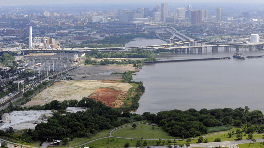
| A look from Light Rail to what used to be the Carr Lowry Glass Company in Westport |
This can be a good thing, certainly it doesn't have to be bad. I have likened UA to the new Medici of Baltimore in the sense that they are a power house in a city and that a lot of investment comes through them. The Medici brought lots of arts and culture to Florence. If Kevin and Scott Plank, founders of an enterprise that is more locker room than Louvre but there is always hope. Meyerhoff didn't start out so high brow either. The Planks first out of sports apparel endeavor is more spirit than spiritual, though, a whiskey distillery with visitor center and tasting area.
The Urban Design Committee of AIA has eyed the Middle Branch as Baltimore's "second waterfront" since 1990. The Planning department in Masterplan has relied heavily on the Turner plans for the Westport shore line. It will be important now, to update those plans while the Planks are still figuring out what they want to do. Public interest, water access and recerational areas need to be asserted and nailed down now.
 |
| City Middle Branch Masterplan (Future Land Use) |
A letter written in 2005 has still a lot of the right components, even if the Warner Street area has been ruined since then by the Casino and its mammoth garage. (see below).
 |
| The Middle Branch, a softer and quieter more natural waterfront |
The Middle Branch is an exciting opportunity for Baltimore once more to think about water, yet in a new and different way. The Middle Branch as a softer, more natural and quieter urban waterfront.
Klaus Philipsen, FAIA
Links:
Baltimore SUN article about Under Armour Westport purchase
BBJ article about Under Armour Westport purchase
 |
| Cover of a 1990 Middle Branch Report of the AIA Urban Design Committee |
from the 2005 AIA Letter of the Urban design Committee to the Planning Director:
On behalf of the Baltimore Chapter of the American
Institute of Architects Urban Design Committee, I would like to thank you and
the Planning Department for sharing with us your planning vision and efforts
toward planning for the redevelopment of Middle Branch. We very much appreciate the opportunity to
meet with you, have a personalized presentation on your planning efforts to
date, have our admittedly loud voices heard, and in general, participate in the
planning for future development of Westport.
Based on your presentation, our committee would
like to share with you our thoughts for consideration as you move forward with
your planning efforts. In general, we
applaud your effort to try to stay ahead of the development and to begin to
establish a vision for public and private investment. We felt that your presentation was
thoughtful, and clearly, you and your team have been working hard to work
through all of the complex issues that affect the redevelopment of this
area. We do, however, feel that some
additional consideration and thought should be given to take the planning for
Middle Branch to the next level. As such
we have listed some of our ideas below:
1.
Consider that there is more to Westport than just the waters edge. Planning should extend beyond deep into the
heart of Westport, and to a certain extent, beyond I-395 westward into the
city. Westport is inexplicitly tied to
the greater urban environment.
2. The planning department
should coordinate transportation planning efforts with the city and state to
proactively plan for better access to Middle Branch. The potential volume of traffic generated by
new development could be significant and if not planned for could have a
negative impact on development potential. An improved Annapolis Road connection to downtown, a Waterview Avenue
connection, improved I-295 access, are critical and could be defined as
gateways into the area. The Warner Street district should be considered as a
vital connection to and extension of downtown. Additionally, planning should include pedestrians
and potential access to the stadium and an extension of the greenway system
into the area.
3. Ensure that open space corridors, possibly
boulevards, are created to ‘bring/pull’ the water back into the development. Possibly connect these corridors with waterfront open
spaces, green, or perhaps hardscape at a major activity node that would frame
views of the Hanover Street Bridge.
4. Require all development parcels to create a
pedestrian promenade along the waters edge and establish, thought zoning, a
generous setback to ensure public access to the water. Additionally, access can be defined as more
than a series of vertical and horizontal strip zones along the water; it can be
modulated vertically and horizontally as a series of dense and open areas
reaching back into the community and up from the shoreline to establish view
corridors.
6. Consider enacting zoning
ordnances so that the vibrancy of potential redevelopment of Main Street is not
jeopardized by the new waterfront development. . A commercial zone could be established along Kloman
Street to activate the Westport neighborhood while still connecting to the
green waterfront zone. This would tend to add to the vitality of the
district instead of draining it.
7. Alternate taller, denser areas with
open, lower areas for visual waterfront access throughout and into the
development. Localized density can be
achieved in the neighborhood of the transit station without disconnecting Westport
from the Middle Branch, and the buildings can interface with the water in a
number of different ways (low and mid-rise). Consider hiding parking
within the building massing.
8. Adjust presentation graphics to convey ‘green’
areas (currently delineated in brown) are green and read as green areas.
9. The area around the Middle Branch
“basin” might be considered as a series “communities” within with the Middle
Branch as the common element. The Westport shoreline is an opportunity to
create a mixed-use “Village” along the water. The parkland is more of a
green zone, while the opposite shore can be defined as a low-lying
institutional/business/etc. area with increasing mass and height towards the
peripheral roadways.
No comments:
Post a Comment